Archive for the 'Wildlife' Category
WATCH THE VIDEO ABOVE !
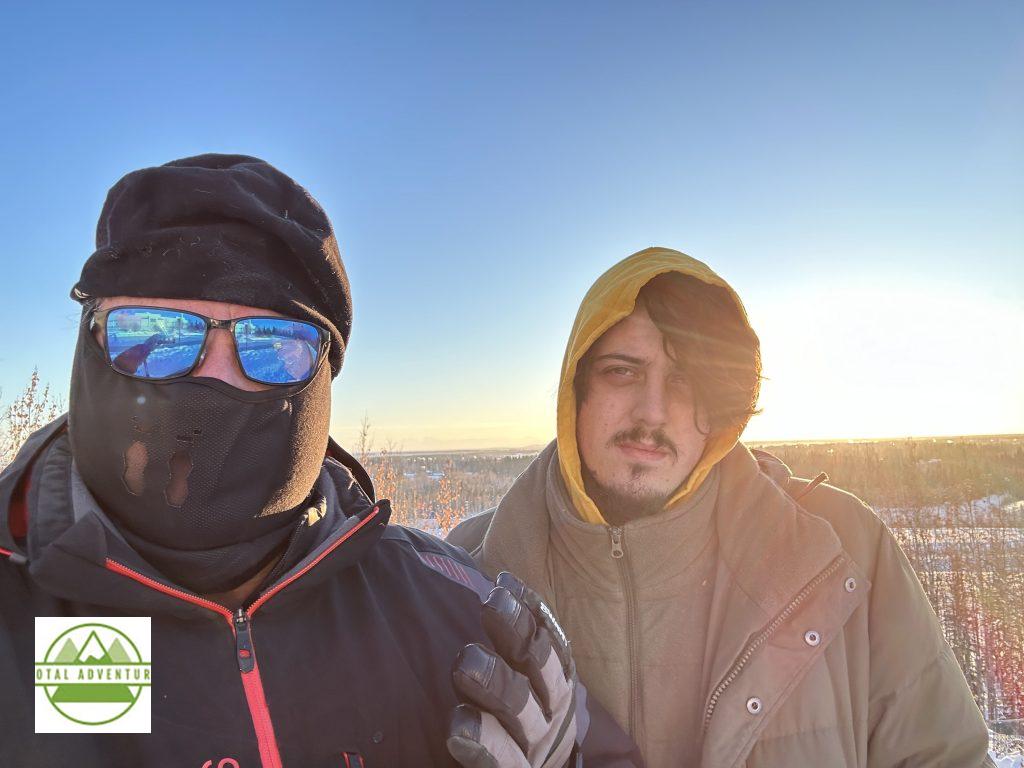
In January TotalAdventure returned to Fairbanks,Alaska, North America’s Northernmost and Westernmost City ,less than 100 miles below the Arctic Circle and just under 700 miles from Russia.
Martin Zuver , Total Adventure Marketing for Alaska ,Canada and until recently the Russian Far East, lives in Fairbanks year round. Russian Far East destinations are on hold till further notice.
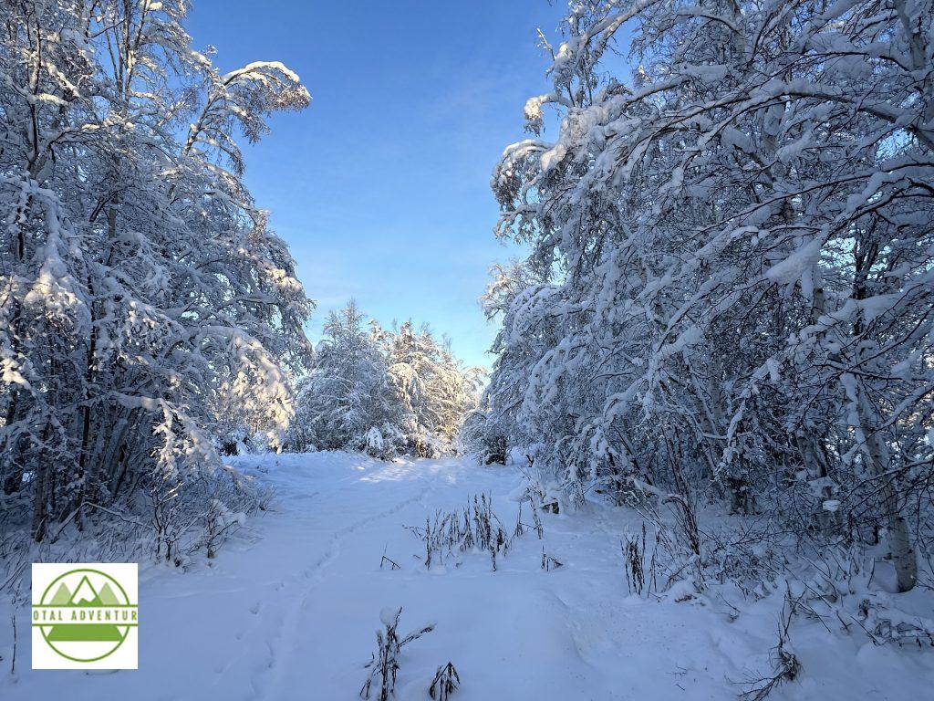
When TotalAdventure last visited in June there was 24 hours of daylight. In mid January the sun rises at 10:30 and sets at 3:20. This picture was taken at 9:45 AM. The day is already an hour longer than the solstice 3 weeks earlier.
Sunset 3:20 PM.
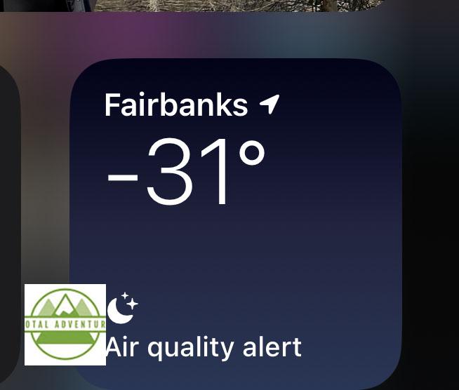
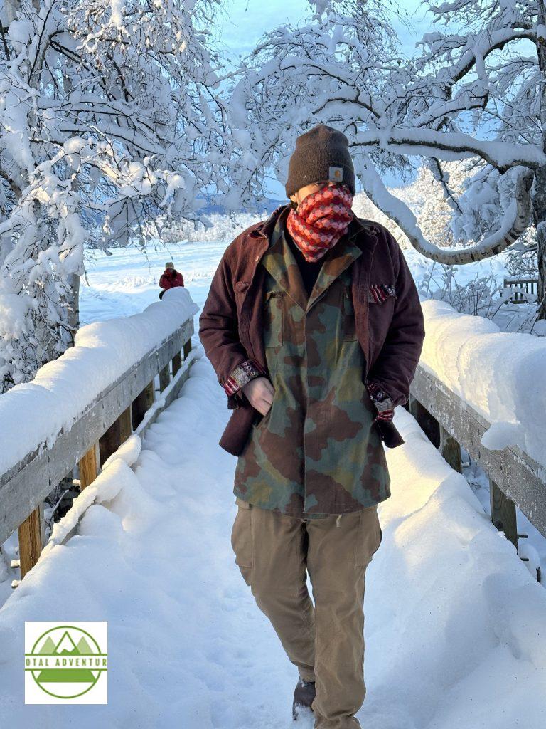
The temperature was -31 F, -35 C when departing for the Lower 48. A few days later it was – 50 F, -45 C. While cold, that was nowhere near the record of -66 F.
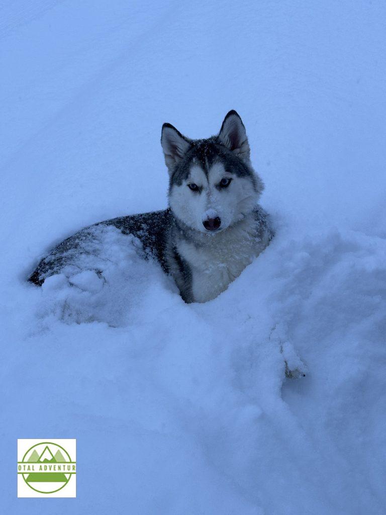
Icy – an 8 month old Alaskan Husky – is right at home in the powdery snow. Sled dogs prefer a snow bed and rarely use their dog houses.
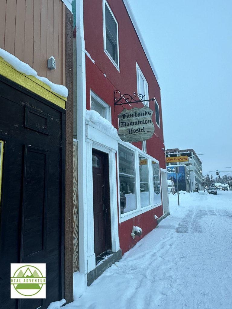
Downtown Fairbanks. Population 32,700.
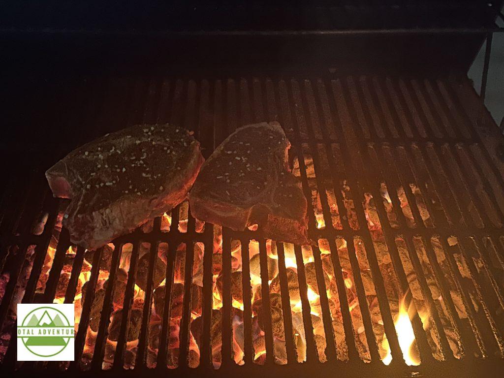
Barbequeing Excellent Alaskan Beef In -20 temperature. Fire has to be very hot.
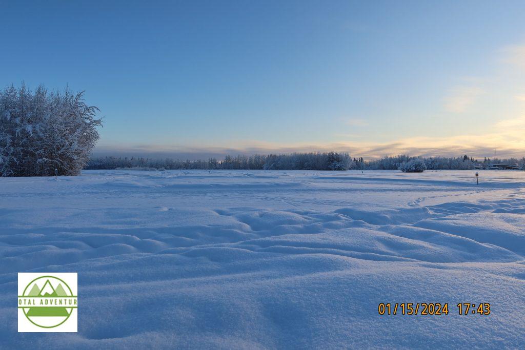
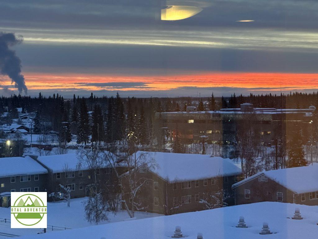
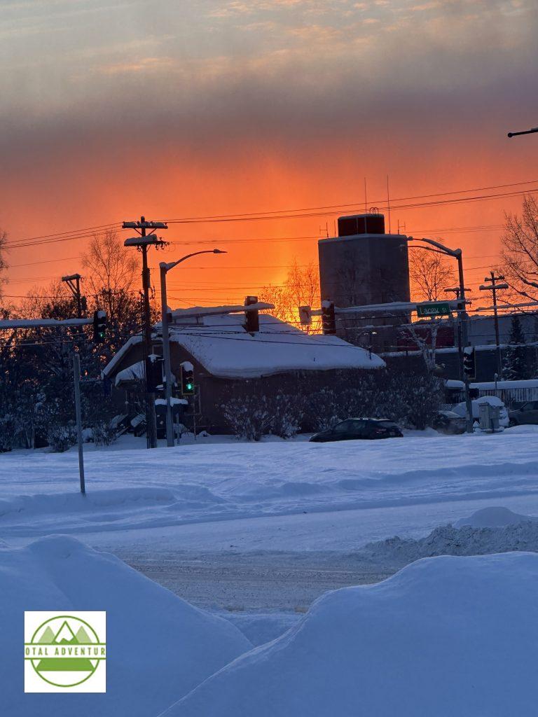
Mid Day sun on the horizon.
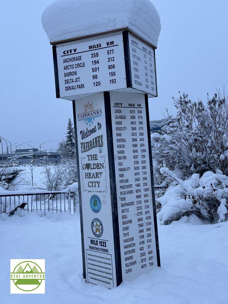
Fairbanks is closer to Oslo than New York – it’s a 6 hour hop over the North Pole.
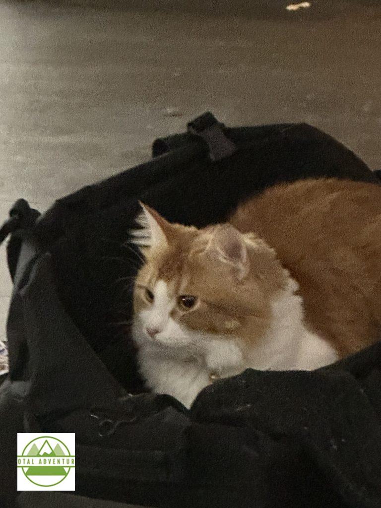
Spicy the Hemingway Cat. He spends the winter indoors.
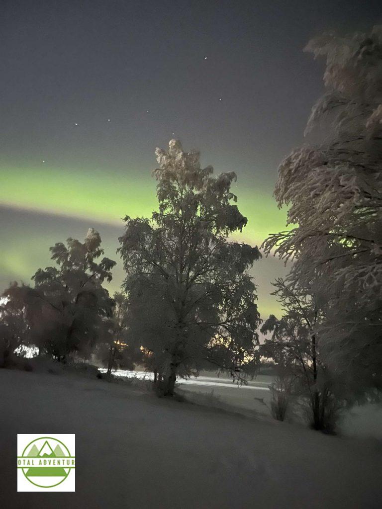
Oddly – my eye did not catch the Aurora,but the camera did !
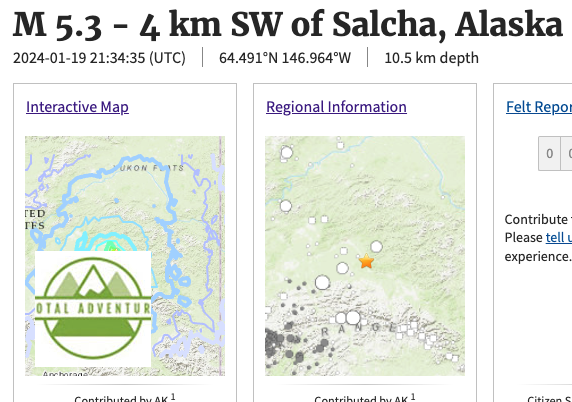
Other Natural phenomena _ A 5.3 Quake occurred just as I was finishing up a video conference in my 7th floor hotel room at 12:34 PM Alaska time. The huge cement building swayed from side to side. A cup fell off a sink, luckily plastic. When I walked to the window to look out ,the floor felt like bouncy foam. There was no damage in the city, but it was the biggest in the interior in about 20 years. Coastal and island Alaska is the northern rim of the Ring of Fire and has some of the world’s largest earthquakes and tsunamis. A 9.2 on Easter Sunday 1964 in Anchorage destroyed the city and killed hundreds. 100 foot tsunamis washed way entire villages and fishing docks.
-24 And Sunny.
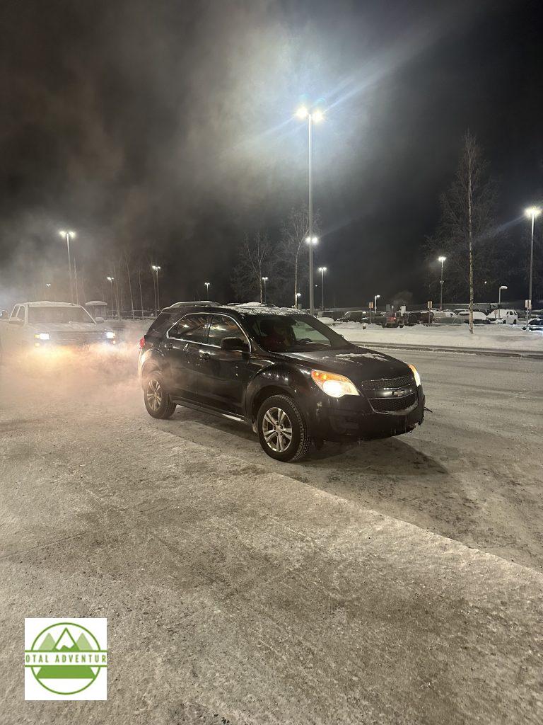
The weather necessitates engine block heaters – cars are plugged in when parked for more than a couple hours.
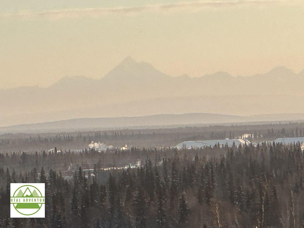
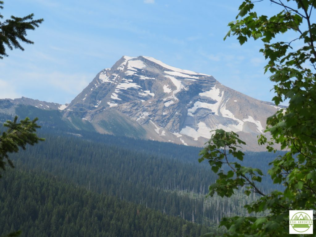
20,000 ft. Mt.McKinley ( Denali) 12 miles to the south.
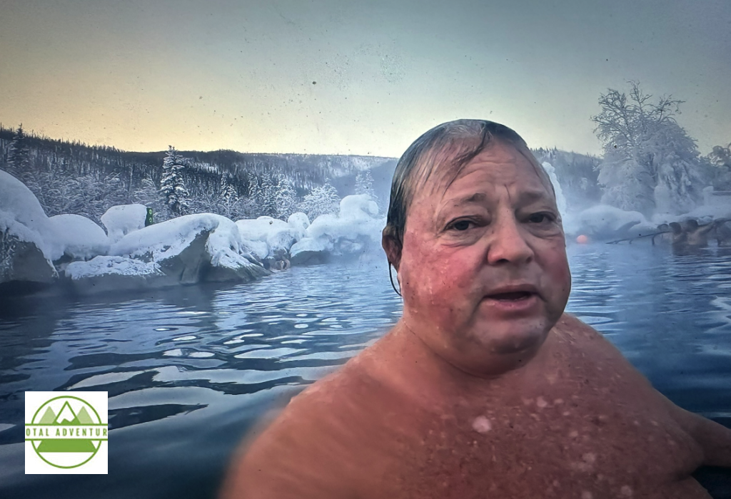
Swimming In -8 air. Water is 106 – the Cheena Hot Springs.SEE THE VIDEO ABOVE AT TOP OF PAGE !
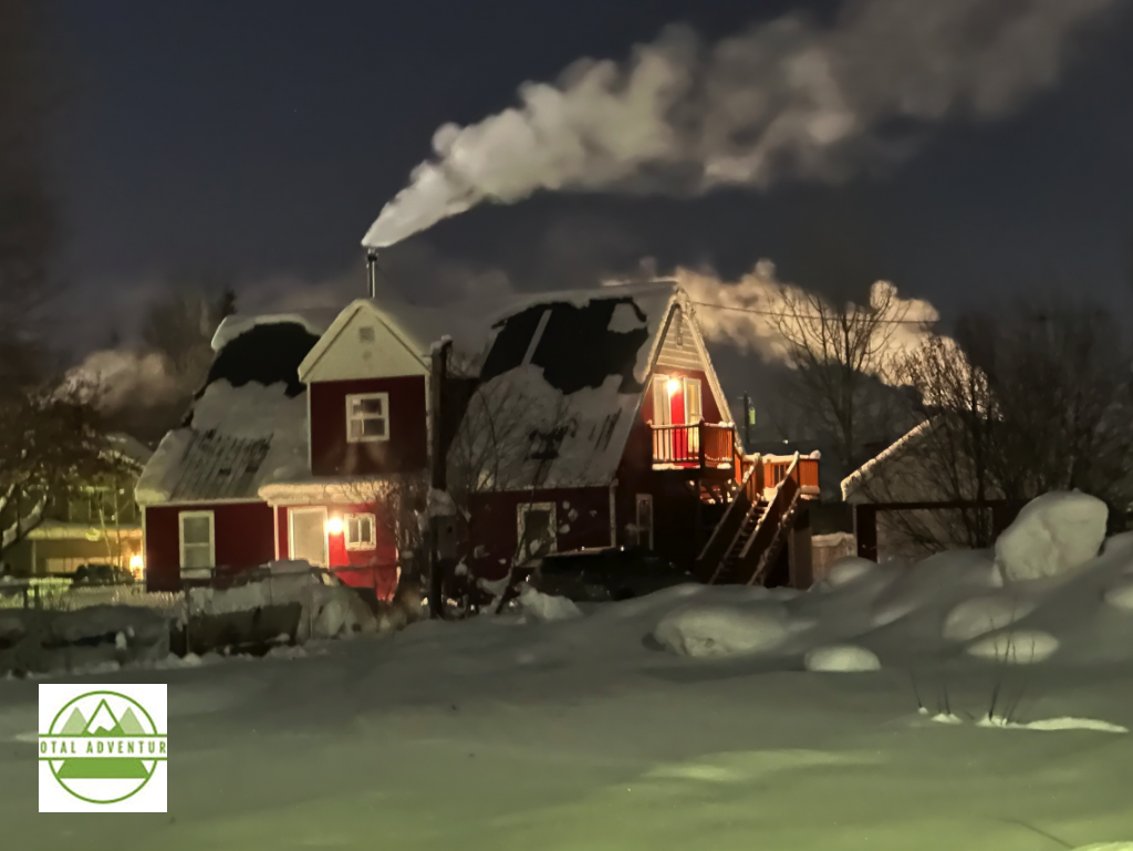
A Cozy Night At Thirty Below.
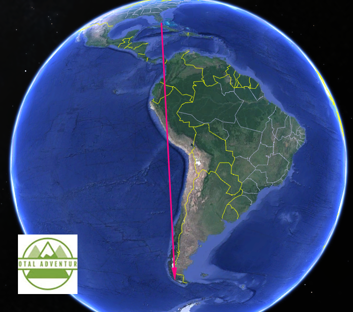
This article is the first of a two part story – where TotalAdventure explores the southernmost reaches of the inhabited world. TotalAdventure was invited by the Adventure Travel Trade Association and SERNATUR ( Chile Ministry of Tourism) to joining two expeditions – one in Torres del Paine National Park – more detail in the next article and another engaging in other activities on Estancias and in the vast preserves of nature. SERNATUR paid for air travel and other essentials. The trips I joined were run by Chile Nativo. Besides exploring the incredible nature of the region – we met with 25 companies chosen to work with us to sell their packages on TotalAdventure. 32 other buyers , along with press , were invited to promote the pristine unspoiled remote areas of Chilean Patagonia , the Strait of Magellan – the Gateway To The Antarctic.
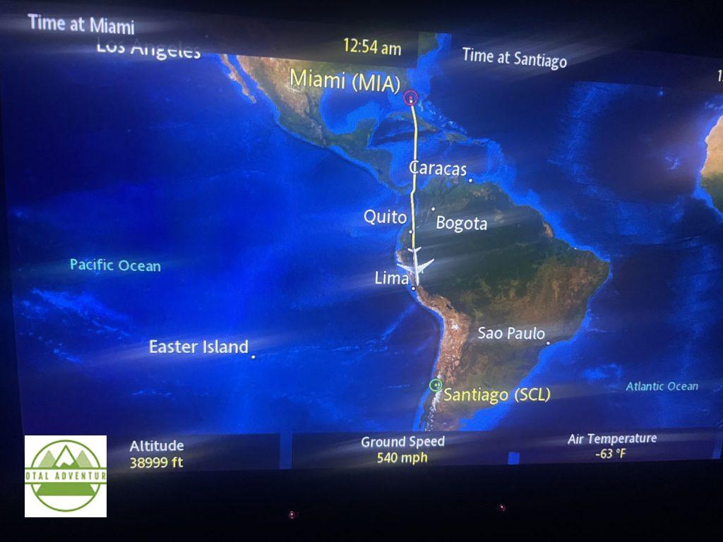
TotalAdventure has been commuting to the Southern Cone this year. First, 8 hours to Santiago. Then another 4 hours down to Puerto Natales.
To El Fin Del Mundo – The End Of The World.
From Summer To Winter.
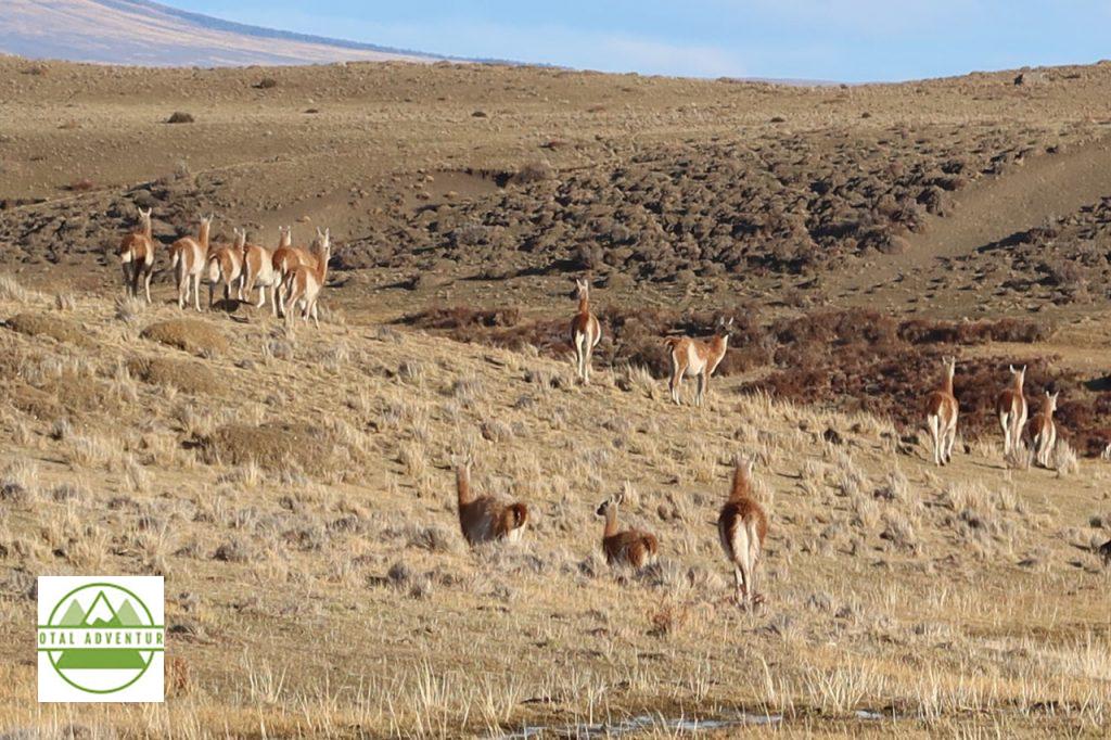
Where The Guanacos Roam.
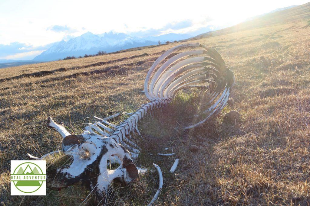
Stripped Clean By Pumas.
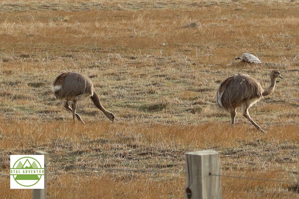
Rheas, A Smaller Version Of The South African Ostrich.
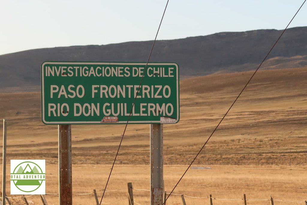
Argentina Border. In order to drive to other parts of Chile, one must drive over 1600 km through Argentina. Chile is almost all islands or impassable glaciers and forest from Puerto Natales to Puerto Montt. Relations between the two competing Latin giants are cordial ,but not always friendly.
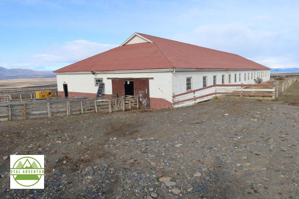
We spent the day at Estancia Cerro Guido, very near the Argentine border crossing at Río Don Guillermo. The Estancia has huge herds of sheep, and allows visitors to experience daily life on the Patagonian steppes.
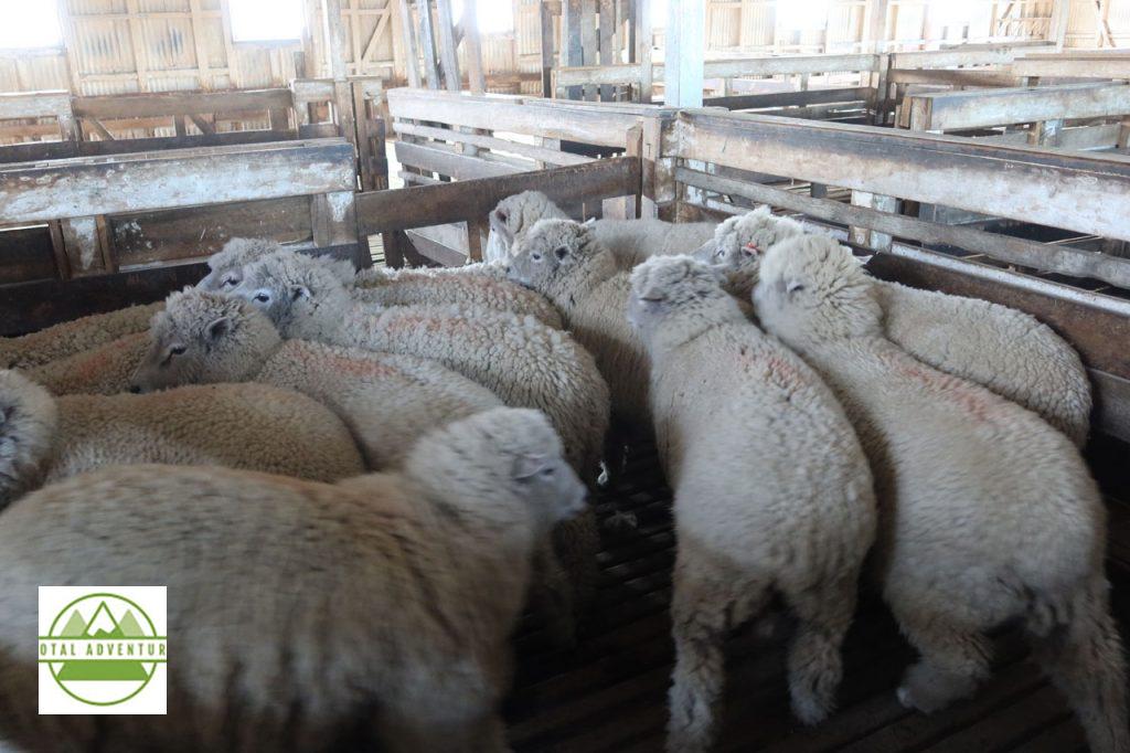
The sheep are very wooly by winter’s end.
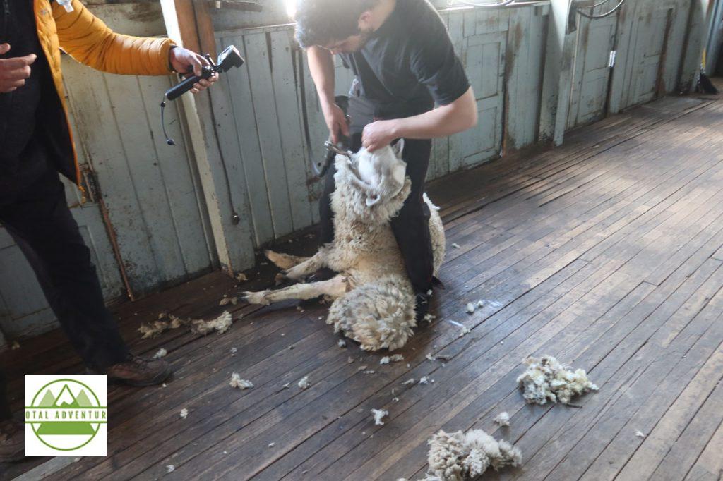
It’s time for a haircut. While the ewe is mildly annoyed, there is no pain. It can be dangerous for the wool to get too thick and heavy. In freezing rain and heavy snow, the animals can’t move and can die of cold. This past winter ( May to October) was the coldest and snowiest in many years – the Estancia had to rescue some herds .
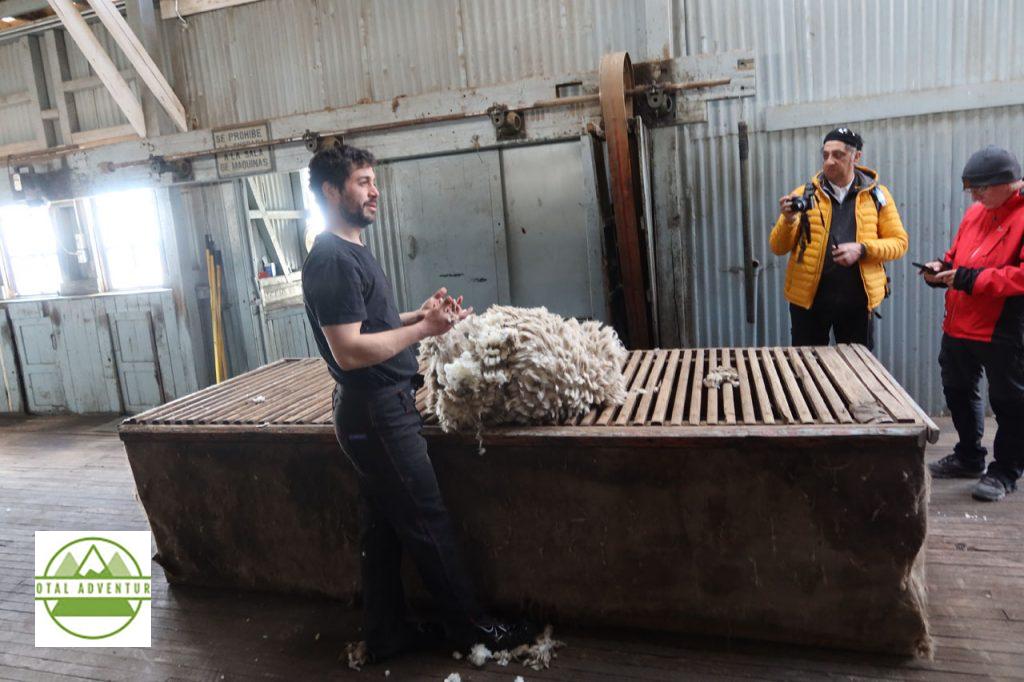
The wool is shipped all over the world to be made into high quality sweaters, dresses, socks and hats.
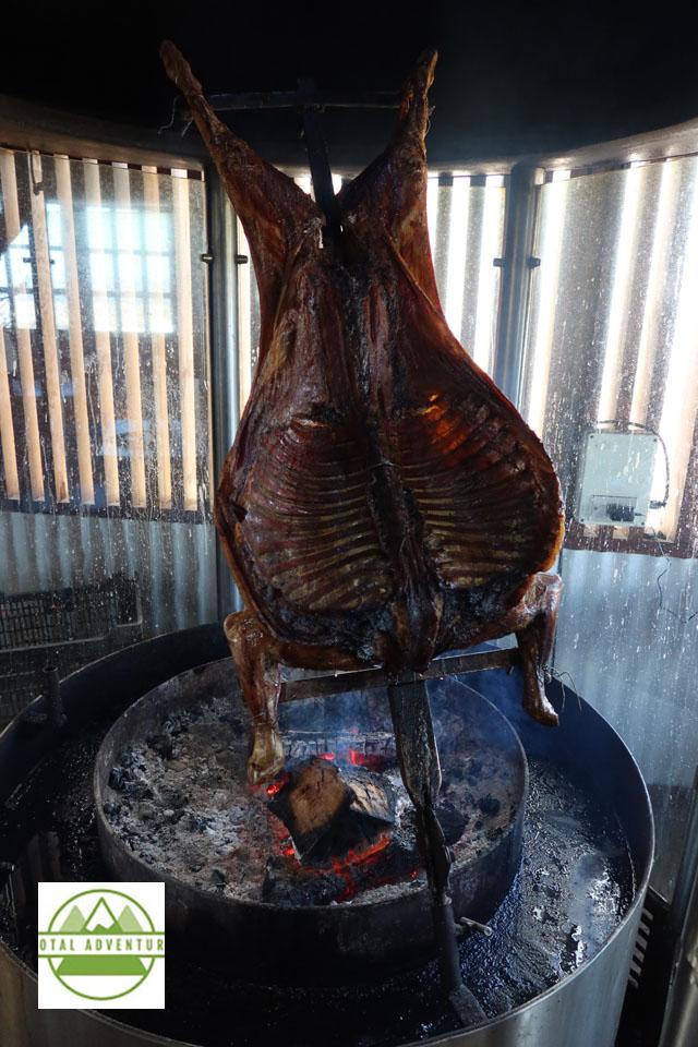
Lunch at Estancia Cerro Guido. Parilla del Cordero. ( Lamb ) A guest might enjoy this daily.
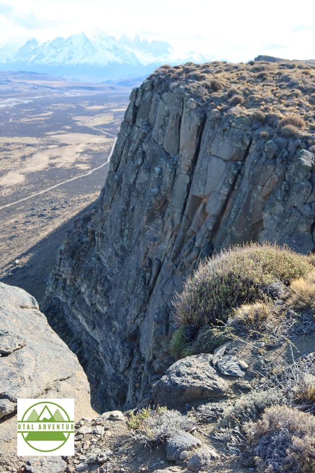
View From On High – Towards Torres Del Paine.
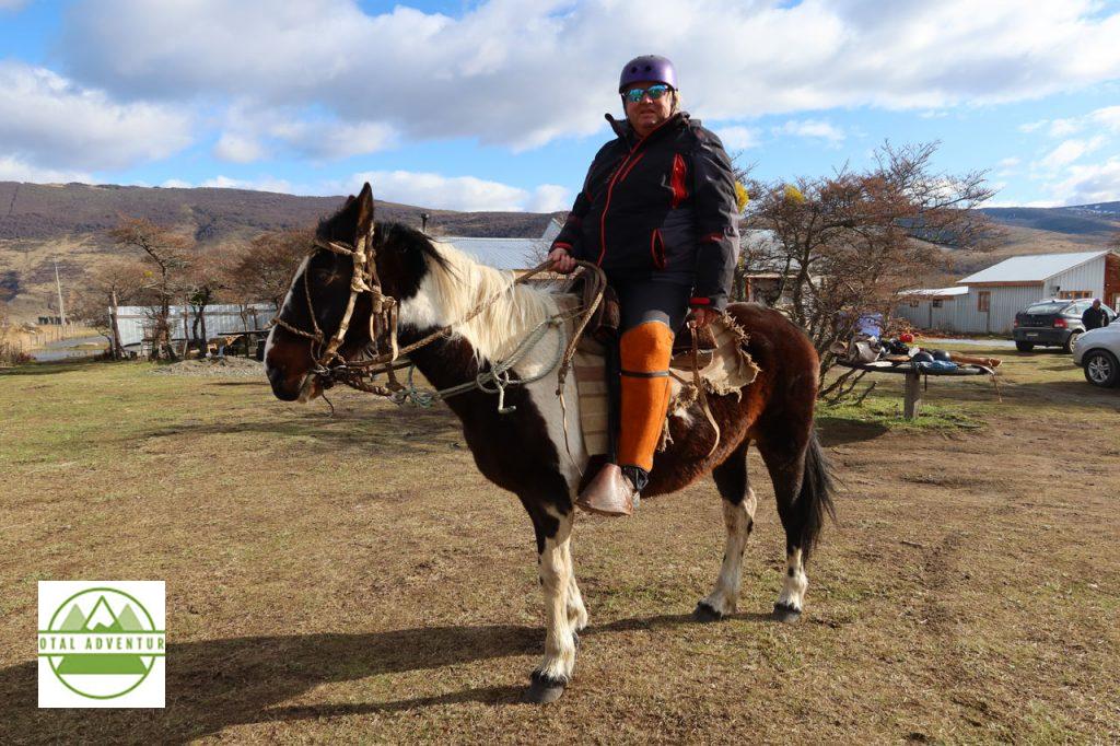
The next day, outside of Puerto Natales we rode horses up Cerro Dorotea. The outfit was not totally my choice. The horses were well tempered and responsive to more experienced riders, such as myself.
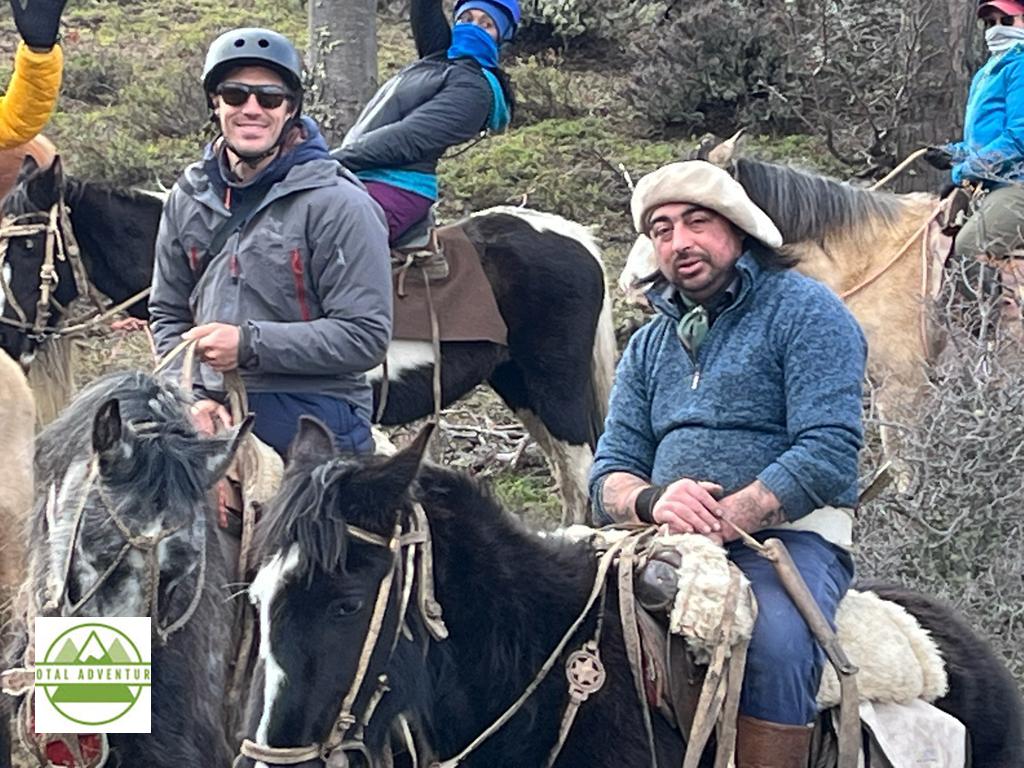
Led by Guachos – Born In The Saddle !
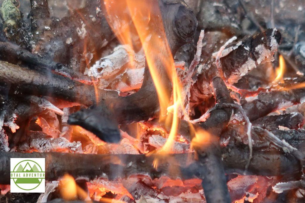
A warm fire at the mountaintop. It was sleeting at the top.
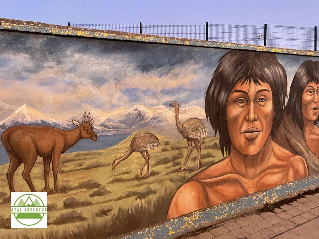
Patagonia Before The European Settlers.
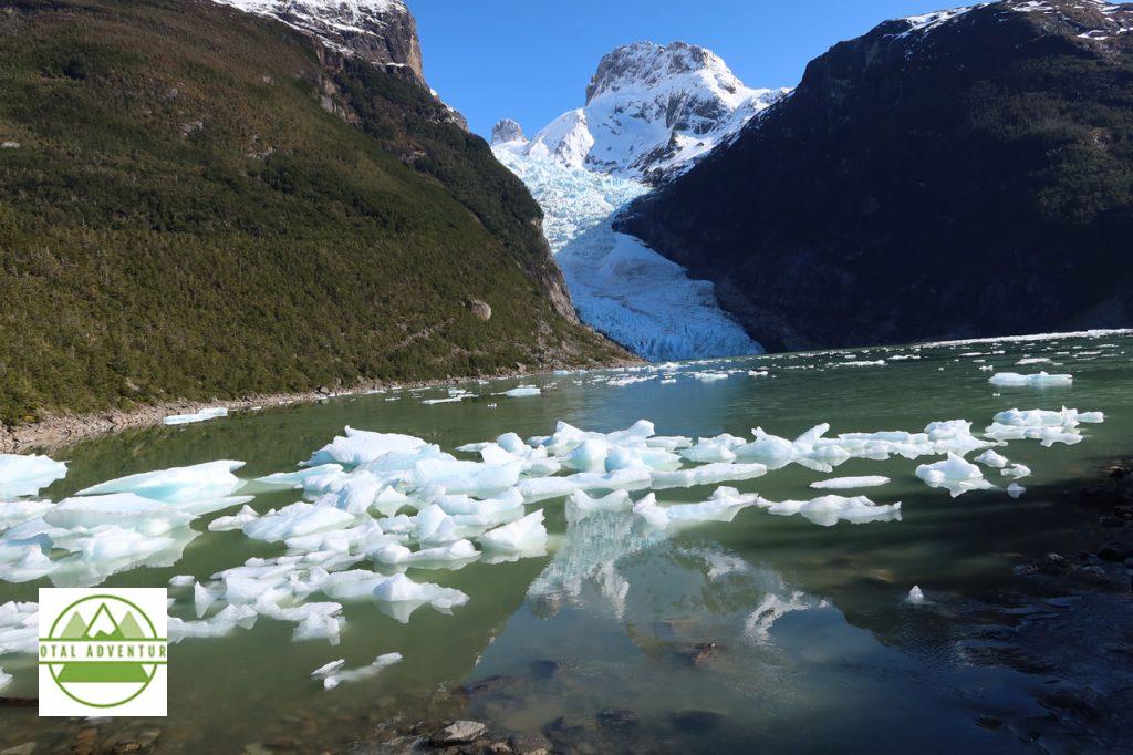
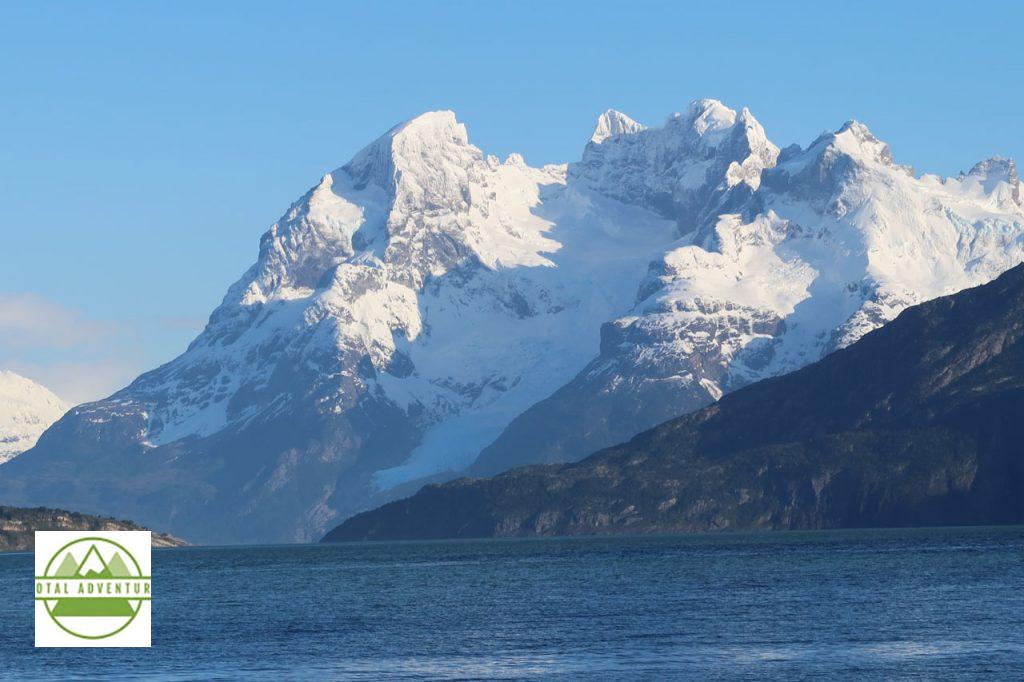
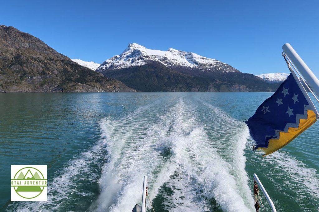
On the final day, before sales meetings began, we boarded a cruiser for an expedition through Fjord Ultima Esperanza to Glaciar Balmaceda, about 50 km from Puerto Natales.
The saltwater fjord extends a long way from the Pacific.
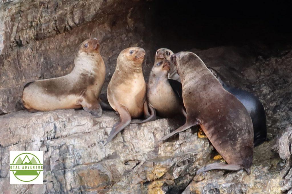
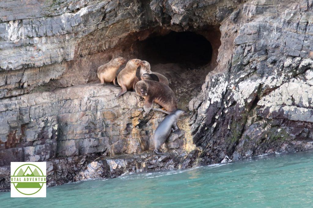
Seals live in caves along the cliffs.
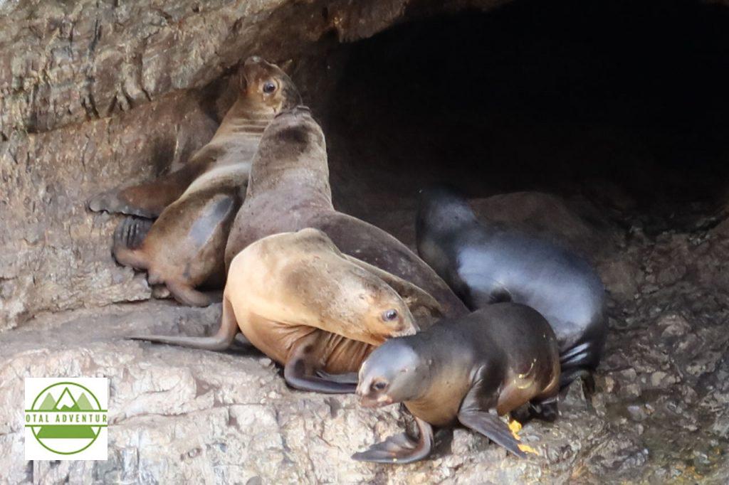
Mother And Pup.
The days are spent fishing and getting some late winter sunshine.
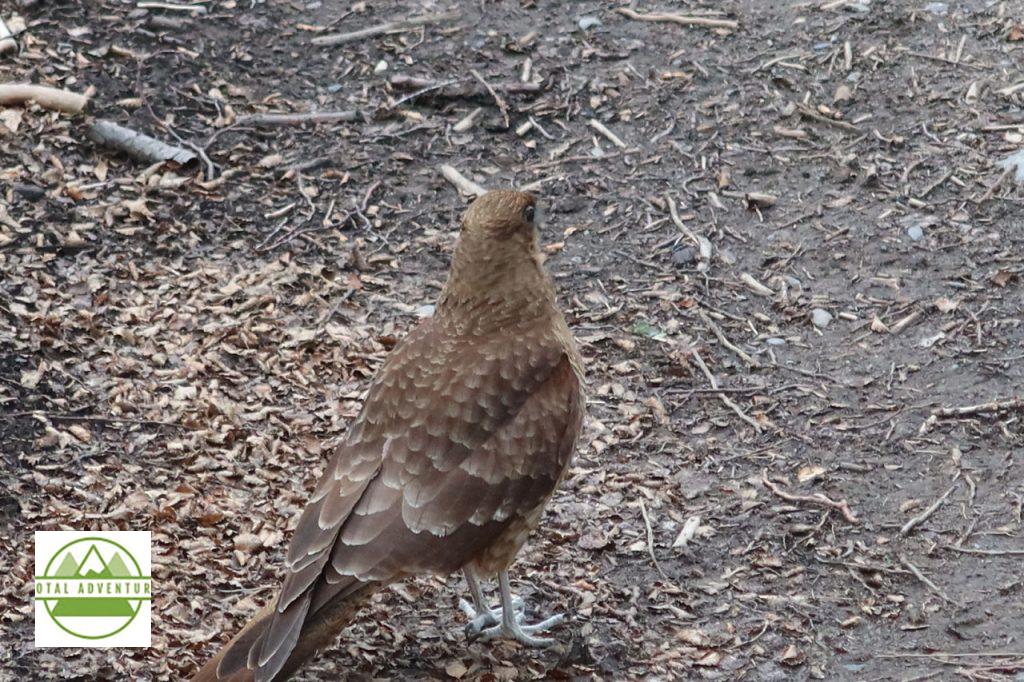
A low flying bird . The caracara ? Ornithologists please let us know..
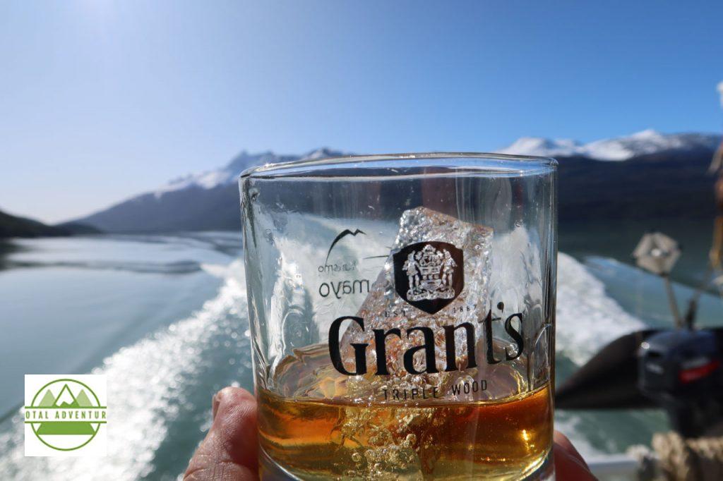
I’ll Have A Grant’s . On 3000 Year Old Glacier Rocks Please.
Abstract Nature.
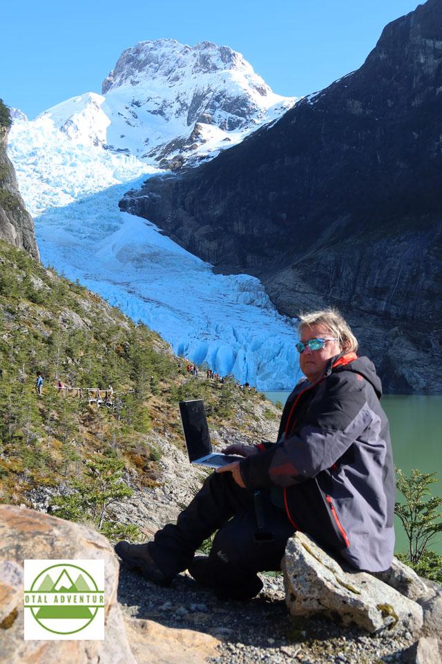
The Explorer At Work.
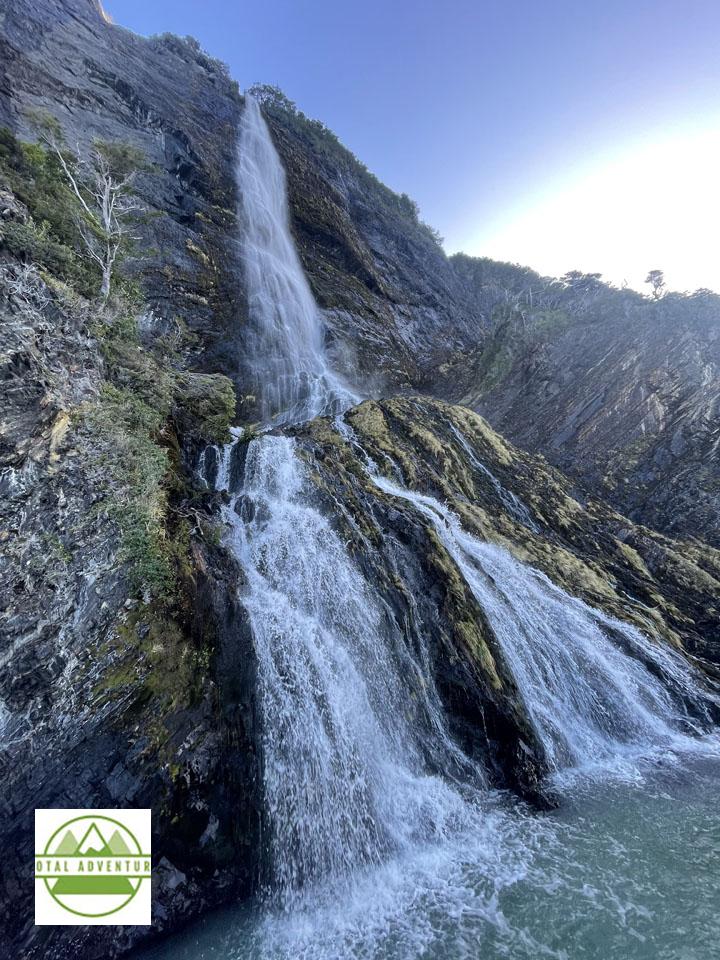
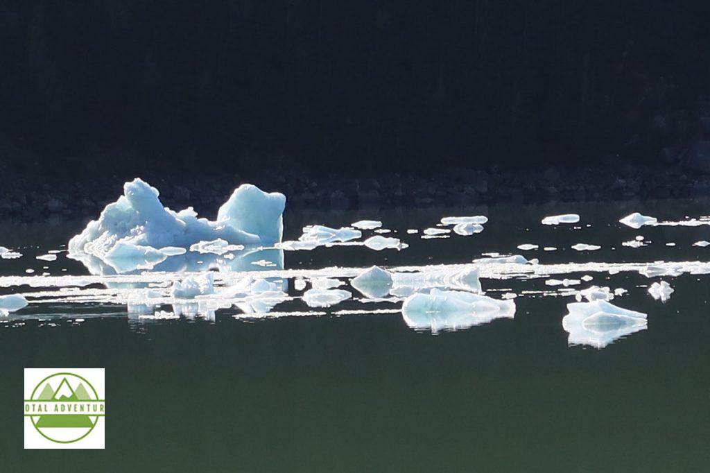
Glacial Waters spilling into the fjord.
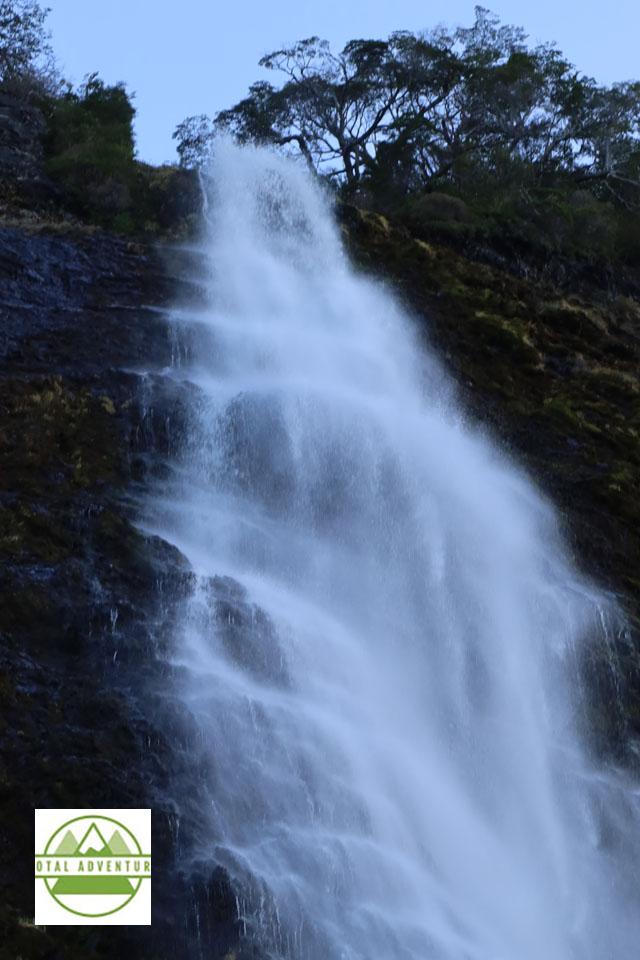
Purest Water Anywhere !
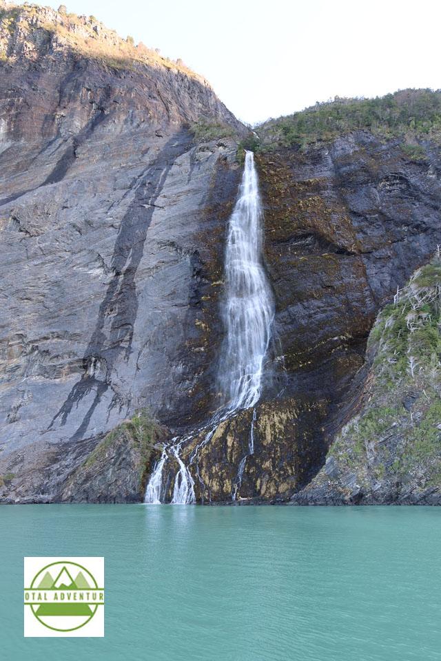
Down From Glaciar Balmaceda.
Bandera de Patagonia.
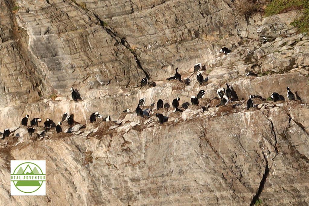
Magellanic Penguins Live On The Cliffs – Safe From Seals.
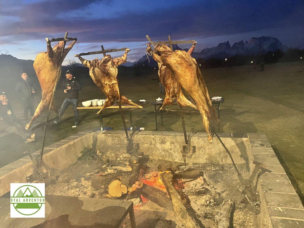
Outdoors Adventures Concluded – At the Hotel Rio Serrano we were greeted with an incredible Parillada de Cordero. The next two days were spent meeting with 25 local adventure providers – all of whom we hope sell adventures on TotalAdventure Chile Nativo already is !.
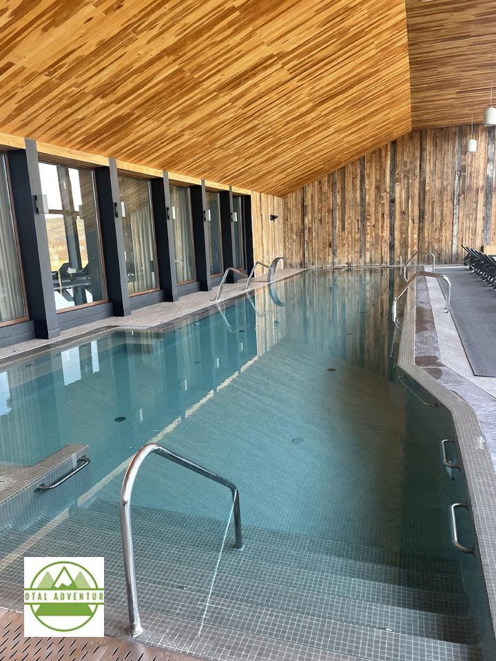
Beautiful warm pool, with nearby saunas, whirlpools and gym to warm up after a day on the glaciers !
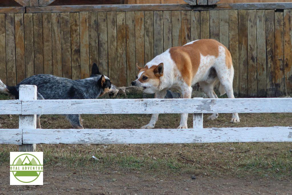
All too soon, the adventures came to a close and it was time to head to the airport. Observed outside at a roadside cafe – two sheepdogs entertaining themselves.
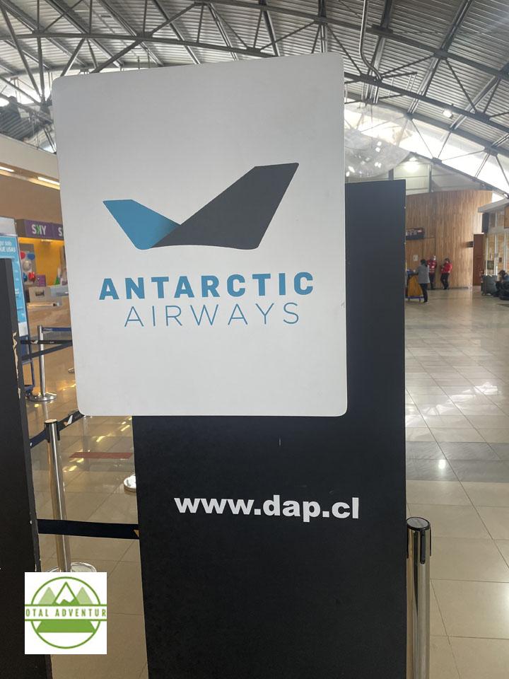
From Punta Arenas it’s a 4 1/2 hour flight to Santiago, where I had a 7 hour layover, so went into the city to have dinner with a friend. After a connecting flight through Bogotá on Avianca, I was back in Miami the next afternoon. Punta Arenas is the second most southerly commercial airport in the world – with actual flights to Antarctica – about 800 mies south.
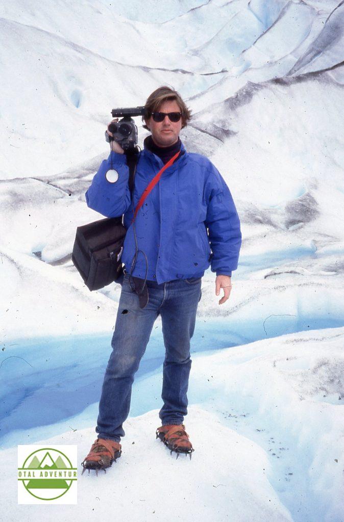
I first came to the Far South of Patagonia in February, 1991. I drove to Puerto Natales from Rio Gallegos, Argentina. I was one of 5 cars to cross the border that day. This photo is on Glaciar Moreno in El Calfate, Argentina. 31 years later, I am happy to report that the nature has not been changed much – due to strict and well planned conservation and sustainable tourism. Of course there are many more hotels, restaurants and tour companies catering to adventurous travelers from all over the world. Also technology is far more advanced. That’s a Sony Hi-8 video camera – considered quite advanced for the time with 480 lines . I had a custom made battery belt that powered it all day. To edit, I had to rent a $ 200 per hour studio in New York. Now I shoot on a GoPro 10 with up to 5300 lines and edit on my MacBook Pro. It was great to be back – stay tuned for TotalAdventure’s return to Tierra del Fuego and onwards to Antarctica next month – December 2022 !
In Late July TotalAdventure was invited to take part in AdventureNEXT Patagonia by the Adventure Travel Trade Association and SERNATUR – the marketing section of the Chile Ministry of Tourism. 32 Adventure Travel marketers were invited from all over the world to experience far-off, far South Chilean Patagonia.
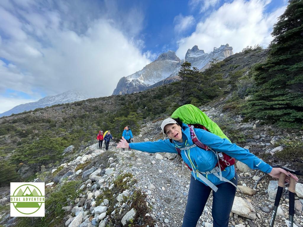
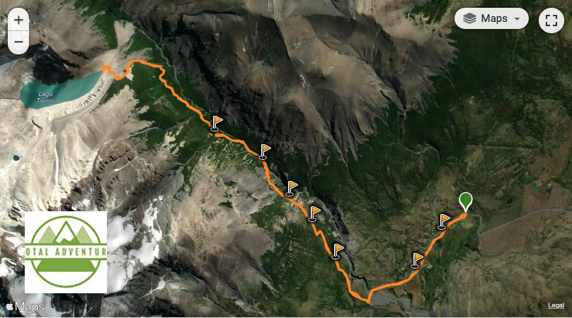
12 of us were chosen to participate on the rugged World Famous – “W Trek” an extensive 4 day hike through Torres del Paine National Park. The trip was with Chile Nativo.
The adventure began the night of Labor Day . 8 hours on the LATAM flight bought us from a humid 90 ( 32C) degree night in Miami to a bright late winter morning in Santiago. There, it was 38 (3C) degrees.
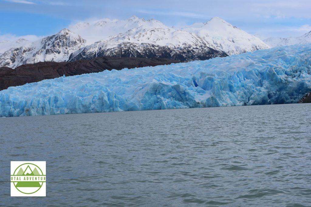
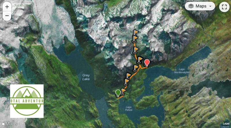
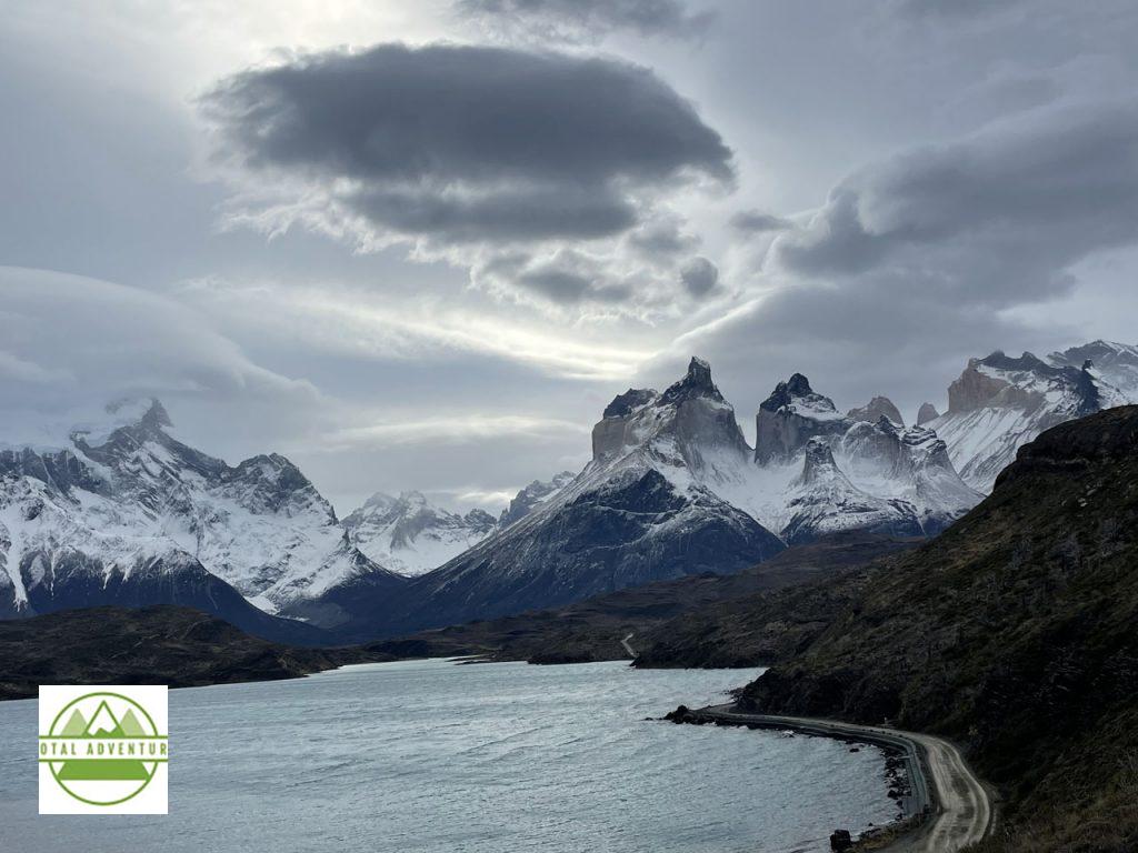
4 hours more on Sky Air bought us to Puerto Natales. Latitude 52 South . As we go off the plane it was snowing, with fresh snow on the ground and 0 C 32F. After a night relaxing and dining at Hotel Lago Grey , we we boarded a ferry to take us about 15 km to Grey Glacier at the other end of the lake.
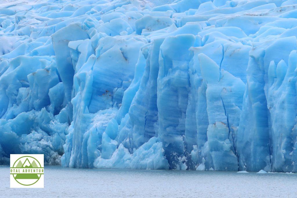
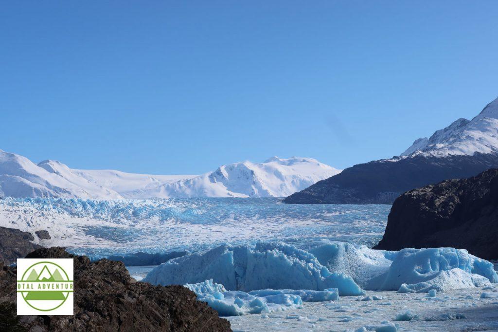
Grey Glacier is a tongue of the Patagonian Ice Sheet – the world’s third largest after nearby Antarctica and Greenland.
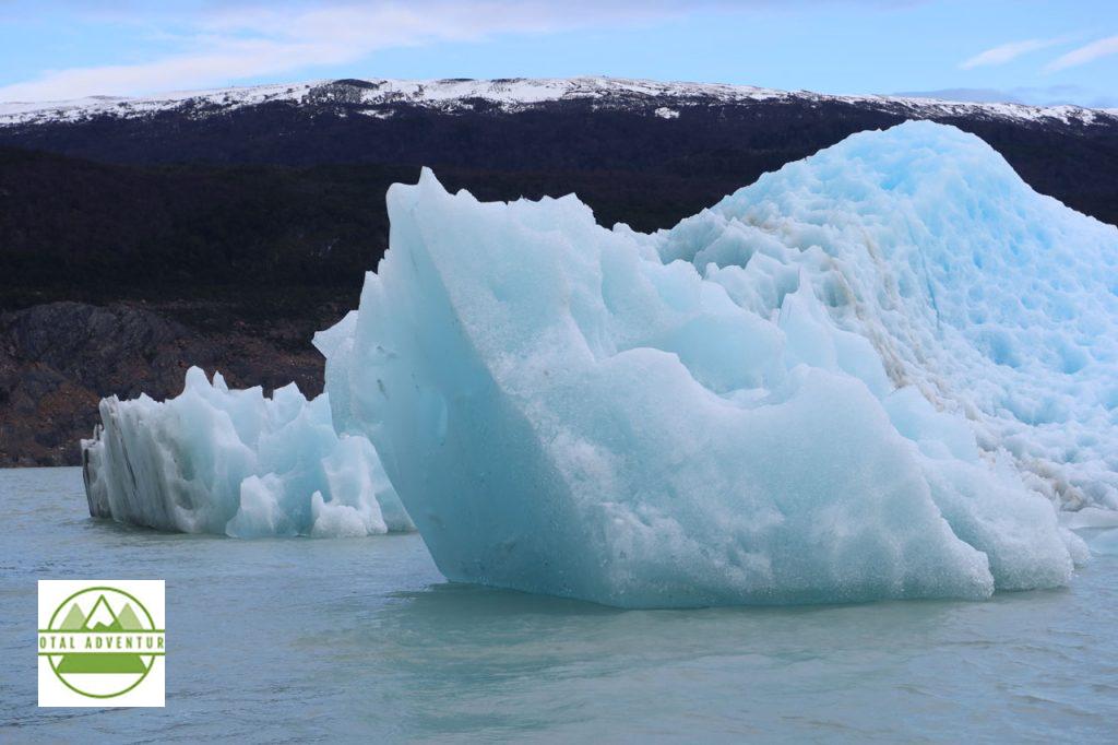
The lake it melts and calves into is a constant 2 C – a person will die in just a few minutes if they fall in – losing consciousness after 2 minutes.
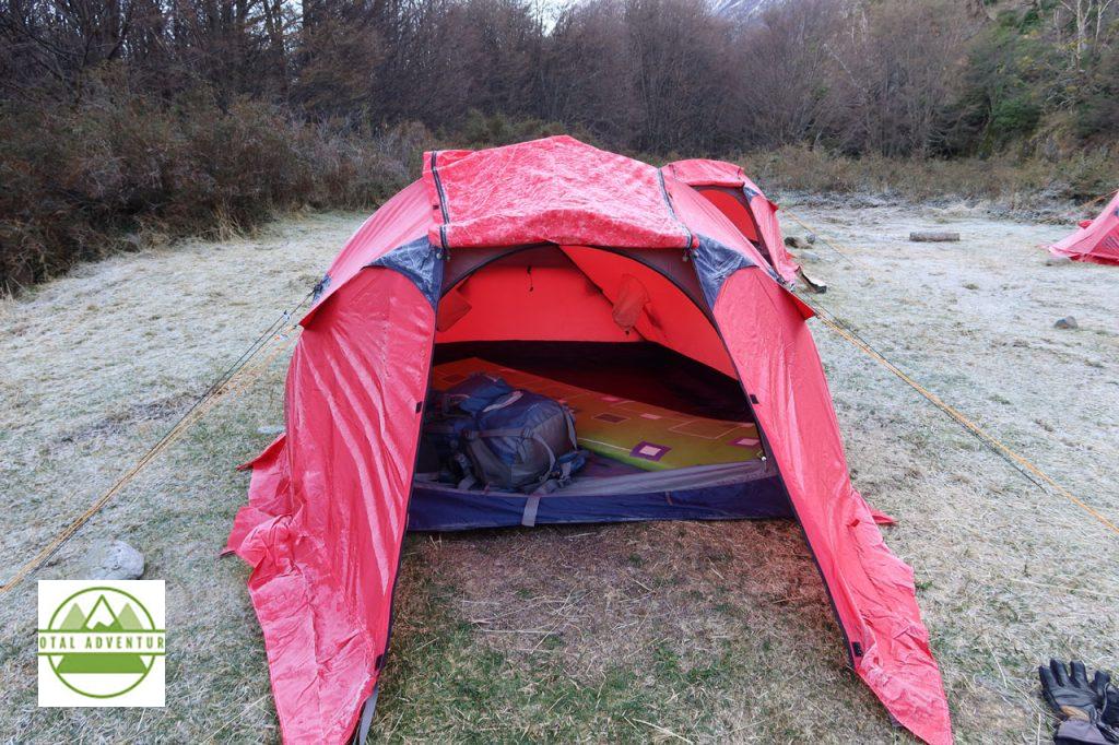
After we left the ferry ( see video) our Group dropped off our things at camp. The tents were already set up. It was super-cold – note the frost signifying subfreezing temperatures at mid day.
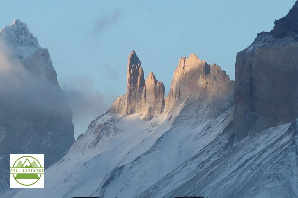
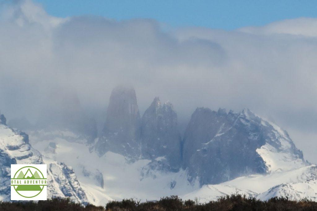
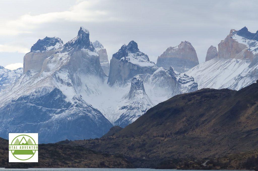
Above us and about 20 km distant, are the Torres del Paine. 9800 feet 3015m high, formed by magma ejecting upwards from under the Earth. Many think these mountains and rock formations are the end of the Andes. They are not ! This is the Paine Mountain Range, formed just 1 million years ago, not 64 million like the Andes.
A glacial tongue/
We ate our excellent lunch, packed by Hotel Lago Grey on top of a rock escarpment overlooking the glacier.
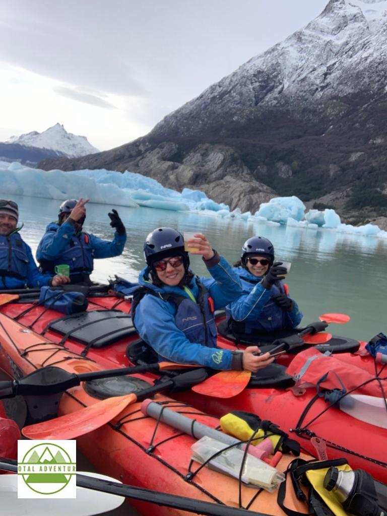
After lunch it was time to kayak. Everyone got suited up and went off exploring the icebergs. Big Foot Patagonia runs the excursions with all equipment. Credit:
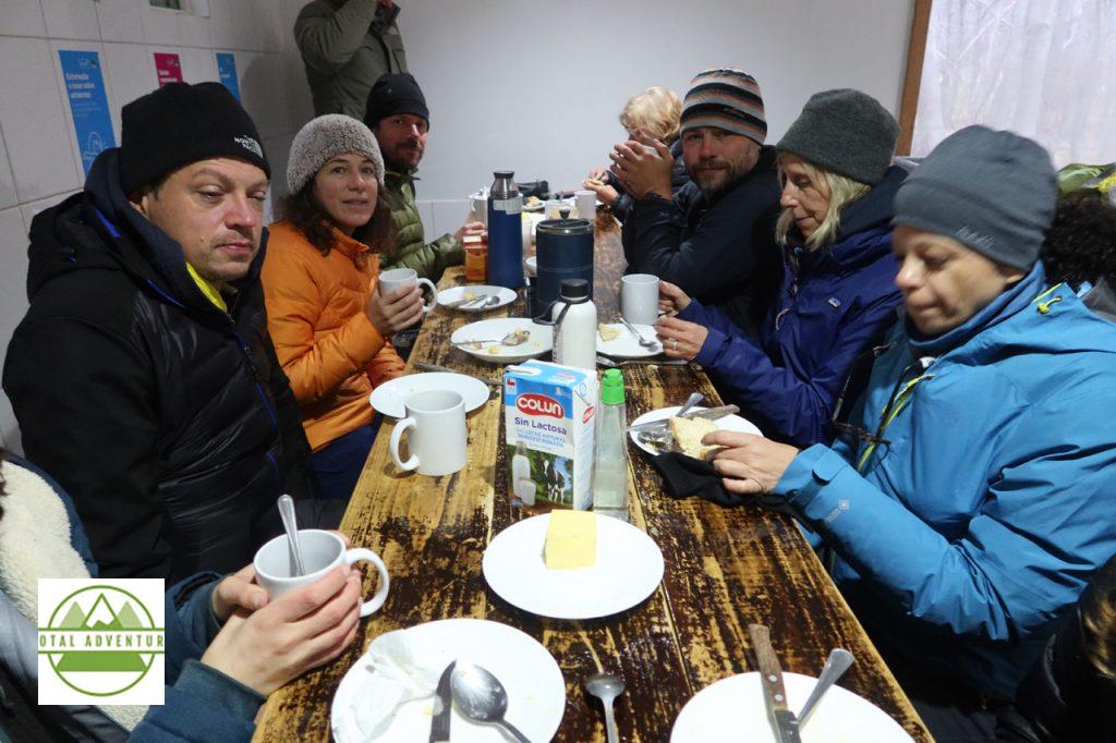
We endured a very chilly night in the tents. Even with down sleeping bags it was cold. We had a hearty breakfast in the morning inside the camp shelter. The sun does not rise until almost 9 AM in September , so it was still like night.
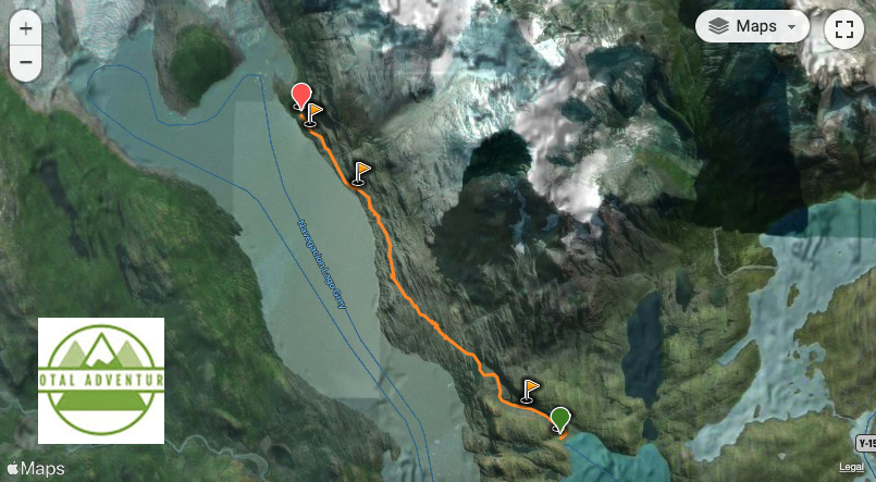
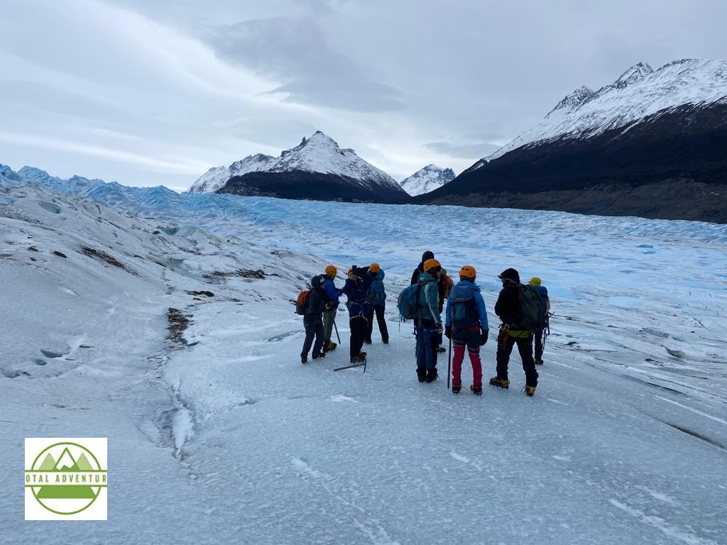
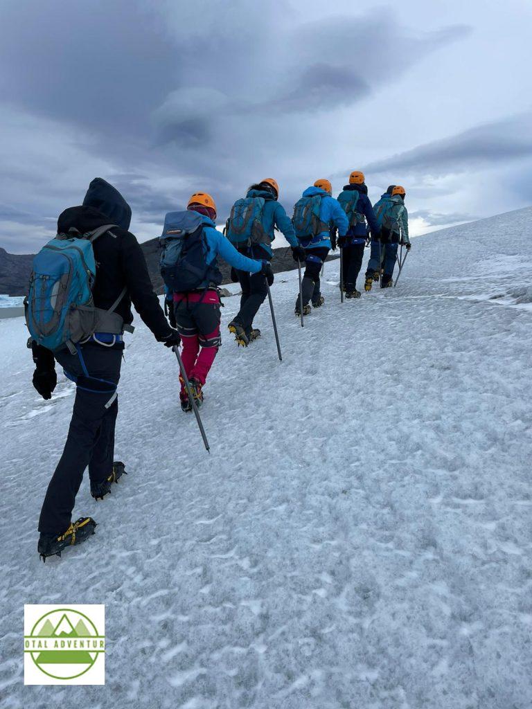
Thursday, September 9th, began with a 5 hour trek across Glaciar Grey. Followed afterwards by a 12 km hike to the next camp.
Under the guidance of Big Foot Patagonia. Credit:
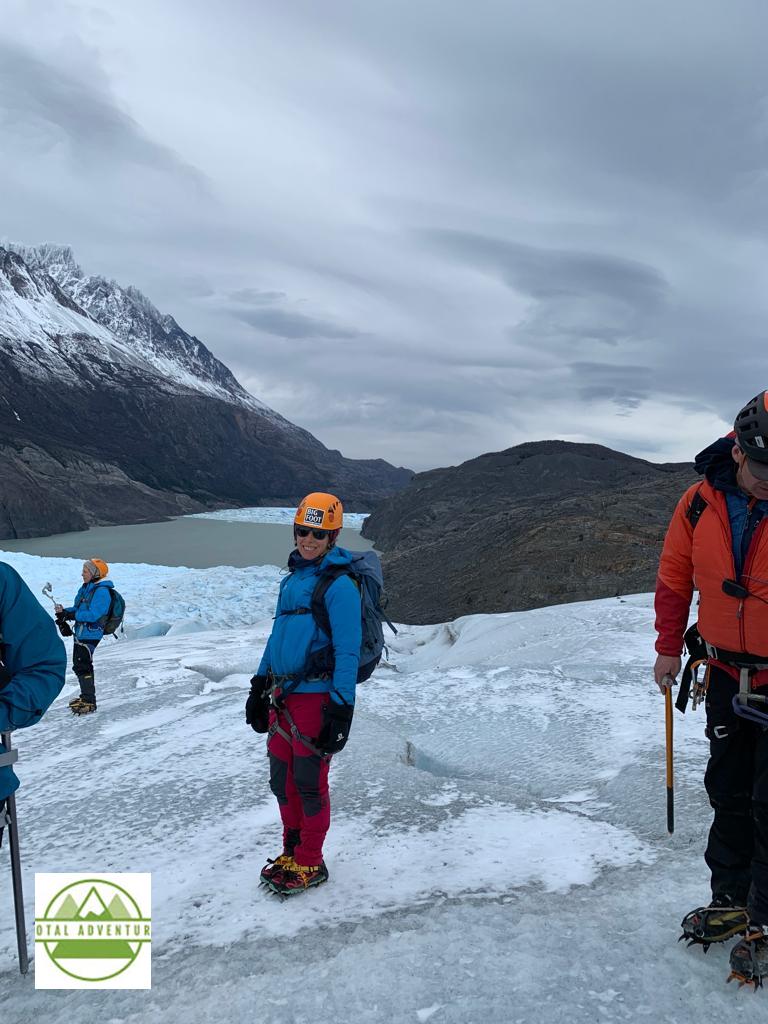
It is a long rocky uphill hike just to get to the glacier. Credit :
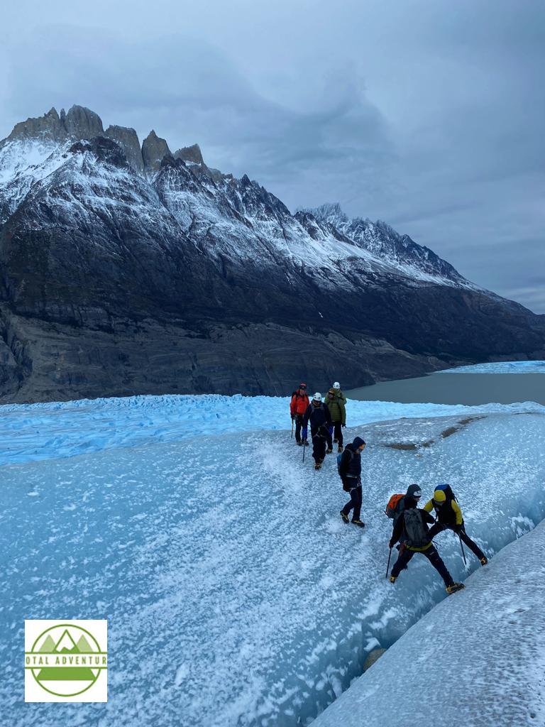
Across the crevasse . Credit :
After getting off the ice, it was time to hike to the next camp. The group did not arrive till evening and then it was off to sleep.
The third day was truly magnificent. The skies were mostly clear, with warmer temperatures.
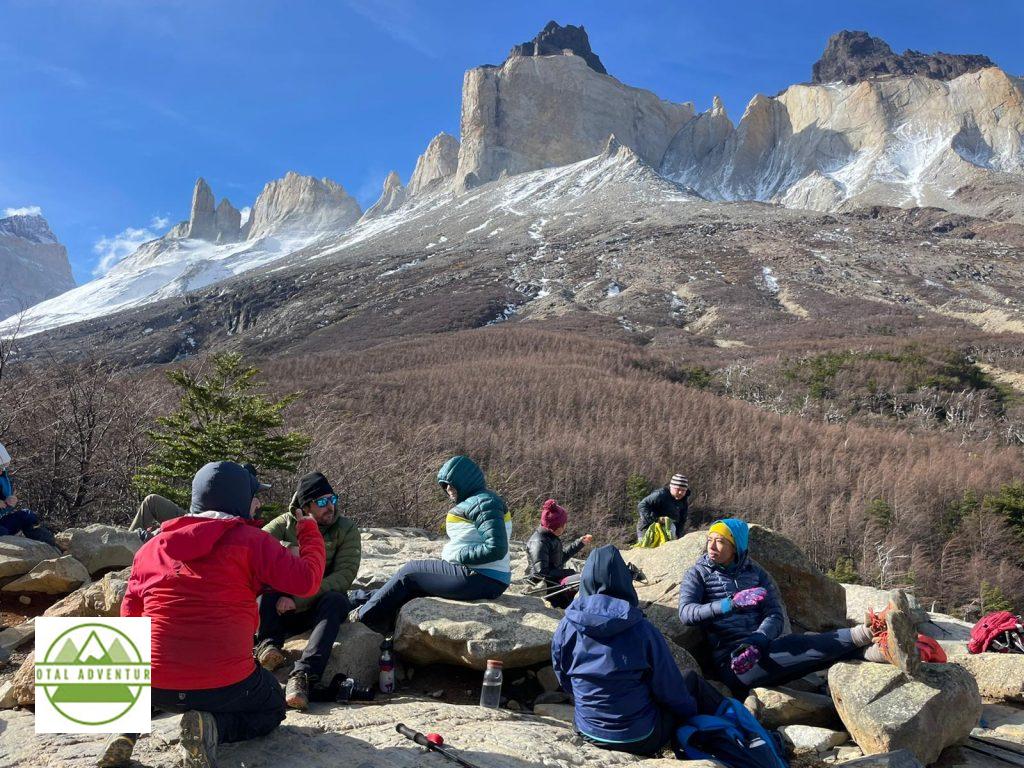
At The Foot Of Cuernos del Paine. Credit :
Onwards & Upwards ! Credit :
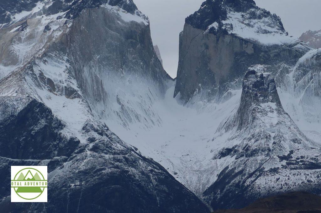
Los Torres From Lago Pehoe.
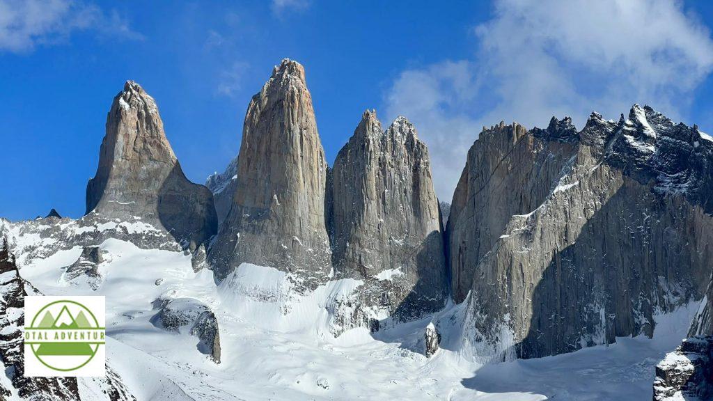
Los Torres From The Lookout Point, after an 18 km hike.
Imagine Skiing Through The Chute – could be done with a hang glider for the cliff down below. The tallest of the Cuernos del Paine was only recently climbed for the first time ever. The rock is soft and chalky – making it very dangerous to hammer in pitons.
Te final day led to a luxurious hotel – welcome after camping out.
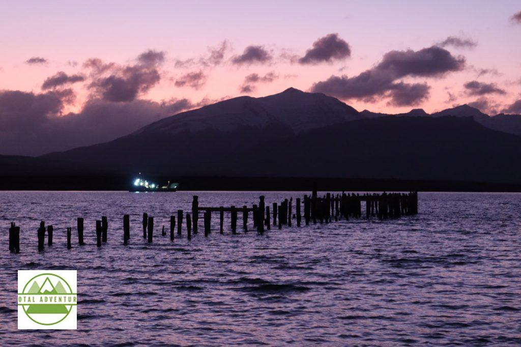
Sunset In Puerto Natales. There For A Night Before Exploring The Fjords.
It’s not easy being an adventurous spirit but living confined to the city, so today, October 8th, 2021, I am starting my 3 days snorkelling-intensive trip in the Galapagos Islands with a tailored-made itinerary.
I visit the islands as much as I can, but each new occasion makes me feel like I’m a privileged alien who is on a mission to discover an entirely new world, not ruled under the normal laws of biology.
This time, I have coordinated my hotel stays, meals, and snorkelling tours with Andean Travel Company. The rest of the adventure is up to me, so here we go!
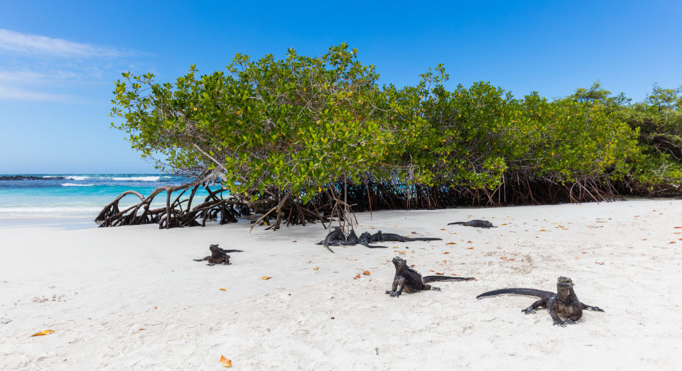
Yesterday I arrived and took the afternoon at leisure to explore Santa Cruz island’s amazing white coral beaches where flocks of iguanas defiantly stare at you and block the way. The world’s only marine iguana is endemic to these islands.
I’m staying in a hostel in the middle of the bustling, colourful town of Puerto Ayora, one of the three urban centres of the archipelago. I would very much prefer this whole place to be inhabited, but people have been driven to these islands by the promise of economic success for decades now.
I was picked up by my guide and we walked a couple of blocks towards the dock. We embarked on a speedboat to Seymour Island.
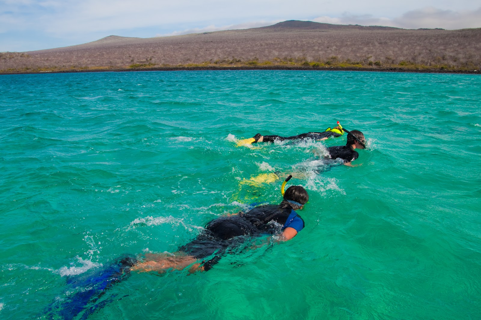
I was provided all the necessary equipment and went directly to business (after listening to the guide’s directions). My very first sight was a group of whitetip reef sharks cruising between the low basaltic cliffs below me. I did not expect that my first animal observation would be this quick and thrilling!.
Colourful fish such as the king angelfish, boxfish, and parrotfish swam around, and I got lost in thought admiring them. A strange sound brought me back to reality. It was as if small missiles were being shot… It was the sound of blue-footed boobies and pelicans plunge-diving at enormous speeds to catch fish!
These daily snorkelling tours provide lunch, and I’m grateful for that, as it is a very energy-intensive activity.
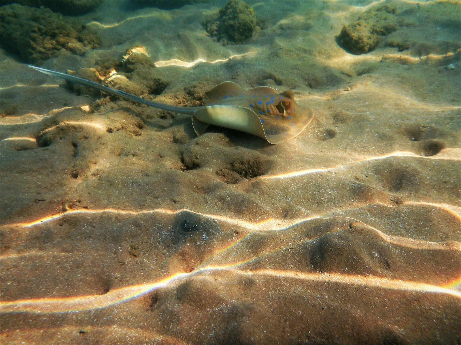
In my second swim of the day, I spotted one of my favourite marine animals, the black-botched ray. It looked so elegant with its perfectly aerodynamic platform and majestic in its cyclic underwater flight. I also hoped to see a scalloped hammerhead shark, but they are difficult to find, so let’s see what happens tomorrow.
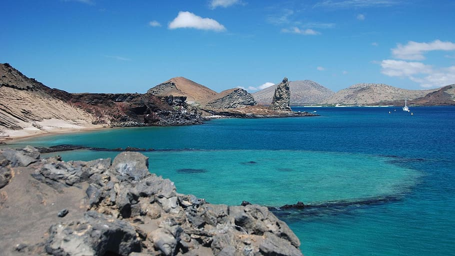
Today, October 9th, 2021, I’m heading to one of Galapagos’ most iconic landmarks. Pinnacle Rock on Bartolomé Island. Located northeast of Santa Cruz island, 2 hours away in a boat, this is an immense spearheaded obelisk rising from the ocean. We disembarked on the appropriately named Golden Beach, and from there I started swimming into a shallow cove full of precious coral formations and reef fish.
During my time inside the cove, however, my mind was obsessed with swimming around the massive Pinnacle Rock itself. We got there in due time, along with the rest of the group and the guide. (No matter how good of a swimmer you are, when snorkelling always stay close to your group!)
At the underwater intersection where the sea bottom becomes a cliff, I found spectacular lava formations, where reef and Tiger sharks were accommodated inside natural galleries. Swimming ahead, I found medium-sized sea lions who adventured so close to my face that I actually got a bit scared. I tried to make as much eye contact as possible with them, and it’s a tender sensation that I will never forget.
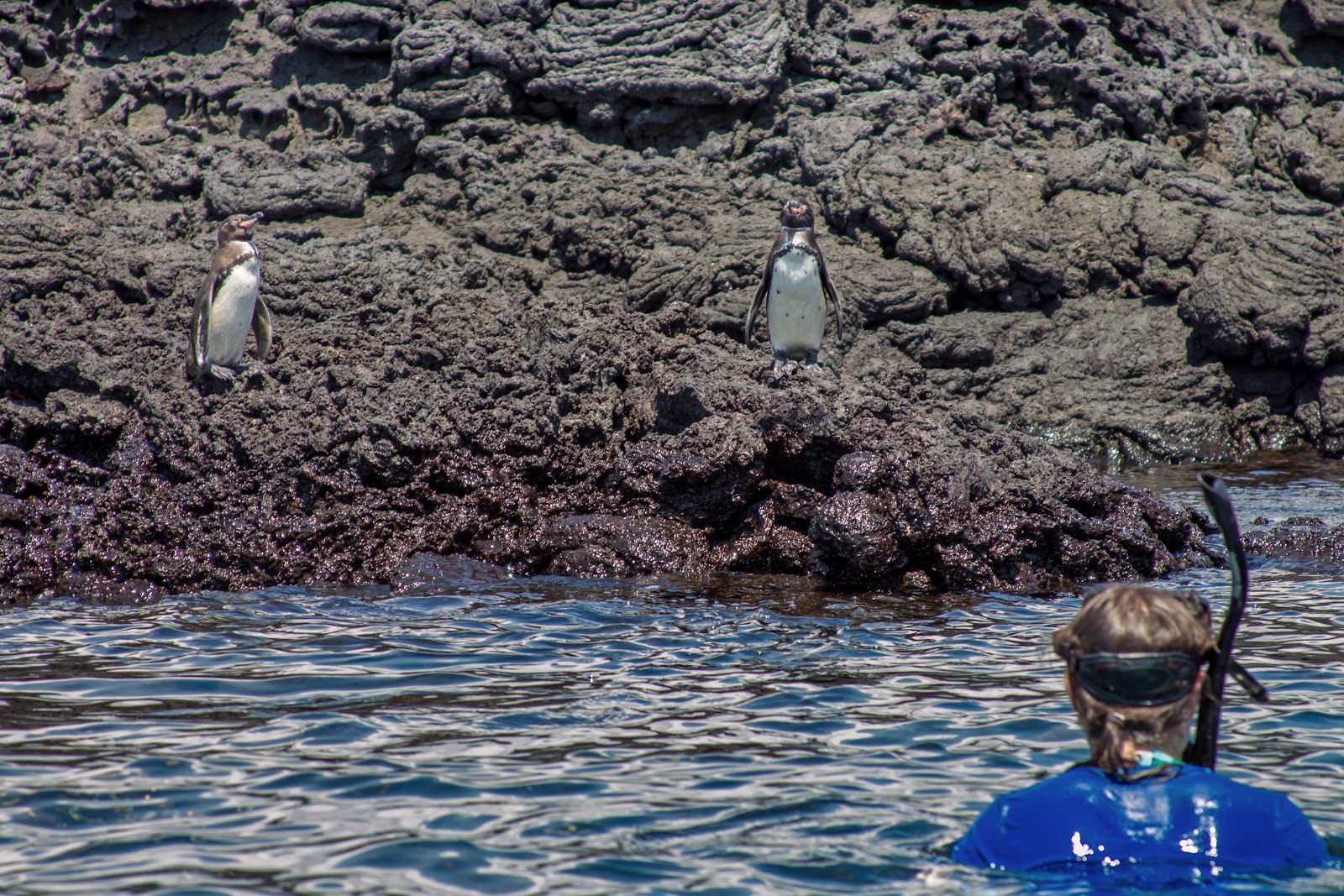
To finish off this day perfectly, we spotted the endangered Galapagos penguin standing on some rocks above the water. An Antarctic bird in these warm waters is certainly an unexpected sight, but they are one of the best examples of the unique animal adaptations happening on these islands.
Day 3! I cannot believe that today is the last of my snorkelling trip. We navigated northwest to Santa Fé Island. The area destined for snorkelling was well-protected from open sea currents, so my first thought was that this might be a smart choice for beginners. These calm, shallower waters, however, delivered generously.
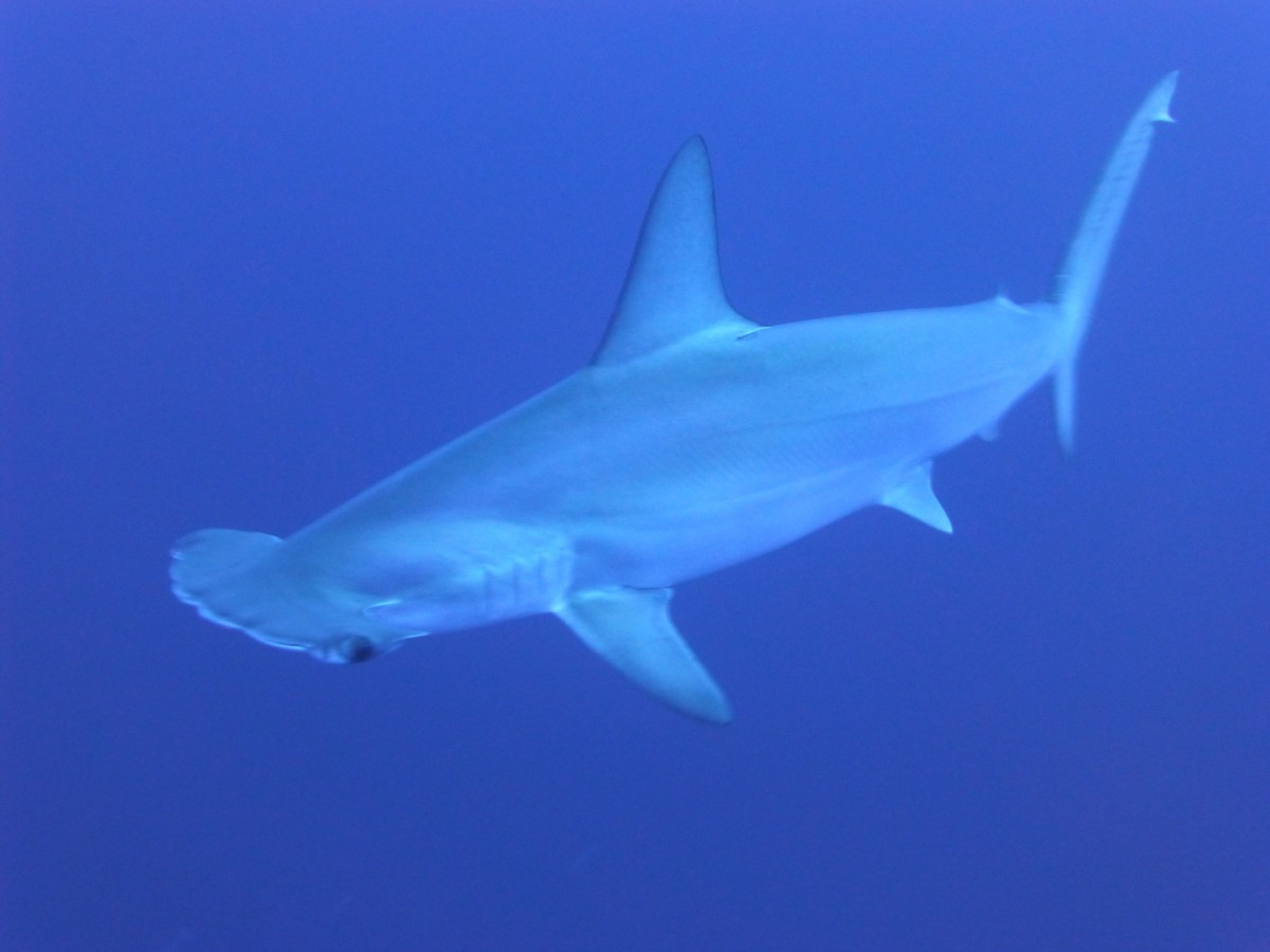
Fluorescent blue chin parrotfishes, yellowtail surgeonfishes, and pufferfishes swam around the turquoise waters, and sea lions made me close company again. I really felt as if these boys knew that I was on a mission, and decided to escort me to the right place. To the open waters where the scalloped hammerhead sharks finally decided to reveal themselves. What an amazing creature, a perfect example of the ambitious effects of evolution. Its distinctive, enormous head works as a sensor that has yet to be explained by science. I couldn’t have asked for a better ending to this trip.
Thank you, Galapagos! May we be able to do enough to preserve your treasures!
On the morning of Friday,July 24th I left Deadwood South Dakota and within an hour had entered Wyoming on SD 34/ WY 24 . The first stop was Devil’s Tower.
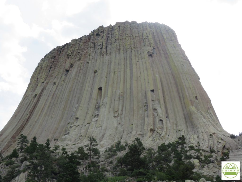
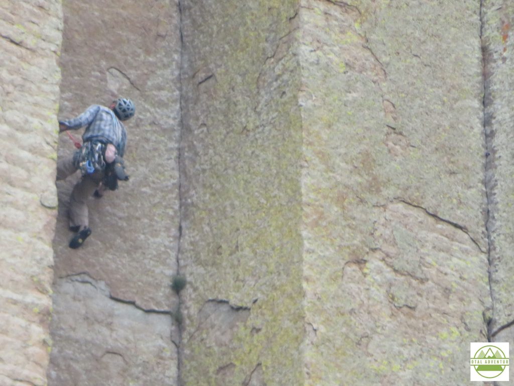
Rising straight out of flat farmland,Devil’s Tower is 867 feet and formed in a short time due to volcanic upthrust. It is very geologically different than the Black Hills over 100 miles away, or the Rockies , more than 200. You can experience it in the video above.
By mid afternoon I settled into Sheridan, at the foot of the Big Horn National Forest. As usual I dined alone on the hotel porch rather than in a lively restaurant .COVID life on the road. Everything closed by 8 anyway.
Big Horn National Park offers hundreds of square miles of hiking, climbing, glacier trekking and ATV trailing. Since it’s not a National Park, it’s not well known except locally. I was the only Florida plate, most were from Wyoming and Montana.
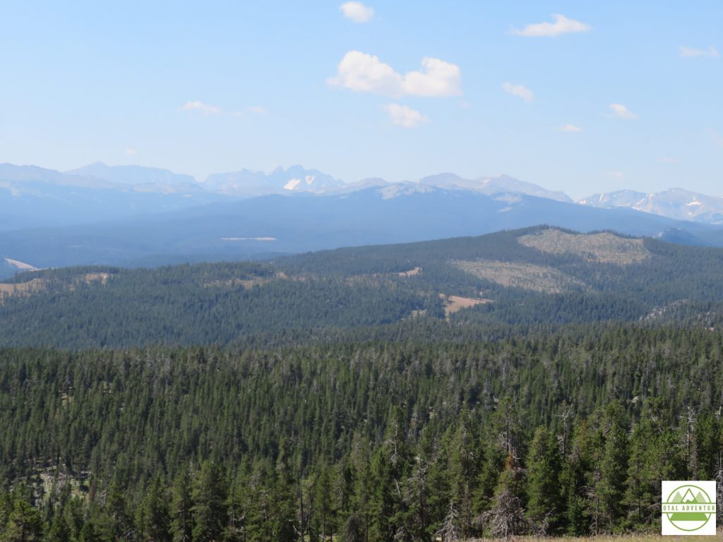
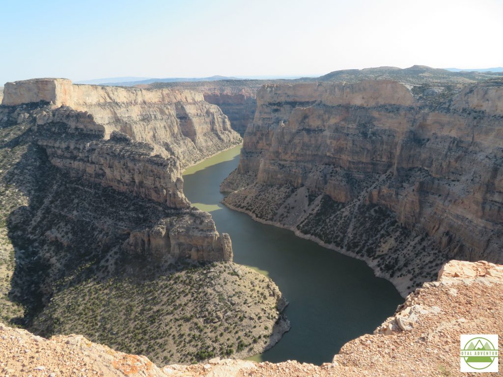
Dropping down a few thousand feet from the Big Horn Range, TotalAdventure explored the Snake River Canyon , traversing the Wyoming Montana border. The canyon had been dry with a seasonal stream until a dam was built in the 1930s.
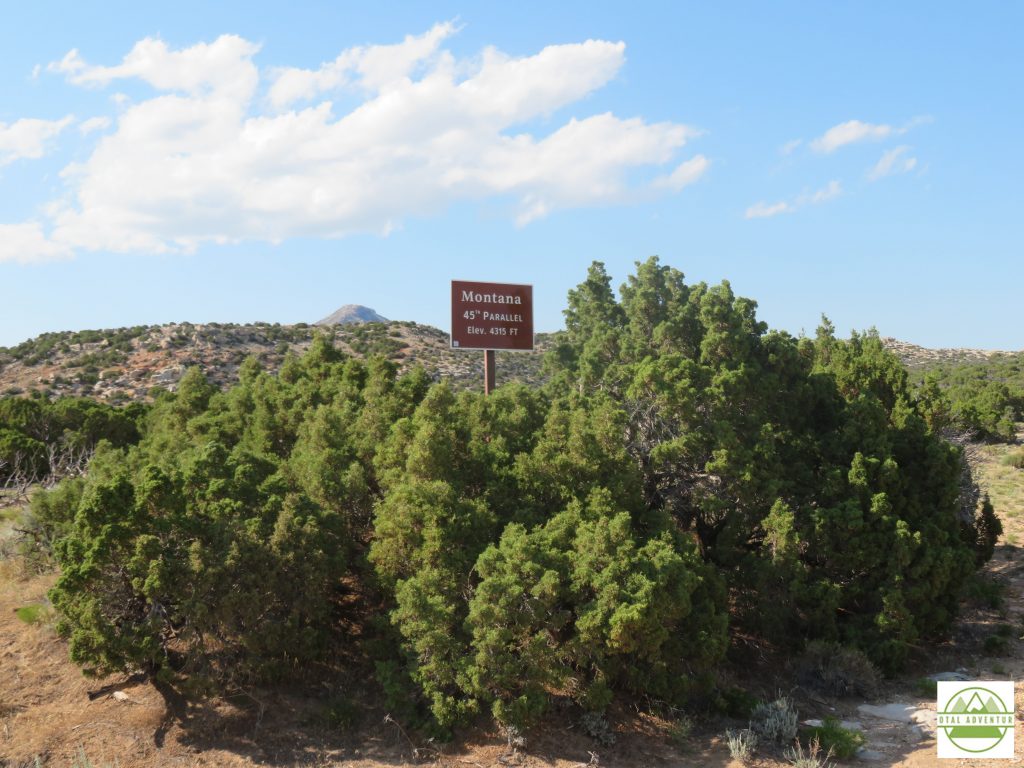
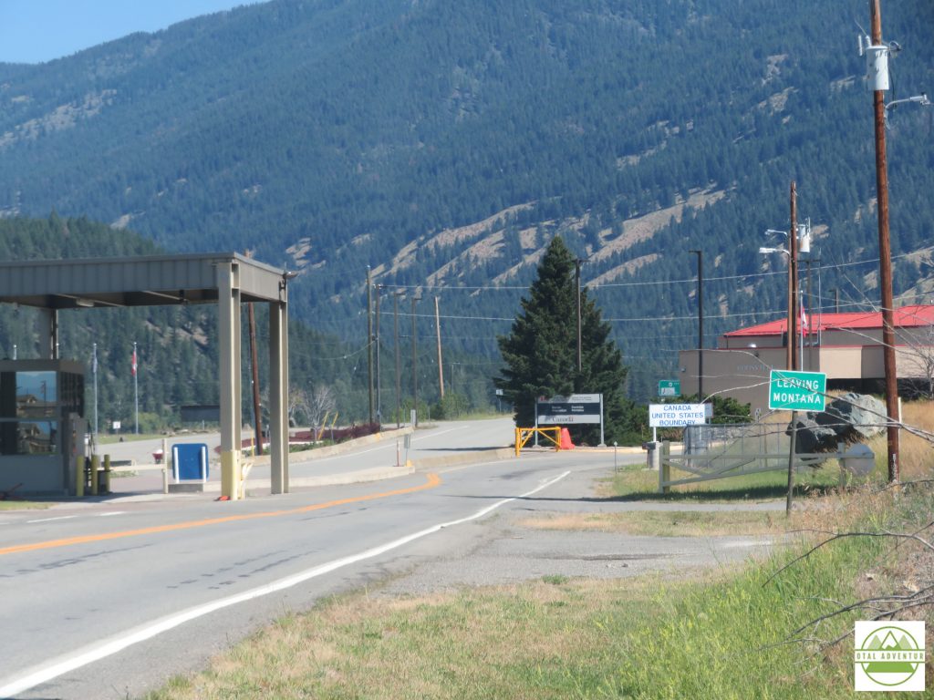
I then entered my 49th state, Montana ! Just one more to go – Oklahoma, but won’t be there until the return trip East in September.
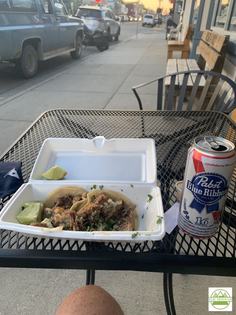
Before Yellowstone, I overnighted in Billings and Red Lodge Montana. In Billings I enjoyed a big Montana steak, but when I arrived at my hotel in Red Lodge after a day in Snake River, about 7:30 to discover that due to COVID my hotel restaurant was closed and the few restaurants still open in town would be closing at 8. This New York/Miami traveler is not used to small town hours but had to adjust on this trip or face night time starvation. I was the last one served from the line at a Mexican cantina and scored a PBR from the bar/casino across the street. The bars closed at 9 !
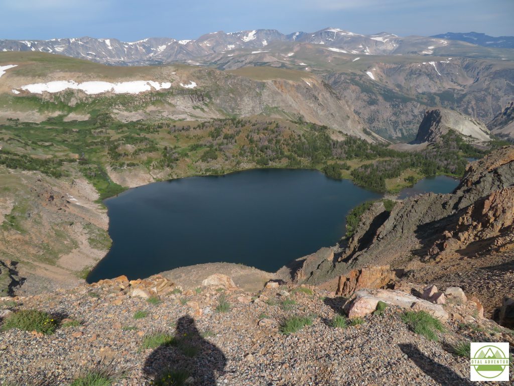
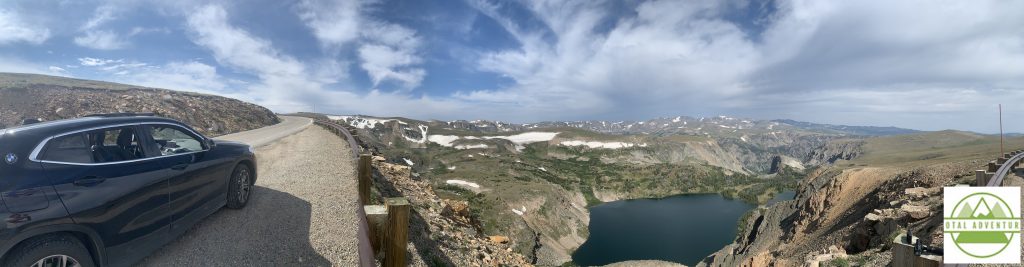
From Red Lodge to Yellowstone the winding ,high altitude Beartooth Highway crisscrossed several times between Wyoming and Montana.
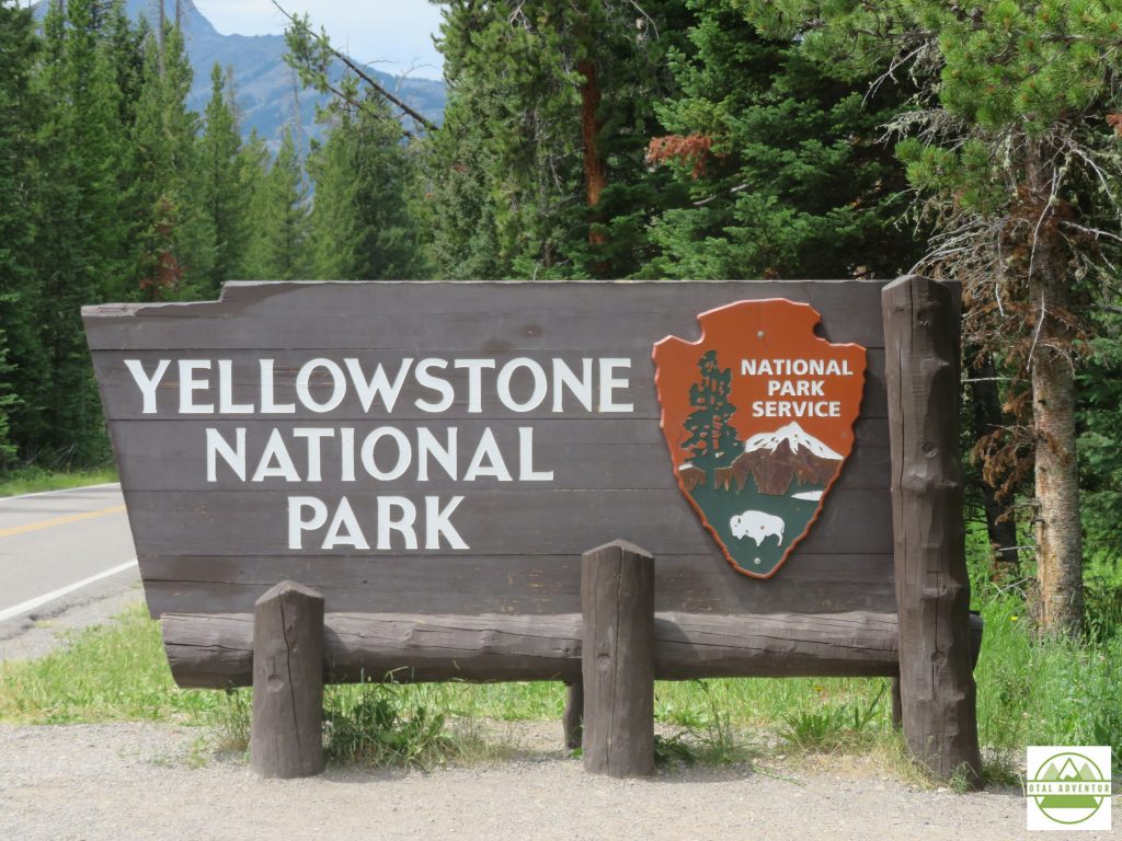
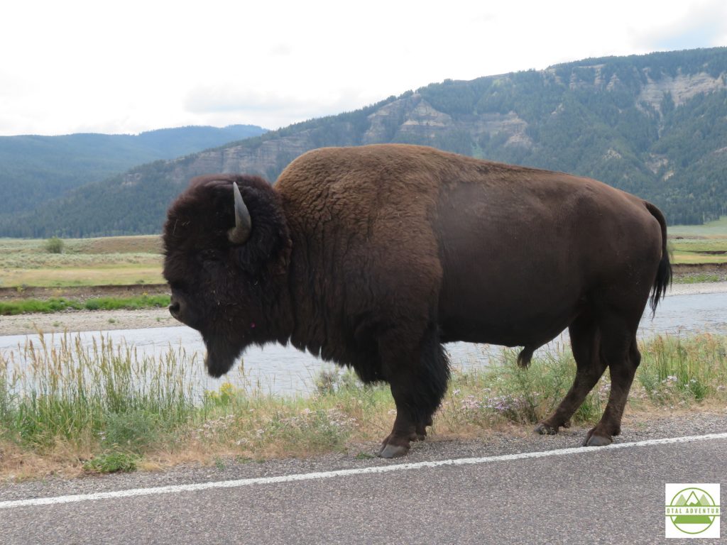
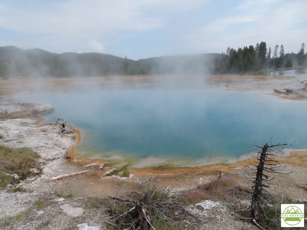
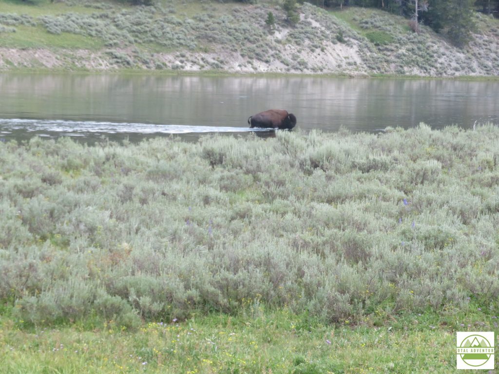
The Summer of 2020 was probably one of the best to explore Yellowstone. Though crowds were sizable , they were all American crowds, as most foreigners, not even Canadians, could visit in the COVID summer. The notorious traffic jams did not appear.
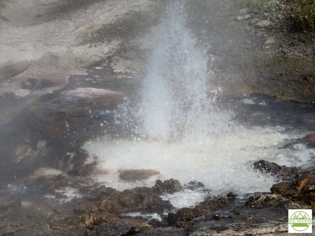
Yellowstone sits atop a super volcano. When it does finally blow – anytime between the next 10 minutes to 10,000 years – the park will become a 50 mile wide lake of boiling red lava and will cause global cooling for years to come.
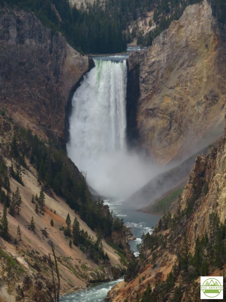
The falls look even more incredible in the video above. Be sure to watch it all.
After a day and a half in Yellowstone ( many people stay a week or more) it was time to head north into Montana. Passing Big Sky on a beautiful highway with a legal speed limit of 80 mph I arrived in Butte around sunset. I would stay there 2 nights, to explore the old mining city , to catch up on work ,do laundry and get the extremely dusty X2 washed.
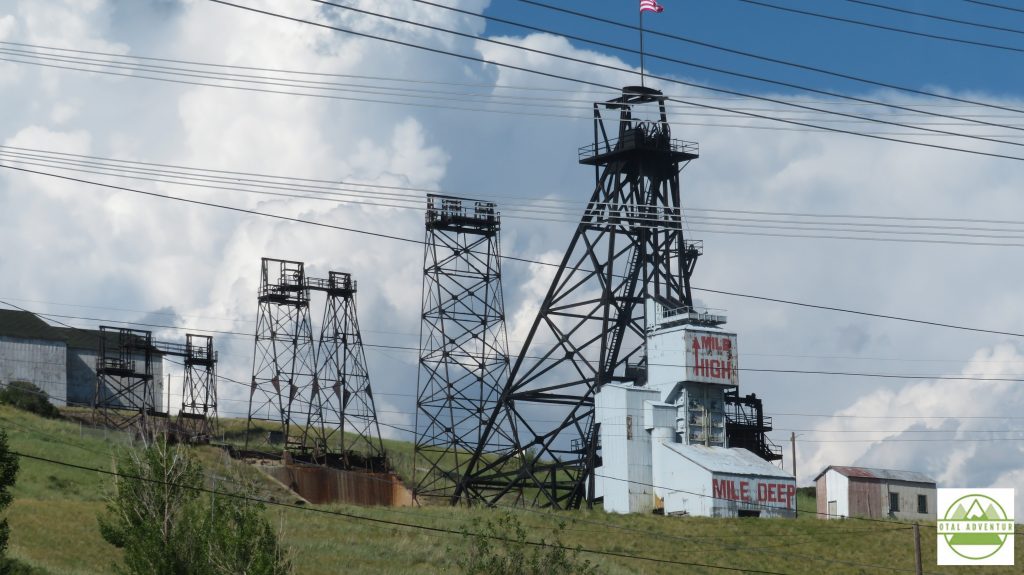
Gold Copper and silver were mined here. Butte was known as the “Richest Hill On Earth.” Miners came from all over the world. Copper is still mined, but there’s not much left. The old city is quiet but not quite abandoned.
From Butte , a few more hours to the Northwest and I arrived in Whitefish ,gateway to Glacier National Park. Whitefish was full of California ‘refugees”,many who had arrived in private jets ,escaping mask and lockdown restrictions in their home state.
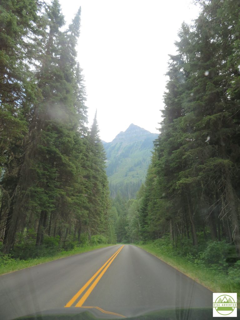
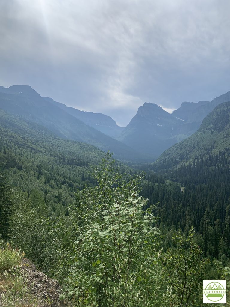
In Glacier , on the first day of August, I swam over a mile in 2 lakes and walked in the snow.
On the morning of August 2nd, I left Whitefish for a day of mostly dirt roads from Montana into Idaho. I missed my westward turn and would up at the Canadian border. When I originally thought of this cross country trip,years ago, I had always meant for it to include Canada. Winnipeg, Saskatoon, and Banff would have been on the itinerary. But in March 2020, the Canadian government had shut the borders to all but commercial traffic, due ,of course to disease spread.
All I could do was look into this closed off , beautiful land – in this case the easternmost corner of British Columbia ,near Alberta. The next several hours was on windy isolated dirt roads – into the town of Yaak .
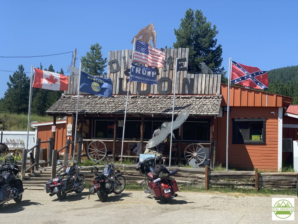
I walked inside the bar, which of course was all bikers . Had a friendly beer and they were amazed I was all the way from Miami. No photos were permitted, probably for very good reasons.
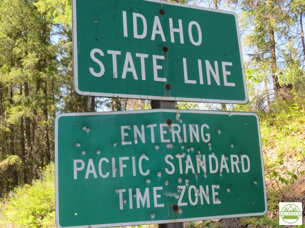
I spent the night in touristy Couer d’Alene, Idaho, another town where restaurants closed at 8 and I had to order pizza by 9 before that closed too. Changed clocks back for the last time. The next day – through Washington State, past Spokane – to Portland ,Oregon – almost completely cross country !
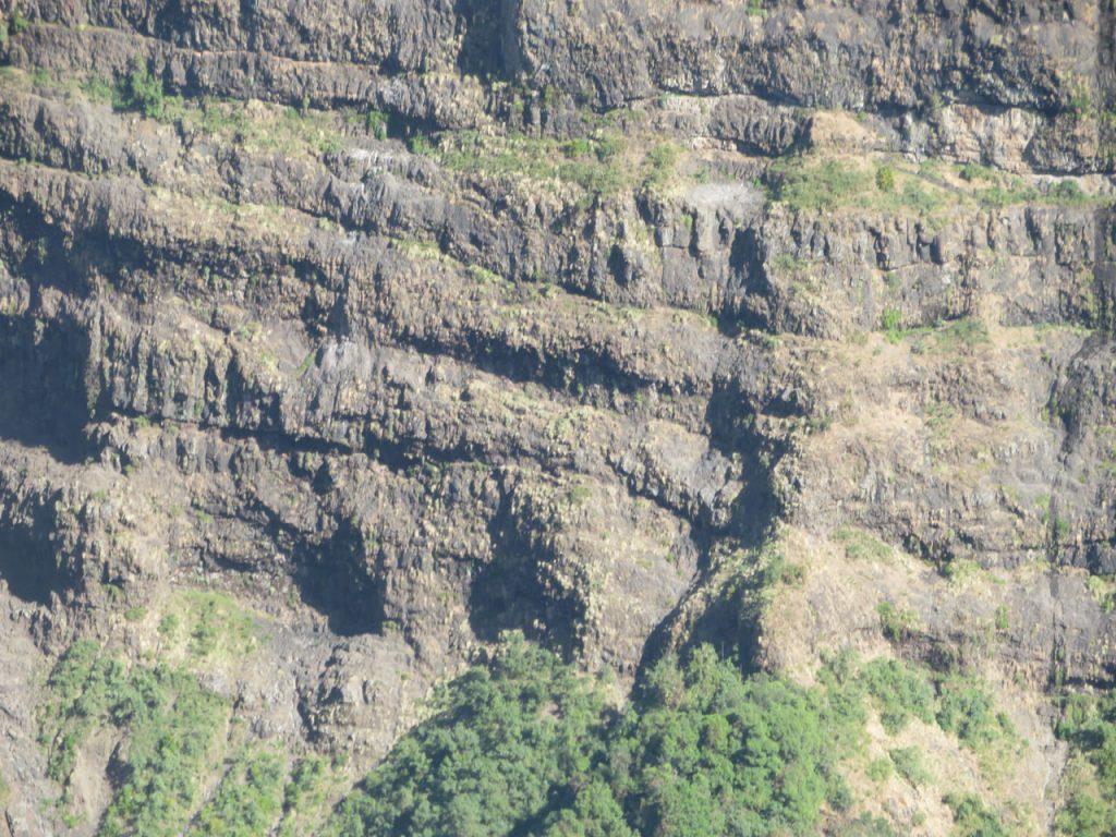
The Simian Mountains In Northern Amhara State Were Formed By Extreme Volcanoes About 40 Million Years Ago. They Tower West Of The Rift Valley, Which Runs Almost The Whole Length Of Africa.
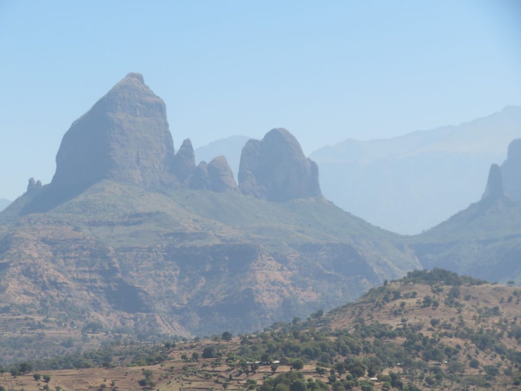
The Highest Mountain Is 15000 Feet ( 4550 m) . Snow is known to fall in the wet season. TotalAdventure experienced below freezing temperatures in the early mornings.
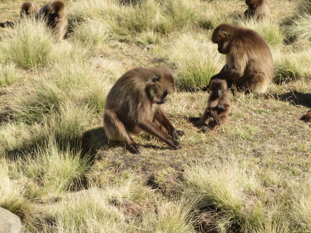
A Gelada Monkey Family Forages For Dinner. Snacks from tourists are strictly forbidden.
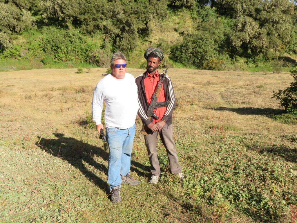
A Guard With An AK-47 Is Mandatory , To Guard Against Hyenas In Simian Mountains National Park. Hyena jaws are so strong they can snap a femur like a small chicken bone.
GeladaMonkeys sleep on the cliffs at night, in order to be inaccessible to hyenas.
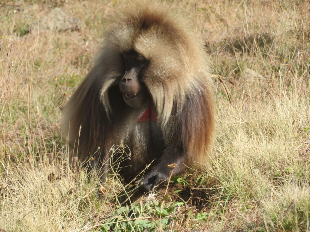
A Father is unfazed by his human cousins. They are 5 times as strong !
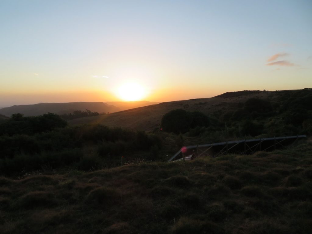
Sunset From 11,000 Feet ( 3384 m) at the Simian Mountain Lodge.
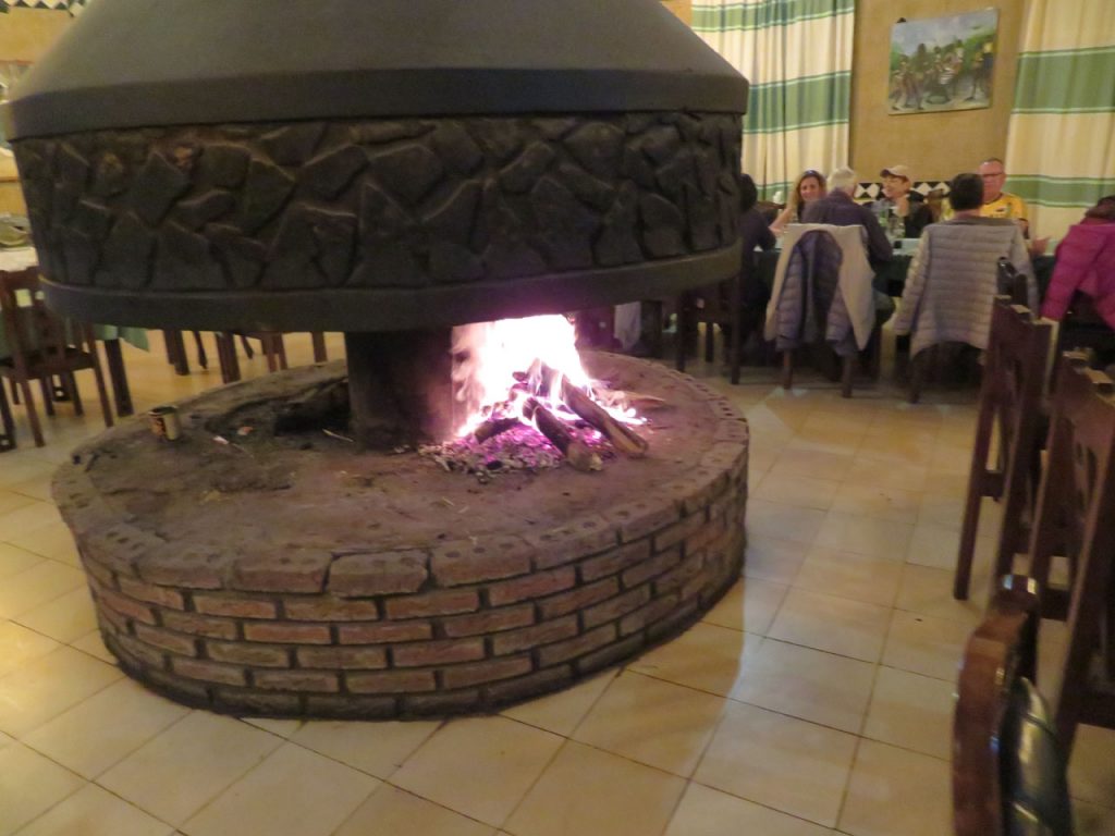
A Fireplace Keeps The Dining Room Warm. Outside it was 26 F ( -4 C)
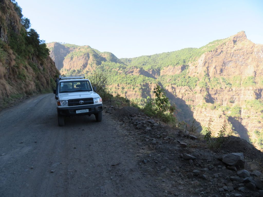
Our drive out of the mountain range. Drivers must be careful, with 3000 ft. cliffs on every curve.
After many delays and thirty hours flying time via Dubai, I finally arrived in Addis Ababa late Monday night. Tuesday morning we started out on our two day road journey to Lalibela. The bandwidth is very low, it took me all night o upload the camel video. Just a few pictures today.
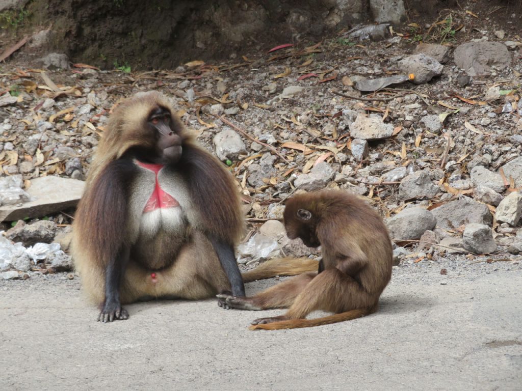
Gelada Monkeys, Known as the Bleeding Heart Baboon. They are not baboons, however.
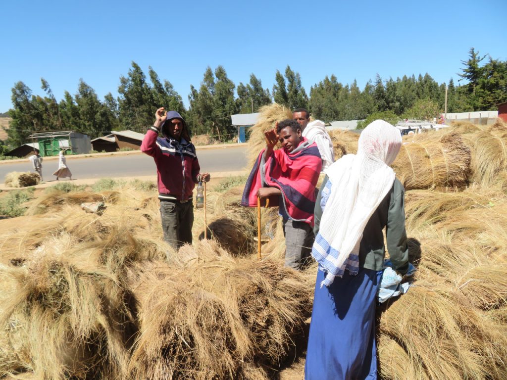
At A Roadside Donkey Market.Or A Hay Market ?
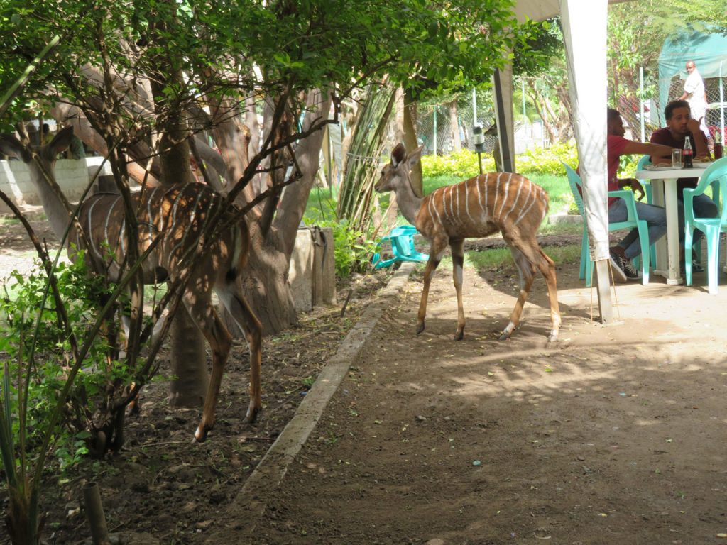
Impalas Or Gazelles Join Us For Lunch.
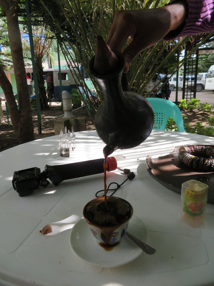
Strong Coffee Is Served !
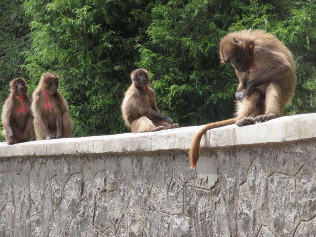
A Troop Of Geladas.
Trying To Learn Some Amharic.
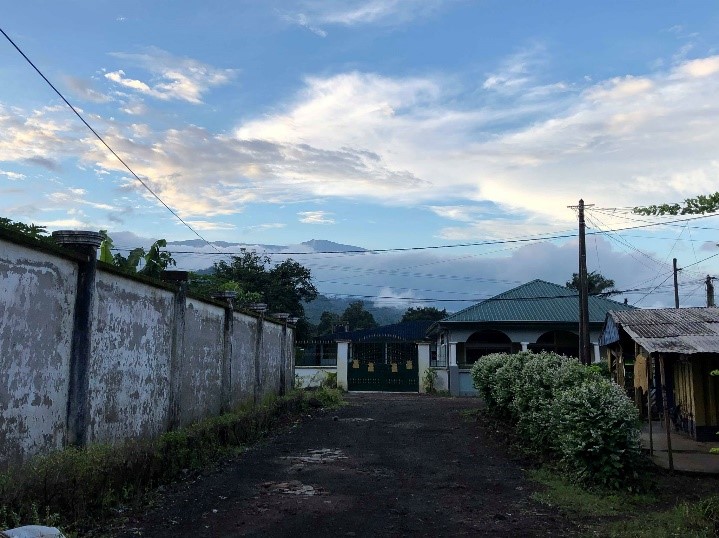
A glimpse of Douala
I arrived at Douala airport (one of the two biggest cities in Cameroon) late in the evening August 10th, 2019. I was warned before arriving that I would very quickly and easily make friends. This was lucky for me because the very first person I met on the airplane was crucial to my making it safely to my destination. In Cameroon, people tend to be very kind and inviting. Perfect strangers helped me fill out paperwork, navigate the airport and safely find my driver.
Once I was in the car, the ride to the volunteer house was about an hour and a half. The city of Douala was such a culture shock- it was almost indescribable. Unfortunately, it was after midnight, so I could not see much, but what I did see was SO different. The city was nothing like my experience of a US city. The infrastructure from roads to buildings were seemingly dilapidated and old. Many markets and shops were simple tents or just products (like bed frames) laying on the side of the street.
Yet, much of the city was still very much awake at 1AM. There were clubs and bars full of people and loud music. The most mouthwatering smell of grilling chicken permeated the air everywhere we went.
Older cars and bikes were driving all over the road in a strictly Cameroonian way of driving. The traffic was another major culture shock. Laws that would be enforced in the US seemed more like suggestions here. Red lights don’t necessarily mean stop- they mean look before you go. Many roads were not divided into lanes, and the ones that were were completely ignored. Cars weaves around each other sometimes squeezing four side by side. Bikes, pedestrians, and cars shared the road equally.
Perhaps the scariest part is when we were stopped at two roadblocks- one leaving Douala and one entering Limbe- by police. They just wanted to check our identification, but they were holding very threatening machine guns and were not very friendly. The stretch between the cities was very natural and forested, but too dark to see anything.
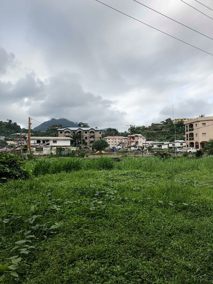
Limbe
I woke up to the sounds of an animal orchestra outside of the research house. Combined with the sounds of all the primate species at Limbe wildlife center were the screeches of all the neighborhood chickens, cats, dogs, pigs, horses, and other unidentified animals.
Limbe wildlife center is a major attraction of Limbe and the reason why I am here. The LWC is a wildlife education and conservation center. The animals kept here were orphaned as a result of bushmeat hunting or the pet trade. This is a huge issue in Cameroon and throughout Africa. Animals are often killed for meat, and the infants are kept as pets or trophies in horrible living conditions. They are rescued and brought the LWC for rehabilitation and to live with members of their own species. I am lucky enough to be spending 3 weeks volunteering at this sanctuary.
One of my first stops in Limbe was the local market “old market”. The most efficient way to get there is by motorbike. This was a totally new experience to me- clinging to the back of a bike in weaving traffic. The market was much like stores in Douala where tents or small wooden shelters cover the fruits and vegetables spread on burlap sacks on the ground. There were probably 20 or so shops at the market with a wide variety of African produce. Many merchants will help you find what you’re looking for, and you’re almost guaranteed to go home with a free sample of some new or unique produce.
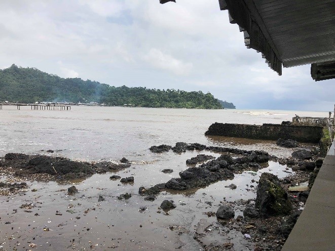
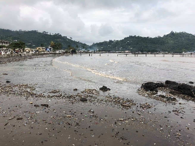
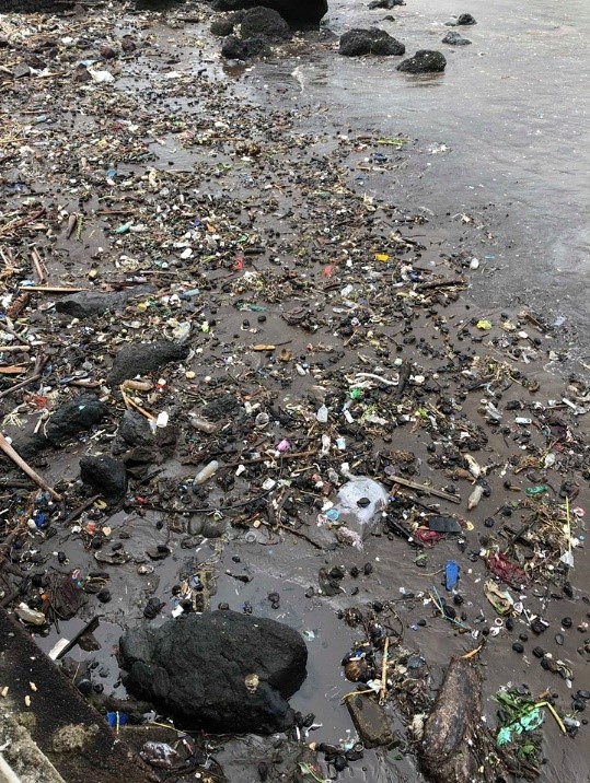
Just a few blocks from the market is mars bar- a European themed restaurant and bar on Down Beach. Down beach is a black sand beach that stretches along the coast of Limbe. It is not very good for swimming because of the amount of litter, but it is popular for the fishing culture and economy of Limbe. The beautiful Mountain View and the sunset over the ocean also make it well worth the visit.
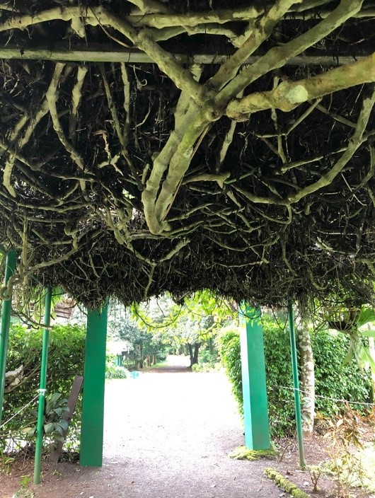
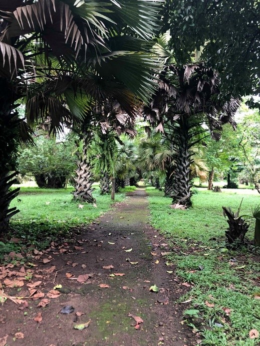
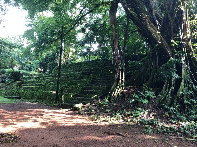
Finally, another worthwhile attraction is the Limbe botanical garden. The garden is home to many beautiful (and some edible) plants. There is also a “naturalistic” amphitheater, a nearly 200-year-old cemetery, and plenty of beautiful views. While you are there, be sure to check out Hot Spot, a restaurant within the garden that has delicious burgers, and sometimes even cheeseburgers- which are extremely rare in Limbe.
Overall, the breathtaking nature, incredibly sweet and welcoming people, and the laid-back lifestyle of Limbe made it one of my all-time favorite destinations.
TotalAdventure does not currently . have adventures in Cameroon, but we invite Cameroon companies to apply. For another exotic area in Africa, check out our trip to Ethiopia. https://totaladventure.travel/trips/203383
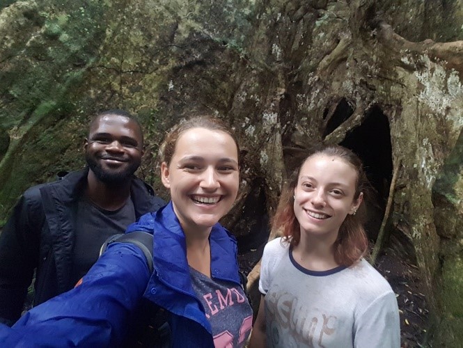
In the summer of 2019, I was offered the amazing opportunity to volunteer at a Cameroonian primate sanctuary as an animal care giver. During one of my days off from the sanctuary, a fellow volunteer (Tesse) and I took a tour with local guide Thompy Ekonde. He showed us around “Mangrove Forest” just outside of Bimbia. The road there was long, winding, and treacherous with huge rocks, ditches, and falling logs. Many times we had to pull over to calculate exactly how to place the car. Upon arriving at the forest, we trekked through the trees for about two hours as Thompy showed us some of the breathtaking native African flora.
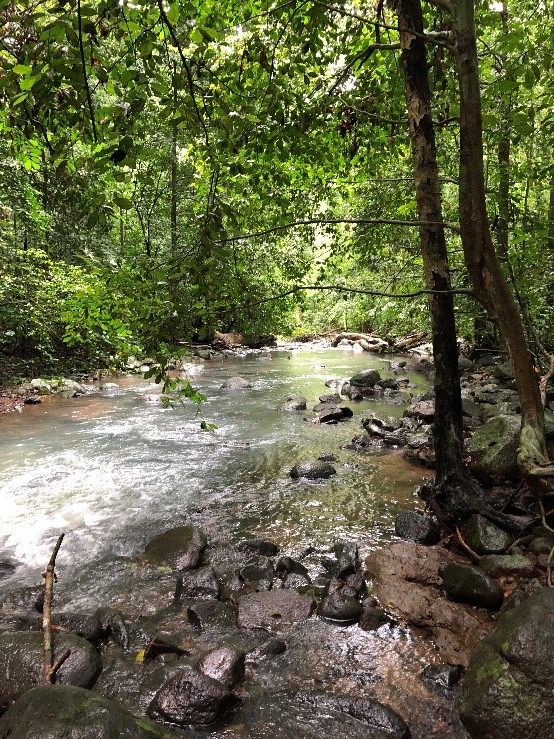
We had to wade through two shallow but powerful rivers cutting through the lush forest.
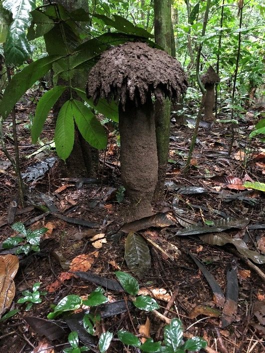
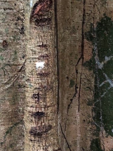
This tree is called the “milk tree” by locals. It is used in Cameroon as a medicine, the bark and white sap underneath are harvested and made into a drink for breast feeding mothers. The drink is said to increase the amount of breast milk produced, in a country where it is culturally significant to have many kids.
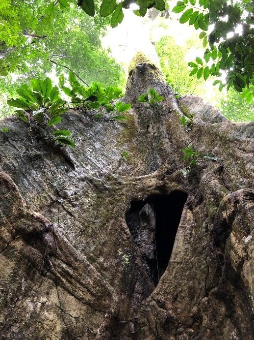
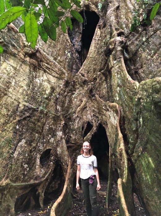
This tree pictured is the largest and oldest tree in the forest at over 400 years old, and too tall to see through the forest canopy.
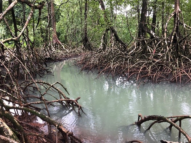
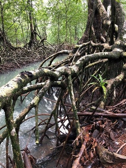
This is a small section of the acres of mangrove forest. During our visit, it was low tide and was very easy to see the magnificent system of roots tying this forest together.
TotalAdventure does not currently . have adventures in Cameroon, but we invite Cameroon companies to apply. For another exotic area in Africa, check out our trip to Ethiopia. https://totaladventure.travel/trips/203383
2014 was an incredible travel year for ArcticTropic. We explored Myanmar ( Burma), European Russia,Siberia,Mongolia,China,Japan,British Colombia,Canada,Singapore,Philippines and Panama. Here’s 184 clips in 11 minutes. This version is natural sound,a musical version will be uploaded soon.